Have you already hiked on the Amalfi Coast or even on the CAI-300? Or do you plan to hike there in the area?
Then we look forward to your comments, tips, suggestions or questions!
We have set up a separate section for feedback on the current state of the trail.
Quick navigation: Valuable comments on the topic...
Recommendation for further long-distance hikes
We love to travel on Mediterranean long-distance hiking trails and can recommend other beautiful travel and hiking destinations besides the long-distance hike on the Amalfi Coast! You can find them on the following website:
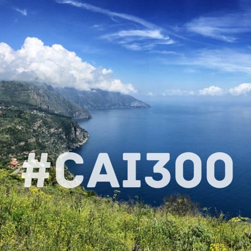
You can find current impressions from other hikers on Instagram at #CAI300
Dear Frank,
Just got back from my hike from Maiori to Sorrento.
Your information helped me a lot in the preparation and along the way - many thanks for the extremely thorough write-up!!!
As a base for the last two days - excursions to the Campanella headland and exploring Sorrento - the Grand Hotel Hermitage in Sant'Agata has proved very popular. It costs less than some B&Bs, the location for bus and hiking trails is perfect and the view over Sorrento is fabulous.
I can only say to all hikers: make your way to the Amalfi Coast!!!
Hello Bertram,
thank you very much for your great feedback! I hope the weather was already appealing at this time of year :-)
I agree with you: the Grand Hotel Hermitage is very well located to visit Sorrento at your leisure without having to pay the price premium there.
Many greetings
Frank
Hello Frank,
A friend and I are planning to hike the Amalfi Trail in May this year.
Can you tell me whether any of the stages involve climbing ladders or climbing cliffs?
Many thanks in advance and best regards
Dirk
Dear Frank & the whole team,
I have just completed a wonderful 7 days of hiking. I did exactly the tour you described and I am still completely enthusiastic. I followed your tips as far as possible, even with the hotels as far as they were available. But I always booked from day to day and not in advance. No problem in May, you can always find good deals on Booking.com. In the high season it's certainly different.
Thank you for your super informative site and especially for the GPS tracks. They helped me a lot.
I think it's great that there are people like you who have the time and energy to offer all this.
One more tip from me if you are travelling by car.
I parked my car in Salerno at Easy Garage Parking for 7 days.
I can only recommend it. Very nice people and very cheap. I paid 69€ for the 7 days. The car is safely parked in a garage. A shuttle to the hotel (was in the Vigi B&B as recommended by you) is included in the price. A shuttle service is also offered for pick-up.
Important: Book directly via their website. http://www.parcheggiosalerno.it/
And not via the various service portals that appear at the top of the Google ranking, such as Parkvia.com. There, the booking costs significantly more.
Many, many thanks again for your tips and this great site.
LG, Bernhard
Hello Bernhard,
Many thanks for the praise :-) and the valuable tip about parking in Salerno! We hadn't even thought of a car journey when it came to "getting there". But maybe I'm thinking too north German :-) From Stuttgart or Munich, it is of course also possible by car.
Many greetings from Hamburg
Frank
Hello Bernhard,
It's been a while since you wrote your report, but maybe you're still reading it and you can tell me something about the *drive to salerno with your own car*.
At first we thought about travelling by plane and train, but we are already very limited by this and we want to be unrestricted and stay where we like.
come from austria.that's about 1400 km one way to salerno.my concern would be the traffic,as they say southern italy and traffic is already a challenge.would appreciate some info about it,also from others who have ventured the journey by car.thanks lg mathias
Hello Mathias,
Bernhard will probably no longer read your question. However, since I myself have some car experience in southern Italy - even if not directly on the Amalfi Coast or in Naples - I would assess the situation as follows:
Driving your own car in a major Italian city like Naples at rush hour is probably a challenge in itself. Likewise, the route along the Amalfi Coast - if you want to do it by car at all - requires safe control of your own vehicle even in stressful situations (tight bends, oncoming traffic with buses and trucks, steep coast, honking cars...).
However, I would say that getting to Salerno is fairly easy: If you park your car there as Bernhard suggested, it's only a few kilometres from the motorway exit to the car park. I actually find the motorways in Italy quite relaxed (because of the speed limit and tolls).
Of course, I am now assuming that you will hike the entire tour on foot and not travel by car in stages.
I hope this helps a little in the decision-making process.
Many greetings
Frank
Hello frank,
thank you for your quick reply.sounds good with the journey,we will also tackle it so we want to motorway so far down to salerno and then hike the entire tour.thank you again lg mathias
Hello Frank,
While planning a guided tour for our DAV section following my inspiring short trip to the Amalfi Coast, I now also came across your site.
Thank you very much for all your detailed information and the beautiful photos. All very inspiring :-) - and even though I need accommodation with a larger number of beds for my group, one or two things from your wealth of experience will definitely flow into the planning of my long-distance hike along the spectacular Amalfi Coast and on the Sorrentine Peninsula. :-)
And even though travelling by plane should remain the exception in our tour programme, I like to look around on your other pages and am curious to see what you will do next and what you will publish afterwards.
Best regards from Leonberg and many more wonderful backpacking tours
from Gisela
Hello Gisela,
thank you very much for the lovely feedback - we are honoured that the DAV informs us :-)
If your programme on the Amalfi Coast is set, I'd be happy to post a link here....
Many greetings
Frank
Hello you two, we are just finishing our last evening of our holiday, which began a week ago Saturday via Rome in Salerno. You guessed it, we picked your hike and followed it to a large extent. First of all, of course, a huge thank you for the detailed work, which was a valuable help to us in the preparation and during the hike. We always had the maps of each individual stage with us via the app from the German Alpine Club, otherwise it would have been critical. We took away an incredible number of scenic impressions and had several nice encounters with locals. We also had scary encounters with some of the fauna of the Amalfi Coast (snakes, for example) and culinary highlights in Positano, Torca and Schiazzano. With SITA Sud we experienced the whole range, from punctual and friendly to two hours of unplanned stops ("But the bus will be here in 10 minutes..."). What we would like to see on future trips are more culinary tips. From our side, we can only give the following tips: Less luggage is more, most accommodations offer a laundry service for those who don't want to wash themselves.
On stage 5, from Torca onwards, the utmost attention is required, as the paths are sometimes very overgrown and the real right path is often only 4-5 metres away from the seemingly right path. And last but not least, a day off is a good idea to experience the country and its people a little more intensively at some point.
All in all it was fantastic, all the impressions, encounters and little challenges. Thank you very much for your effort and keep it up!
Tina & René
Hello René & Tina,
Thank you very much for your report! On the subject of luggage: We have set ourselves the guideline "max. 10kg luggage + water". This requires a bit of discipline when packing, but it's worth it.
I will include the information about the orientation difficulties from Torca in stage description no. 5 in the next few days.
Many kind regards from Hamburg,
Frank
I am absolutely thrilled with your site and the great reports. I would love to start right away. Some of my questions have already been answered in the previous comments. Since I have only ever done day hikes and not long-distance hikes, I have the following question:
Does anyone have experience with luggage transport?
If you want to add a few days of rest at the end of the tour.
Hello Regina,
If I understand you correctly, it's about being able to pick up an extra piece of luggage with fresh clothes etc. at the end of the hike, isn't it?
The only practicable possibility I see for this on the Amalfi Tour is the following: As in Germany, there is also the possibility in Italy to have parcels poste restante to send. The corresponding service of the Italian Post Office is called fermoposta and includes 7 days storage. I haven't tried this myself yet and can't give any information about the reliability and speed of the Italian post ;-). In any case, I would not send the package with extra clothes from Germany, but from an Italian post office, e.g. in Naples or Salerno. The following links are for your information:
Regina Sample Woman
FERMOPOSTA Sorrento
Corso Italia, 210
80067 Sorrento NA
If you try this, I'd love to hear your feedback afterwards!
Many greetings
Frank
Thank you very much for your detailed answer. When I am in the concrete planning phase, I will try to send the suitcase to the last hotel via the booked hotels by taxi or courier service. I think that should work.
Update:
The topic Luggage storage is easier to solve than with the Italian postal service.
See info under Luggage storage.
Frank
Hello Frank,
now also my knowledge of maps for all those who also want to go hiking on the Amalfi Coast.
For those who want more than just the electronic maps: there is a compass map at the usual scale of 1:50,000, on which some paths are very clearly marked in red. In addition, I have the map MONTI LATTARI, newly published by the CAI, at a scale of 1:25,000 at das-landkartenhaus.de and find that the two cards complement each other quite well.
Best wishes and happy planning
wishes Gisela
Hello you two,
first of all, thank you for the excellent website.
We are just back, we hiked the Amalfi Coast in 6 days in the first week of October 2017. Your GPS tracks and eBook were our companions and helped us a lot.
Our experiences and tips:
Arrival:
We chose the vehicle and paid 40 francs motorway toll in Switzerland and a total of 130 in Italy. Arrival from southern Germany within 1.5 days without any problems.
Starting point:
We parked in Pompei and took the train to the suburb of Salerno Vietri sul Mare. There you descend to the coast and you can already see the starting point at the church you described. Additional need about 1h from the station, but no additional bus ride.
Stages:
We combined stage 3 and 4 and spent the night in Montepertuso. From there, the entrance to the continuation of the trail is easy to find and you don't have to go down to Positano first. We found this to be a really great route, in no way inferior to the famous "Path of the Gods". The next stage then follows the coast to Nerano. Here beware: the hiking trail is practically non-existent on the last stretch between Torca and Marina di Cantone. Orientation really only by GPS in high bushes. Overnight stay in Nerrano. Last stage then to the lighthouse at the end of the peninsula, continue to Termini and then by bus/train to Pompei/Naples. In total 6 days.
We found it such a round thing: the whole coast without a bus stop to the very last tip.
Map:
There is a very good map: Costiera Amalfitana, scale 1:25.000 for 7,50€. Unfortunately not available everywhere. With hiking trails and short descriptions and times.
Conclusion:
A fantastic hiking trip. Away from the towns almost always alone. Beautiful places and scenery.
Highly recommended, but only in spring and autumn :-)
Kind regards Jörg
Hello Jörg,
Thank you very much for your detailed tips and the variant on travelling by car!
I'm really interested in your route above Positano. Do you have any more information? We searched in vain for such a path. The only thing we found was a path under construction that ended in a dead end.
Perhaps we can simply exchange ideas by e-mail?
Many thanks in advance!
Frank
Hello all,
You have created a great site - respect!!! All in all, I think it's great to set up an information service documenting long-distance hikes in Southern Europe. I have also walked the Costa Brava, from Argeles-sur-Mer (F) to Blanes (ES) - twice!
I can highly recommend the Costa Vicentina (www.rotavicentina.com), I hiked almost the entire route in April this year - it was great!!!
Keep up the good work !!! If I should take the Amalfi Coast under my legs in 2018, I'll be in touch here again ....
LG
Markus
Hello Markus,
Thank you very much for the compliment :-) I have been asked several times about the Portuguese coastal hike, that is definitely on our list!
Many greetings
Frank
Hello Frank,
We were on the Amalfi Coast in mid-October and followed your route, we also used your recommendations for accommodation. We were very enthusiastic about the tour, the accommodations were without exception very good.
It also worked great with Viewranger on the smartphone, the GPS files helped us a lot.
Thank you very much for your great travel site. We are already looking forward to new tours;-)
Hello Ingrid,
Thank you very much, I'm glad you enjoyed the hike on the Amalfi Coast!
We then post new tours at http://www.wanderndeluxe.de in front of. By the way, you can also subscribe to a newsletter there :-)
Many greetings
Frank
Hello Frank,
Congratulations, really a great site!!!
If I had found them before my Amalfi hike, I could have saved myself some research...
The Rother hiking guide "Gulf of Naples" also briefly discusses long-distance hikes at the end. I used it to build my route from Corpo di Cava to Sorrento. By the way, it's a pity that you recommend the bus between Positano and Colli di San Pietro. That was one of the most beautiful tours, even if it was really hard to find in parts. But with the GPS track from Rother it went quite well.
If you are interested in my tour, I have written a detailed report in the Outdoorseiten forum:
https://www.outdoorseiten.net/forum/showthread.php/100212-IT-Treppen-Trekking-an-der-Amalfik%C3%BCste-%C2%96-Von-Corpo-di-Cava-nach-Sorrento
Many greetings
Wolfgang
Hello Wolfgang,
Thank you for the link with your detailed report. When I look at the pictures of your "Stage 6: Agriturismo La Ginestra - Colli di San Pietro", I become quite envious :-) The pictures are really great! We tried to find this route in the rain and fog, but then had to abandon it, so we grudgingly included the bus route in the tour description. In the meantime, however, both you and Jörg have confirmed independently of each other that the "upper connecting path" does indeed exist. And that you will reach your destination if you stick to the GPS route and don't let missing markings or overgrown paths stop you :-)
Therefore: As soon as I find a little more time in the next few weeks, I will adapt my route description.
Thanks again for your feedback!
Frank
Hello all,
What do you think, is a 3-stage tour also possible? Which stages should that be from your point of view? I find the whole thing very appealing, but for us the outbound flight would be on Monday and the return flight on Friday, ergo only 3 full days...
Thanks for feedback
Greetings
Timo Kemming from Münster
Hello Timo,
In case you haven't discovered it yet, I have already published shorter variants described with 4 or 5 stages. With only 3 stages, I would limit myself to stages 2-4, then you take in the central Amalfi coastal highlights (Amalfi itself, the Sentiero Degli Dei and Positano). This means that you start in Maiori and end in Positano.
For the journey: There is a Sita bus from Salerno to Maiori (Timetable) and one from Positano to Sorrento.
Three days is quite short, but if there is no other way, the above option would be my suggestion.
Many greetings
Frank
Hello,
after watching a documentary about the Sentiero Degli Dei, my father wanted to plan a trip to the Amalfi coast to go hiking. Of course, I was totally blown away by your site! I have never planned/organised more than a few days of relaxation at the Baltic Sea...
He would like to extend his stay with 2-3 days of beach holiday/Dolce Vita. Can you give me a tip on the best place to do this? What about the beaches in Sorrento, or would an extended stay in Schiazzano at the Lubra Casa Relax, which you are so fond of, be a better option? Does it make sense to stay there for 3 nights and then hike to Sorrento? Or do you add the days at the very end back in Naples? Sorry for all the questions, but I'm so excited right now that I almost want to go myself ;) The tour will take place in September.
Many greetings
Anne
Hello Anne,
nice that you are so enthusiastic :-)
Regarding your questions: The area around Sorrento is so beautiful that you can't really do much wrong - no matter where exactly you add a few more days:
I hope that any of these alternatives will fit your father very well :-)
Many greetings from Hamburg
Frank
Dear Frank & Co,
if I go your way this year at the beginning of May, will it probably be as Bernhard says: that you don't have to book accommodation in advance?
Your site impresses me very much and I am extremely looking forward to it!
Many thanks in advance and best regards
Ulrike
Hello Ulrike,
Based on Bernhard's experience and because of the generally large amount of accommodation on the Amalfi Coast, I also think that a spontaneous search for accommodation at the beginning of May should be successful. You will still be hiking before all the bridge days (Ascension, Whitsun).
All in all, it's probably a question of personal taste: do you want to stay flexible and be able to spontaneously stay longer in a nice place? Or is it important to know in advance where you will be staying and at what price?
We have found that it is more relaxing for us to have done most of the organisation before the holiday. This saves time and research effort on each individual hiking day and, last but not least, is a good way to get up and keep hiking even on a rainy day :-)
Have fun hiking in May and best regards
Frank
Hello Frank,
We discovered your site today and are thrilled. We want to hike the tour in March and thank you already for the great planning aids.
Does the chosen hiking direction have a special reason? We are planning exactly the opposite!
Many greetings from Swabia
Hello Christian,
From a purely technical point of view, there are no restrictions in terms of direction. In my opinion, however, there are several reasons for the direction from Salerno to Sorrento:
On the other hand, I can't think of any real advantage to hiking in the opposite direction. But feel free to give me a hint as to what made you plan the other way round! I'm sure it's interesting for other readers!
Many greetings from Hamburg
Frank
Hello Frank,
The Bavarian radio station broadcast the hiking series "Wanderlust". The chosen path begins in Sorrento.
https://www.youtube.com/watch?v=96QiWNxt2v0
Thanks for the quick reply - maybe we'll reschedule.
Greetings
Christian
Hello Frank,
we are also planning to go on this tour in May.
One question regarding luggage: what was the volume of your backpacks?
Is a head for heights necessary for the tour - are there any exposed areas?
Thank you and best regards from Bavaria
Angelika
Hello Angelika,
Our backpacks have a volume of 45 and 48 litres respectively, although we didn't use them to the full. You can also find some information about this under https://www.wanderndeluxe.de/kategorie/packlisten-wanderausruestung/.
It is difficult for me to make a reliable statement on the subject of a head for heights, as I am not afraid of heights myself and therefore, in case of doubt, I do not remember some exposed places that might be a problem for others. In any case, there are no via ferrata-like places where you have to hold on to a rope or similar. But there are plenty of narrow paths on the steep slope with a view of the sea. For the most famous section - the "Sentiero Degli Dei" (stage 4) - there are plenty of comments and assessments on the subject of vertigo on the web. Perhaps the Google image search with the search terms "sentiero degli dei vertigo" will also help here for a personal assessment.
I hope to have helped you and wish you a beautiful and successful hike in May!
Frank
Hello Frank,
We are thinking of walking from Maiori to Positano for 3 days in October with our children (4 to 8 years old), with a rest day in Amalfi. The car will be parked in Salerno and from Positano we will take the ferry back to Salerno. Our girls are good on foot, but the luggage would certainly have to be carried by my wife and me. Is this a realistic plan with children or too ambitious?
Kind regards
Andreas.
Hello Andreas,
I think that such a hike from place to place will be a really great experience for children! That's how I got into hiking at some point :-)
For route planning: When hiking with children, there is probably a rule of thumb "age times 1.5" (source: https://www.merkur.de/reise/klappt-wandern-kindern-ratgeber-reise-479807.html). So at 4 years old, the distance should not significantly exceed 6 km, with 100 metres of altitude counting as one kilometre.
I have the following ideas for short sections:
That's it from my side for now.
Many greetings
Frank
Dear Frank,
Wow, it's a load off our mind that it's possible from your point of view - not that the little ones are overburdened. We thank you very much for the effort to give us a little itinerary, especially on the first day I was worried about the length. Maybe we can take a day longer and hike to Bomerano, the family council might decide on that when we are there.
Thank you very much for everything and best regards from sunny Weimar!
Andreas.
Hello Frank,
What footwear do you recommend for this long-distance hike?
Are trail running shoes the right choice or sturdier, higher shoes?
Thank you
and
Lg
Hello Josef,
Although the hiking trails on the Amalfi Coast are not exactly alpine (there are no scree slopes, etc.), you should bear in mind that you have to carry about 10-12 kg of backpack weight on a long-distance hike. Especially when descending several hundred metres in altitude, sturdier hiking shoes or even hiking boots pay off. Equipment recommendation). If you get blisters on your feet because your shoes don't fit, that's very annoying on a long-distance hike...
Therefore, in case of doubt, I always recommend the firmer/higher version.
Many greetings
Frank
Hello,
I have another good tip about maps: the CAI map is available free of charge on the following site:
http://www.caimontilattari.it
Hello Ralf,
You are certainly alluding to the map recommended by Gisela above (https://www.das-landkartenhaus.de/wanderkarte-monti-lattari-il-lupo), isn't it? Then the map is actually available in a pretty good preview version in the header of the start page of http://www.caimontilattari.it.
Logically, the resolution of 1:25,000 does not quite come within the range offered by the digital maps based on OpenStreetMap. But anyone considering buying a printed map of the Amalfi Coast can get an accurate picture there in advance.
Thanks for the tip!
Frank
Thank you, thank you, thank you! A quite wonderful and quite wonderfully described tour. We were on your tracks at the end of March 2018 with our eleven-year-old daughter and enjoyed every minute and every step on this varied hike. Without your tips we would not have found so many paths so easily. The time of year was ideal for walking because it was refreshingly cool, but the pools and sea were too cold or not even filled up yet.
A small tip for a similar and yet completely different hike: the Rota Vicentina (fishermen's path) in Portugal. Lonely, dreamlike, totally decelerating. We also have high hopes for a one-week hike on the Azores island of Santa Maria (Ilha a Pé) in June: from restored shepherd's hut to shepherd's hut.
Hello Claudia,
Thank you very much for the great feedback and the tips in Portugal! I've heard about the Rota Vicentina several times, the hike in the Azores is completely new to me, do you mean this one: ilhaape.com? That looks great in any case!
Have fun in June!
Many greetings
Frank
That's the one!
Thanks again for the tip about the Azores hike. I liked the idea of the renovated shepherd's huts and the possibility of transporting luggage so much that I even wrote a small article recommending it:
https://www.wanderndeluxe.de/azoren-rundwanderung-auf-santa-maria-5-tage/
Addendum: I like your suggestion with the Azores hike so much that I have added it to my recommendation list under https://www.wanderndeluxe.de/azoren-rundwanderung-auf-santa-maria-5-tage/ recorded!
Dear Frank,
This is the second time we have been on the road with you! After we hiked the La Gomera circuit in 2016 (with two nights per accommodation and corresponding additional day tours), this time we made a 13-day hike out of your Amalfi hike (plus additional Pompeii, Capri, Naples).
Depending on the hiking possibilities on site, we stayed in the accommodation for one, two or three nights.
Albori (1), Maiori (2), Amalfi (3), Bomerano (1), Santa Maria del Castello (3), Colli di San Pietro (1), Schiazzano (2), Sorrento
First of all, my conclusion: A great area and an equally great hike, again perfectly worked out by you, from the bus at the airport to the hiking and accommodation suggestions and the wayfinding.
Now a few experiences from the track:
I highly recommend spending the first night in Albori. (Above Raito and easily accessible on foot from there.) Although we didn't land in Naples until 3pm, we were already in Raito (bus, train, bus) shortly before 6pm and there the short hike to Albori was a perfect immersion in the countryside, away from the hustle and bustle. Albori is beautiful, completely untouristed, a quiet dead-end village in a fantastic location. We really liked the 'B&B aeternitas', from whose terrace you have a wonderful view all the way to the sea. From there, the long first stage is shortened by 20 minutes and you can start walking right away in the morning.
In Amalfi we found a very good place to stay: At the beginning of the mill valley is the B&B 'Valle de la ferriere', good breakfast, unbelievably impressive view from the breakfast terrace, completely away from the hustle and bustle, a good restaurant (Da Maria) in the village run by the landlady's husband, very hospitable people, prices somewhat above average, but still within reason.
Another recommendation is to do the tour in 7 stages (without the bus ride), with an overnight stay in Santa Maria del Castello, above Positano, Agritourismo La Ginestra (this was recommended in one of the comments and we stayed there for three nights with a day hike down to Positano and a second up to a peak of Monte Lettari). (We found the climb from Montepertusso up the high trail not difficult to find, thanks to your addition, and the high trail that followed was for me the true King's or God's Trail, incredibly beautiful, full of flowers and views, and deserted.
The following stage to Colli di San Pietro should definitely be planned as a whole day's stage, because an extensive rest on Monte Comune is a must (magnificent view) and the path that then follows makes some demands on wayfinding (marked, but overgrown) and the path condition makes it quite arduous at times.
We liked the accommodation you recommended at the Colli very much, as well as the one in Bomerano. In Schiazzano, unfortunately, we were too frugal and stayed at the Casale Marzia....
Thanks again for your elaboration
Almuth
PS.
On the subject of backpacks: I bought a smaller hiking backpack for this tour (35l+10). (Concession to my age, 62). That's enough if you pack sparingly, and it's much better to carry than a larger backpack that's not quite fully packed, as everything tends to slide down there. It was a new feeling to carry a backpack, despite the many metres of altitude and thousands of steps...
Hello Almuth,
Thank you for your (second) detailed feedback on our walking routes! I can still remember very well your first Remind feedback.
It's very nice that you were able to try the high trail variant above Positano. I'll have to do that again sometime :-)
Where to next?
Many greetings
Frank
Hello Frank,
Great site! I'm on holiday for 2 weeks at the end of June and thought of doing a hiking tour. First I thought of Iceland, but then it's too cold for me :-) As you can read, this would be my first real hike, but since I like to go for long walks, I would like to try it out. But I have no experience at all, so I have a few questions:
- What about the equipment? Are walking shoes really necessary or can you also walk the route in good sports shoes? (I'm mainly concerned with comfort here).
- Do you think it is possible to spontaneously pitch a tent on the way? I like to be independent and depending on how I like it at a certain point, I would then not necessarily have to go to a hotel.
- I would like to run the whole tour, but I would arrive on Monday and fly back on Sunday. Do you think that is feasible?
Again, huge compliments and thanks for taking the time to share your experiences and tips here!
Kind regards,
Nadine
Hello Nadine,
many thanks for the praise for the website :-)
- How a little further up as already written, I actually recommend taking hiking shoes with you. Normal sports shoes are not designed for the additional weight (backpack with 10-12 kg). There are certainly light hiking or trekking boots (category A/B to B) with which you can travel comfortably and yet safely.
- Wild camping is forbidden in Italy and especially in areas like the Amalfi Coast, which is very well developed for tourism, I could imagine that you might actually have to pay a fine if you get caught.
- Hiking with luggage on your back for several days is noticeably more strenuous than a day hike with little luggage. If you don't have any real experience, I would even recommend planning shorter stages rather than 6 stages in 5 days.
These are probably not the answers you wanted to hear :-) I hope this helps you with your planning anyway.
Many greetings
Frank
HIGHLY RECOMMENDED, the hike around the Azores island of Santa Maria. Arrive. Little house perched above the sea. Lid off the pot. What's delicious to eat? Coming home, spreading out, showering off the sweat, the first glass of wine from the cooler that our landlord Ioannis has already put in the house. And then recapitulate the day. Remembering the unbelievably beautiful places of this small island. This vastness, this peace, these thousands of shades of green - it's very close to paradise. The body is running at full speed, the head is getting all clear and calm and wide. We only met three other hikers. But we saw birds, birds everywhere, singing a magnificent duet with the frogs. Gnarled trees, gigantic trees, hydrangeas, giant ferns. Cows on the right, cows on the left, cows standing on the crest of hills, like the Osborne bull in Spain. A spontaneously conjured menu by the enchantingly hearty Aida on the beach of Maia. Unforgettable days on a breath-taking island. Absolutely RECOMMENDED!
Hello Claudia,
that sounds really great! If only I had more holidays :-)
For all others: more info at https://www.wanderndeluxe.de/azoren-rundwanderung-auf-santa-maria-5-tage/ and http://ilhape.com/.
Thank you for your report!
Hello Frank,
first of all, thank you for this page, I walked the whole tour with my father a few weeks ago, we sweated a lot sometimes, but we also had a lot of fun.
At this point, however, I would strongly advise against descending directly to Marina di Crapolla at the end of the 5th stage. The path was more badly than fairly marked (barrier tape...) but partly slippery and the undergrowth was up to head height in May. We struggled down more badly than fairly, but I would strongly advise against it, especially with somewhat larger backpacks. The access to the bay from the other side of Marina del Cantone, on the other hand, is a much-used hiking trail, which is no problem.
Hello Verena,
Thank you for your valuable feedback! On stage 5, do you mean the section between waypoint 8 and "Marina del Cantone"? Then I would add that to the stage description.
Many greetings
Frank
Hello you two,
we recently finished our hike from Raito to Sorrento. Yes, we really did it in August :)
First of all, thank you for the wonderful description and the helpful tips for the tour.
Here are a few experiences on our part:
- Sure, it's warm in August. Nevertheless, the vegetation is beautiful and the tour is easily manageable with sufficient water supplies. Apart from the half-day hikers on the Sentiero degli Dei, the rest of the hikers can be counted on one hand :)
- The app OruxMaps in combination with OpenStreetMaps helped us very well. Water points are also listed there.
- On stage 5 before and especially after Torca, the path was overgrown in parts and you had to keep your eyes open to continue and find the markings.
All in all, it was a great experience - we can only recommend the tour to everyone!
LG Helen and David
Hello Helen & David,
Many thanks for the feedback! For stage 5, we can only hope that a few more hikers will find their way there in the future - and thus prevent the slow overgrowth of the path.
I don't know the app OruxMaps yet, but I'll have a look at it soon.
Many greetings
Frank
Hello you two!
We did our Amalfi Coast hike largely according to your recommendation and with your GPX data. Perfect! A big thank you for your super preparatory work! We stayed in Sorrento for a few days and then took the bus via Amalfi to Vietri sul Mare. About 10 euros for two for a 3-hour bus ride along the coastal road. We found this the best option, the train is complicated because of the different routes in Pompeii.
We walked the whole of stage 4 from Positano to Colli San Pietro and found it to be the most beautiful tour (especially from Monte Commune, close to the cliffs). On the way, we gladly took your recommendation Monte Vico Alvano. We had planned a 3-night "break" in Amalfi and Positano, with a smaller tour in the area every day. From Positano (by bus up to Montepertuso) we also climbed Monte San Michele. A real highlight (not only because of the 1,444 m) due to the panoramic view from Naples, Vesuvius to the Amalfi Coast and Sorrento! All the paths up there are well laid out and easy to walk (the steep staircase in the last third of the climb is just exhausting because of the steady ascent, the last climb to the summit is also easy to walk).
Stage 5 is really overgrown from Torca onwards, but doable. While the GPS tracks were helpful all along the route, especially for finding junctions (or when accidentally leaving the track), from Torca onwards this tool was very helpful in many places along the route.
We were on the road from 31.08. - 10.09.18. Outside the towns almost always alone! It was still quite hot most of the time, even for us. There is rarely water on the pure mountain stages. We always had 1 x 2 and 2 x 1 and 1 x 0.5 litres of water with us on the day tours. On the ascent, 2 - 3 litres of water are already drunk, which is what you need. The water is the real problem in this heat, and you have to take care of it. The trails themselves are not difficult, but you should not underestimate the metres in altitude.
In the end, we returned to our hotel in Sorrento and spent a few more days on holiday (we had left our suitcase there).
It was a very nice experience for us!
Many greetings
Hubert and Brigitte
Hello Hubert and Brigitte!
Thank you very much for your detailed report! Your variant with 10 days also sounds very worthwhile. And we envy you a bit for the view on Monte San Michele. We also spent a day at this altitude (on the opposite mountain peak), but unfortunately saw nothing except fog and clouds. Maybe I'll include this as an additional tip for Positano in the stage description for stage 4...
Many greetings
Frank
Hello you two!
I'm really looking forward to it... we're flying to Naples on 04 October and want to hike exactly your tour along the Amalfi Coast. Your site increases the anticipation enormously and offers so many helpful tips - great, many thanks!!!
Now another question: we want to stay on the coast for a few days to swim, stroll and relax. Do you have any other tips apart from the postal option on how we can transport an additional bag with luggage to Sorrento? Did Regina's variant with the courier work?
Many greetings from Munich
Lenka & Andreas
Hello Lenka&Andreas,
Sorry for the late reply! We are currently "on tour" again ourselves and somehow your question slipped through before our holiday.
Unfortunately, I don't have any new information on the subject of "additional luggage" other than what you have already mentioned above.
I hope you have a great time on the Amalfi Coast! And maybe you will report afterwards how you solved the problem!
Many greetings from the South of France,
Frank
Update:
In the meantime, I have some news on the subject of luggage storage, which you can find at Luggage storage finds.
Dear Frank, thank you very much for this inspiring hiking site. I am very happy that I "ran into" it. And even more so to hike this route. I myself started long-distance hiking at 60+ - mostly alone / and I wish that my legs will carry me through the world for a long time to come!
I would like to do the Amalfi Trail with my husband. However, our current plan is to do it in mid-March, provided the weather forecast is good. I have done the Camino before and am therefore not afraid of the weather. Nevertheless, I would like to hear your opinion. We are travelling from Austria, so we can of course postpone spontaneously. But I would like to do it, because I would like to walk a few more paths this year. I look forward to hearing from you. With warm hiking greetings
Isabella
Hello Isabella,
I am very pleased that you are still gripped by long-distance hiking fever at 60+! In my opinion, there is nothing to stop you from doing the tour in mid-March. Among the many reports here, you will also find several from hikers who were also on the road in March. If you are still a little flexible in terms of time, all the better, so you can wait out a bad weather front if necessary.
Many greetings
Frank
Hello you 2,
Thank you very much for this great e-book and especially for the GPS data. We are sitting on the terrace of L Arabesco in Progerola enjoying a last wine of the day with a view of the sea.
We hike the route with our 7-year-old son and can only recommend it if you are fit enough. Be sure to get out of Amalfi (after a swim in the sea) and up to Progerola. The restaurants are still open in October, and the food is cheap and tasty compared to Germany. Tomorrow we'll cheat a little and take the bus back to Amalfi to save us the 747 steps, but then we'll go on again and we're already looking forward to it...... many, many thanks for your organisation. .... without you it wouldn't be so relaxed. Well signposted is something else.....
Hello Ulli,
Great, thank you very much! I'm glad to hear that the hike is also doable with children if you plan accordingly! Andreas asked about this a few months ago, maybe you read the comment above.
Have a good hike and keep up the good weather!
Many greetings
Frank
Hello,
We too have just returned from the Amalfi Coast, which we hiked according to your tour suggestion. After we came across this site by chance, we completely changed our plans and didn't go to Mallorca, where we actually wanted to walk part of the E221 - we were so taken by the pictures and descriptions of the Amalfi Trail. And it was really worth it - we were completely thrilled.
We took the night train from Munich to Rome and from there continued to Salerno in about 1 1/2. We found this way of travelling very comfortable and time-saving, especially as we like to avoid flying whenever possible for ecological reasons. Since we were already there at noon, we wanted to start walking right away. But since it was already a bit late for the long stretch from Raito, we took the bus to Cetara and walked from there in about 5 hours to Maiori, also a very beautiful and particularly lonely stretch. After that, we largely followed your tour suggestions. On the Sentiero degli dei we started walking before sunrise, so that we almost had it to ourselves and the day was also good enough for the extension of the stage above Positano. We found this part even more beautiful than the Sentiero degli dei. This venture almost failed because of one of the many forest/area fires we observed during the week. The fire went right up to the path, but the fire brigade waved us on and we were even able to watch the helicopter extinguish the fire. Pretty exciting.
Instead of Schiazzano, we stayed at the campsite in Marina del Cantone in a bungalow. We found it very nice there and also had another opportunity to swim in the still very warm sea. In Sorrento, we made a worthwhile detour to Bagno Regina, a lagoon surrounded by rocks, which is only connected to the sea via a small hole. Beautiful.
Thank you so much for your great site, which gave us the inspiration for this unforgettable holiday and your careful work, which made the planning and implementation very easy for us!
Many greetings from Amelie
Hello Amelie,
Thank you very much for your great feedback. You're right: I should definitely mention the train journey on the page. Not really a good option for us from Hamburg, but from Munich by night train, that's a good idea!
Kind regards
Frank
Hello - I walked along the Amalfi coast a few weeks ago following your stages and wanted to take this opportunity to thank you for your very helpful website and the tracks. The area is beautiful, the route wonderfully varied and the holiday was a complete success. Thank you for sharing your experience and all the helpful information. A few impressions of the hike can be found here: https://www.instagram.com/raus.aus.berlin/
Hello Sina!
Very nice pictures you have on Instagram, thank you!
Kind regards
Frank
Hello,
great pages that you put on the web here.
We went hiking on the Amalfi Coast in perfect weather from mid to late October 2017.
Day 1: Flight to Naples and overnight stay there.
Day 2: By train from Naples to Vietri sul Mare. From there we hiked over the Monte dell Avvocata to Maiori.
Day 3: Walked from Maiori (via Minori and Ravello) to Pogerola.
Day 4: Rest day in Pogerola. Visit to Amalfi (by bus).
Day 5: Walked from Pogerola (via San Lazzaro) to Agerola.
Day 6: Walked from Agerola (via Sentiero Degli Dei) to Positano with enough time to indulge in all the tourist amenities in Positano after arriving, checking in and "getting ready for town".
Day 7: Hiked from Positano (via Monte Comune and Monte Vico Alvano) to Piano di Sorrento (Colli San Pietro).
Day 8: Hiked from Piano di Sorrento (Colli San Pietro) to Marina del Cantone. From Marina del Cantone we took the bus to Termini (otherwise we would have had to hike the connecting road all the way from Marina del Cantone to Termini, which we didn't feel like doing).
Day 9: In the morning, short hike without luggage from Termini to the chapel of San Constanzo and to Monte San Constanzo on Punta Campanella with great views of the Amalfi coast and Capri. We left Termini in the late morning to hike (via Massa Lubrense) to Sorrento. Arrived early enough to enjoy all the tourist amenities in Sorrento after arriving, checking in and "getting ready for the city".
Day 10: Travelled by shared taxi - there are also bus, train and even boat connections - from Sorrento to Naples and return flight to Germany.
Conclusion:
A great long-distance hike in a magnificent landscape with magnificent views from the heights, with friendly people and always very tasty food. In the tourist towns you can indulge in all the amenities of the tourist infrastructure. But if you take a few steps out of town, you are immediately alone - with the exception of the Sentiero Degli Dei. You "pay" for all of this with a fair amount of altitude gain and a seemingly endless number of steps. The stairs can really get on your last nerve, because with each step you have to convert your own weight and the weight of your backpack into metres of altitude via your thigh muscles, and your thigh muscles are challenged like on a stepper in the gym. My tip: Take telescopic walking poles with you; this helps enormously, especially on the steps, because you can generate part of the required upward force from your arms by pushing yourself upwards out of the loops of the poles.
Hello Martin,
Thank you very much for your detailed report! Extending the hike to 10 days is certainly a round thing!
I already had the hint about the telescopic hiking poles on the page, but it was a bit hidden. I have now placed it more prominently.
Many greetings from Hamburg!
Frank
Hello!
After we have already hiked on La Gomera this year (many thanks for the great description and planning help :) ), I have now also come across this hike. Is the trail also suitable for hiking with a dog or are there accommodations where you can stay overnight with a dog?
Kind regards Katharina
Hello Katharina,
We are pleased to hear that after La Gomera you are now considering hike no. 2 :-)
There are plenty of dog-friendly hotels on the Amalfi Coast, and Booking.com even has its own dog-friendly hotel section. Filter and search option for pet-friendly hotels.
Among the accommodations we recommend, those on stage 3 (Nido Verde and Casa Pendola) and stage 4 (B&B Villevieille) is classified as pet-friendly. On the other stages, you would probably have to find other accommodation.
I cannot judge whether the many stairs are a problem for your dog, it probably depends mainly on the size of the dog and whether he likes to climb stairs. However, on one of the stages we had a dog as a companion without being asked, who accompanied us from the accommodation to the finish all day: When we arrived totally exhausted, he walked all the way back the same day :-)
Many greetings!
Frank
Hello,
we are planning to do the Amalfi Coast hike in May....
After the hike, we want to relax on the coast for a few more days. Does anyone have an idea where we can store the luggage in the meantime?
Thank you
Strubbi
Hello Strubbi,
Since you're not the first to ask about this, I went looking for luggage storage facilities again today:
Many greetings
Frank
Hello,
I just came across your website while searching on the subject, as I have had the Gods' Path on my radar for a while. Can I get through the route with English? Unfortunately I don't speak Italian, and apart from German I only speak English and a little Spanish.
Many greetings
Sven
Hello Sven,
I think you can get on well there with English. The area is definitely geared towards foreign travellers. In my opinion, English is spoken without exception in the accommodation. And in a pinch there are still translate.google.com/ :-)
Many greetings
Frank
Hello, and thank you for this great site! We have already booked our flight and some of the accommodation, and we'll be off at the end of June 2019.
I'm not really worried about your pre-planning, but I've already read from other hikers that the 5th stage at/around Torca is supposed to be quite overgrown. How should I imagine that? Do you have to fight your way up the slope through the undergrowth in the hope of finding the right path? We won't be taking the bus to Colli San Pietro. Does anyone have any current experience? I will definitely download the GPS tracker app onto my smartphone, but I don't really trust my network provider and wanted to know if it is possible to find the way without GPS?
Hello Steffi,
My own hiking experiences there are already a bit behind me. But I see the greatest difficulty, as far as orientation and possible undergrowth are concerned, between Waypoint 8 and Waypoint 9. So it is a relatively short piece.
Basically, on stage 5 you can't rely on any route markings and therefore have to rely on the GPS route. However, if you download the route and the map material beforehand, you are independent of the network provider. GPS works via satellite signals and therefore also without a network.
I would be happy to receive more up-to-date assessments of the section behind Torca!
Frank
Hello Steffi,
I just wrote a comment exactly on your concern. And yes, it was exactly as you fear. We were there at the end of April and it really was so overgrown that we got lost.
Our GPS on the mobile phone didn't work, so we had to walk virtually blind.
My only tip would be: Do not descend to the bottom! The path is too steep and dangerous!
LG Lena
Dear Frank!
We want to tackle the trail at the end of May/beginning of June! Your homepage is a hit, really great!
Can you already swim in the sea at this time?
We only travel with hand luggage, it should work out! Do you know if you can take trekking poles disassembled in your backpack?
Many dear greetings
Barbara
Dear Barbara,
Thank you very much for your compliment!
At the end of May/beginning of June, the water temperature should be between 18 and 20 degrees. This is actually a good temperature for a short refreshment in the sea.
Trekking poles are unfortunately prohibited in hand luggageas these could potentially be used as weapons.
Have fun hiking!
Frank
Dear Frank,
1000 thanks for your super informative, very good and clear and with extremely much heart blood arranged side, I am felt every 2nd day on it and read me in. We are flying to the Amalfi Coast from 2 to 11 April 2019 and also want to do the tour. As we don't arrive in Naples until the afternoon, we'll stay in Salerno the first night and then explore the area the next day and walk to Albori. Whenever we book something via booking.com, we do it via your site, the tips are just wonderfully helpful and personal experiences are worth many times more than advertising promises on some flyers. I am also impressed by the great response here on the site and we have already been able to benefit from these tips (we will try to find the ascent from Montepertusso to the higher path). I had bought the map "Kompass Penisola Sorrentina Costiera Amalfitana" in advance and I can only advise against buying it. The area on the map (Amalfi coast, Naples, Vesuvius) is simply too big and the map is not detailed enough. We will work with your GPS data and buy another map locally. Until then, thank you for your site, which makes our preparation a lot easier!
Kind regards from the Sauerland
Nicole
Dear Nicole,
I haven't received such a detailed compliment in a long time - many, many thanks! It's very nice to know that others share my enthusiasm for hiking and also think my website is great.
I am not only interested in outdoor topics, but I also enjoy using the technical and practical advantages that an online hiking guide has compared to a conventional, printed hiking guide. Therefore: interactive/zoomable maps, a fairly exact Elevation profile, links to bus timetables with visualised route...
Have fun in April!
Frank
Hello Frank,
A big THANK YOU for the great tour description. We enjoyed the hike in November 2018, it was simply wonderful, but we also had great weather.
@ Steffi H. a tip for the 4th stage:
We walked all the way from Bomerano to Positano (in one day). It's doable, but we got into the dark and that was a shame. Of course, it was November, so think about headlamps at this time of year. This second part, which then falls away if you take the bus, is also a wonderful hike. We would now spread this stage over two days so that you can also fully enjoy this stretch. It is really worthwhile. For this, we would leave out the 6th stage or take another route - perhaps directly along the sea, because there is hardly any view on the described route (only at the end).
The 5th stage was also very overgrown for us, super lonely, but also had its charm.
Next we want to go on the Trieste tour. We will be happy to share our impressions again.
Hello Beatrice,
Thank you very much for your feedback, especially on the long panorama variant of the 4th stage. I think it's great when the hiking route is further refined and improved by others!
And of course I am looking forward to your feedback on the Trieste Circuit Hike - We've added them to the programme for the first time.
Many greetings
Frank
Hello Frank!
I think your site is really great. I'm going to walk the trail with my mother and I'm really looking forward to it.
Thank you so much for sharing your impressions, tips and experiences!
Kind regards from Berlin
Magdalena
Hello Magdalena,
then I wish you a wonderful hike and a good time together!
Frank
Hello Frank,
We are fresh back from the wonderful hike along the Amalfi Coast and would like to take this opportunity to thank you once again for your efforts in preparing everything here so wonderfully for every reader. We met 6 other hikers from Germany and Switzerland on our hike and they all knew your site, which is very significant.
Since some people have asked here about culinary highlights, I would like to briefly present our highlights to you. We spent the first night in Salerno and ate in the evening in front of the Salumeria del Corso, Corso Vittorio Emanuele 64 (you can also find it on Facebook, where the board with the daily dishes is photographed every day). The young men there are very friendly and relaxed. We had a cheese and ham platter, white wine, bread, salad and fried vegetable balls and everything was very tasty and at a fair price.
The restaurant "MamaRosa" in Via Alberto Pirro 82 was outstanding the next day. Many locals eat here and there are excellent dishes with seafood or fish variations. It is not a fancy restaurant, but simple and practical, but of very good quality! Afterwards we went for a hazelnut espresso to Sto Rac le Nock in Via Dei Principati 9. It's a small stand-up café with very nice service.
To shorten your first stage a little bit, we hiked to Albori the next day (well, it was better to take the bus because we got a bit lost :-). The B&B aeternitas is the perfect starting point for the first stage and has a very nice terrace. Since no one lives there, the breakfast is very spartan and pre-packed, but you have a great view. There is a Bruchetteria in Albori, but we didn't try it because we were tired.
In Maiori we stayed at Hotel Rosa, which was very convenient because we were soaking wet when we arrived and could dry our clothes in the hotel room and on the balcony. The hotel is quite good for the price and the breakfast was also good, they advertise on their homepage that they offer a good price if you write to them directly and we were satisfied. In Maiori we went to Gusto Artigianale in Via Casa Mannini 13. Don't be scared ;-) it's Brazilian street food (we didn't want pizza and pasta every day) and they have really tasty burgers, homemade Frenchfries and a really great cappuccino and espresso, great salads and pastries. We went twice straight away.
In Amalfi, we stayed directly in the town and found a good and inexpensive hotel in the Hotel Amalfi. The bathtub did our limbs a world of good ;-) and the roof terrace where breakfast is served is very nice, the cappuccino was very good and the breakfast extensive. In the evening we had a pizza, which was okay, no more but also no less. However, we had a very delicious ice cream at Andera Pansa in Cioccolato on the main shopping street. Since it was so great, we had it twice :-)
In Bomerano we stayed at the B&B A2 pasi dagli dei with the friendly and funny Maddalena. Since we had already stocked up again at a salumeria in San Lazzaro, we had a small picnic in the evening on the very beautiful panoramic terrace recommended by Maddalena.
In Colli die San Pietro we had our most beautiful accommodation and the dearest people at B&B L'Angolo die Campagna. Rosa is wonderful!!! She made us such a lovely breakfast with fresh ingredients from her own garden, which we enjoyed on the terrace belonging to the rooms with a view of Sorrento, the sea and the gardens. If I hadn't pre-booked everything, we would have stayed here for a while. In the evening we went to the Zio Sam restaurant and had a good meal with very friendly waiters.
In Schiazzano we also stayed at the Lubra Casa Relax. As it was relatively cold and of course still early in the season, we could not use the terrace or the bar. The rooms are very tasteful and of high quality.
From Sorrento, we went directly to Naples by ferry and spent another 2 days there. All in all, it was a very nice long-distance hike with beautiful views, wonderful encounters, culinary highlights and physical challenges!
Many thanks for your inspiration
Nicole and Uwe
Dear Nicole and dear Uwe!
Thank you very much for your mega detailed feedback! It's great that you took up the question of restaurant recommendations. It's fun to realise that I'm not alone with my enthusiasm for such hiking tours :-)
Frank
Hello Frank!
Also from me again THANK YOU for your page.
For us it starts next week.
I'm really looking forward to it.
However, I'm not quite 100 % fit at the moment and the idea of a 6-hour tour right at the start is bothering me.
How could we shorten the first day a bit without missing anything spectacular?
Do you see a possibility there?
Kind regards
Suzanna
Hello Suzanna,
If you want to shorten stage 1, I would first take the bus from Salerno to Maiori, store your luggage there and then hike stage 1 more or less backwards and turn around at the sanctuary. For the ascent and descent, you can even take different routes from Maiori (the dotted routes on the map), so that you more or less do a circular hike and are on your way with little luggage on the first day.
Alternatively, one could, in my opinion, also speak of Salerno to Erchie drive. From there there should also be an ascent to the pilgrimage church. Or you can choose the variant with fewer metres in altitude, more parallel to the coast (again, the dotted paths). I checked both variants on Google Maps in the satellite view - it looks technically feasible in any case, i.e. the paths definitely exist.
I hope this helps!
Frank
Dear Frank,
Thank you very much for your suggestions.
One more question about the water supply:
Drinking water points are marked on the maps.
But the water from the tap in Italy is not drinkable after all.
Did you fill up your bottles there anyway?
Best regards from Naples,
Suzanna
Hello Suzanna,
the drinking water points from the Open Street Map material are, in my opinion, really genuine drinking water wells. One of them even made it onto my website with a picture: on stage 5 in Torca:-)
But to my recollection, that was also the only place where I had to rely on such a fountain. In Italy, you can actually buy the big 1.5-litre drinking water bottles in every bar and also in many restaurants and don't have to worry about chlorinated water...
Have fun hiking!
Frank
Hello all,
we were travelling from 19-27 April 2019. We had two nights in Positano, which is highly recommended for this particular town.
This trip was one of the most amazing we have ever done and definitely recommended.
However, we would like to issue a warning (and as I read, others felt the same way): Stage 5 from Torca was extremely dangerous during our hike! We are both experienced hikers and were really scared for the first time at this point. The description of the hike here on the website mentions a small pine grove that you should orientate yourself by. The part after that was so overgrown that the paths were no longer recognisable and we had to fight our way through high grass and thorns. Again and again we walked along wrong paths, because obviously other hikers ahead of us could no longer find their bearings either, and we followed their tracks and then had to turn back again. Finally we found a "path" that was "marked" with red and white ribbons on the undergrowth and led very steeply down to a bathing bay. This way down is not recommended at all. The slope was very steep and slippery from the dry grass. We slipped several times and were totally scratched by the undergrowth. Far and wide there was no possibility to get help.
Before we followed this path, we also followed a red and white marked path leading upwards. Maybe this would have been the right way to Schiazzano. But we turned back, because this path was also very overgrown and no longer really recognisable as a path.
We were later told by our hostess (who picked us up when we arrived at the bottom) that this is the time of year when everything grows rapidly and, especially in the more remote places, you can't keep nature in check.
However, if you exclude this part of the trip, it was, as I said, a very special experience that I would definitely recommend to fit hikers!
Hello Lena,
Thank you very much for your feedback, which I have taken as an opportunity to Route description of stage 5 and point out the danger zone. Our hike was 3 years ago, and even then this section was the most confusing. That makes up-to-date information on the condition of the paths all the more valuable, thank you!
Many greetings
Frank
Hello, dear hiking friends! Thank you very much for creating this great hiking site, which you have put together with a lot of love and effort. I would like to ask you on the basis of which measurements you have indicated the heights and distances.
Best regards and once again "thank you" for all the tips!
Hello Astrid,
For measuring the distance and altitude metres I always use https://www.gpsies.com/createTrack.do. There, the distance is calculated on the one hand, and on the other hand, the altitude metres are also calculated on the basis of altitude information from NASA. In plain language, this means that the altitude information is as objective as possible and not dependent on the GPS device I use. Disadvantage: smaller bumps and irregularities on the route are not counted, although these can of course be just as energy-sapping as many metres of altitude in one go. If you want to read more about this, you can find more information here: https://blog.gpsies.com/article/206/hoehenmeter-gpsies-sucht-die-wahrheit.
Many greetings
Frank
Hello Frank,
I walked the trail from 11.05.-18.05.19 and would like to describe the current state of the 5th stage from Torca, also in response to Lena. The path is equipped with new red and white colour markings, which may have been installed after Lena's hike. The turn-off at the end of the lower part of the small pine grove cannot be missed. There, the CAI300 branches off to the lower left with red and white colour markings, while the CAI355 leads up to the right. This trail is marked with red dots at intervals of a few metres.
Of course, the route of the 5th stage is very rustic and close to nature. But that's what I found great. At no point did I find the 5th stage dangerous.
Hello Peter,
Many thanks for your current assessment of stage 5! In the meantime, I have emphasised more clearly in the route description that the variant "Turn right onto the CAI-355" is the better variant and that the descent to Marina del Cantone on the CAI-300 should be avoided if possible. Lena explicitly referred to the descent in her feedback. It is important to find the right turn-off at waypoint 8 and not to continue on the CAI-300 by mistake.
Many greetings
Frank
Hello Frank,
we were on the trail from 13 - 20.4. We had a wonderful time and thank you very much for all the information we found on your hiking description.
We had a lot of fun. We will certainly do one of the other hikes.
Many thanks!!!!
Dana and Ludger
Hello Dana and Ludger!
Thank you very much for your friendly feedback! I am very happy that you had a great hiking holiday!
Many greetings
Frank
Dear Frank!
We walked the trail at the end of May/beginning of June and, funnily enough, even met two other walking couples who had started the trail on the same day! As the bus line No. 1 in Salerno simply passed us by (tip: you have to step onto the road and signal that you want to get on by waving), four of us shared a taxi to Raito, as otherwise we would have had to wait a whole hour! As a result, a very wonderful hiking friendship developed! Best wishes to Ingrid and Robert, if you are reading this! :-)
The hike is simply fantastic! It was actually my best holiday so far! Thanks Frank for all your tips and information! Your booklet and the GPS data were with us every day!
Speaking of GPS files: I personally wouldn't tackle the trail without a mobile phone and GPS data, the markings are often poor or non-existent over long stretches and the turn-offs are often not clearly recognisable! With GPS data, however, all this was a piece of cake and made the hike so much easier!
Also from our side a note on stage 5: we descended at the turn-off to Marina del Cantone because we wanted to spend two days by the sea. The small fishing village by the sea is fantastic and highly recommended, especially in the low season, but the way down is not. The first part of this section has apparently just been freshly marked and the high grass has also been removed. From the middle of this section, however, it becomes really steep, overgrown and thorny - you can no longer see where you are going, you can't hold on to anything downhill and the earth there is very slippery. In addition, there are many snakes and we almost stepped on a very large one. We arrived at the bottom completely scratched and annoyed! All in all, it was anything but fun! If it is not absolutely necessary, you should rather avoid this descent!
A note: we carried almost 3 litres of water with us every day because we didn't know whether there would be opportunities to refill the water bottles in between. But since there were at least two springs on each stage, this was not necessary at all.
Best regards and thank you again!
Barbara
Hello Barbara,
Thank you very much for your great and detailed feedback!
I have included your reference to "waving at the bus stop" in Stage 1.
Many greetings
Frank
Dear Frank,
Yesterday we returned from our hike on the Amalfi Coast.
First of all, a huge thank you for this homepage! Without your extensive reports, planning, tips, etc. and without the many testimonials, our holiday would certainly not have gone so smoothly and beautifully.
I can also say that this was one of our best holidays!
We hiked the first stages exactly as you suggested here. We were on the road for a total of 7 days. Some changes have taken place:
We definitely didn't want to go by bus either, but we weren't sure if we could do the long version of stage 4. That's why we made a stopover in Santa Maria del Castello, which is highly recommended. We spent a night there in a beautiful, very old but superbly renovated agriturismo (La Ginestra). We climbed up to the rock hole from Montepertuso after the Path of the Gods and had a wonderful place there for lunch. Then we descended again to Montepertuso and from there climbed up through the gorge Valle Pozzo to Santa Maria del Castello. This path was more or less well marked, but fallen trees and overgrown paths took us somewhat to our limits. The ingenious thing about this climb is that it can be enjoyed almost exclusively in the cool shade.
After spending the night in Santa Maria del Castello, we descended via Monte Commune and Monte Vico Alvano to Colli di San Pietro. In terms of kilometres, this was our smallest tour, but unfortunately it was completely unrelaxing because of overgrown paths. My husband also had an allergic reaction to all the vegetation and was covered with many small pustules after a short time, so we cursed a lot as we constantly had to fight our way through metre-high ferns and paths overgrown with thorns. We arrived in San Pietro completely scratched and bloody.
So we took our time and studied field reports and the map again and decided differently for the next stage. We were so "afraid" of overgrown paths that we could not imagine walking the suggested paths. We decided on the path from Colli di San Pietro via Sant' Agata to Termini, which is completely relaxed and very well marked. There are constant views of Sorrento, the Gulf of Naples and also towards Salerno.
After spending the night in Termini, we climbed up to Monte San Constanzo, which we really, really recommend. The view from up there goes back over the whole tour and it is very idyllic and cosy up there. We then decided to go down to the sea again. It was quite easy via Termini and Nerano to Marina del Cantone. From there we went back up and to our last overnight stay in San Francesco.
We spent the night there in a brilliant agriturismo Il Convento with super delicious dinner (everything homemade, planted, farmed - the sausage was from their own pigs and a very tasty homemade wine. Limoncello and tangerine liqueur). It was simply a wonderful last evening and the next morning, after the best breakfast of all the accommodations (homemade bread, rolls and cakes, sausage and cheese, lots of fruit, our own jam, delicious cappuccino), we went to the port in Sorrento in just under an hour from where we took the ferry to Naples.
Overall, I would not recommend walking without a GPS. The vegetation is still very lush at this time of year and the path keepers don't seem to keep up. Also, the paths are not always well marked. Sometimes you just don't recognise a turn-off.
The views on this tour are indescribably beautiful. Again and again the sea, the mountains, Vesuvius, the many picturesque places, beautiful churches and monasteries. And the evenings after the tours are characterised by the dolce vita! We enjoyed that very much.
We would always hike the tour this way, although you actually try to increase the length and difficulty of a long-distance hike over the course of the tours. We found the first stages more strenuous than the stages at the tip of the Sorrento peninsula. But I also think that if you go around like that, you always have the sea in front of you and I would also describe it as more beautiful that way.
We can also recommend the hiking guide "Gulf of Naples" by Rother with GPS data. It helped us a lot when "rescheduling".
Thanks again to all the testimonials and especially to you Frank!
Kind regards
Maren
Hello Maren,
Thank you for your detailed report and the many tips! I took the liberty of linking the accommodation you recommended directly in your comment. In addition, I have also taken your recommendation for the overnight stop in Maria del Castello directly from Stage 4 included.
Many greetings
Frank
Hello, Frank.
I am an enthusiastic reader of your forum and we have written to each other before where you advised me not to do the tour because of my knee problem.
knee problem fixed fit again.will start with the tour in september and exactly as you described.
The 5th stage, which according to reports is very overgrown, will probably be bypassed by bus...
one more question:if we stick to the tour exactly like this with hotels etc.how much will the 7 days cost approx....flight and food extra
Thanks in advance and have a nice summer lg mathias
Hello Mathias,
If you want to get a quick overview of the approximate hotel prices in September, you can use the following tool: https://www.amalfi-wanderweg.de/unterkuenfte-buchen-tabellarische-planungs-und-buchungshilfe/. Simply enter the date of arrival - with one click per stage you will receive suitable offers / price information.
Many greetings
Frank
Hello Frank,
First of all, I would like to join all the others: Great site that you have created here and above all the many experience reports with the many helpful tips!
We came back on Saturday and originally wanted to walk the first 4 stages completely and travel on from Positano (Capri - Sorrento, then train to Naples). However, I must point out at this point that the temperatures as well as the vegetation are not to be underestimated from the middle/end of June. We knew beforehand that it would be hot, but fortunately there are - as Barbara described - a lot of small springs (enjoy at your own risk, we just drank it). What we completely underestimated, however, was the often catastrophic maintenance of the hiking trails. I don't know how Barbara and Maren fared on this stage, but already after our start in Raito the path was overgrown until shortly before Albori. Tip on the side: Unfortunately, line 1 doesn't run on Sundays and the other bus line only goes as far as Vietri Sul Mare. We walked from there to Raito, which wasn't very nice because it was directly on the road, but it didn't take very long. After Albori, the path was really nice for a while until we had to climb the direct path up to the saddle at the waterhole. All I can say is: we would have really wished for a machete! Until we reached the CAI300 long-distance trail, it was an ordeal like no other. The "path" was completely overgrown with chest-high weeds and thorns and without the GPX data we would still be walking around there. I can agree exactly with Maren's report in the third section. We had everything from allergic reactions to bloody scratches and ticks. Itchy legs were a constant companion for the rest of the holiday. The CAI300, on the other hand, was very nicely developed and the view from the pilgrimage church was simply fantastic (by then the mood had improved again). The descent was also good over large parts, but from HM 700 to HM 400 it was overgrown again. The hundreds of steps down to Maiori finally finished my partner off, so that she arrived in Maiori with trembling legs.
The next day, we didn't even think about another hike in the morning. Instead, we cooled our legs in the sea (Maiori has quite a nice beach) and continued by bus via Minori (recommendation: Sal de Riso pastry shop) to Amalfi. In Amalfi, we were gripped by hiking fever and walked the last few metres to Pogerola up a beautiful stairway (around 800 steps). In Pogerola we spent the night in the recommended Villa Maria, which we liked very much.
On the third day, it was already very warm at 7 am, so we again switched to the good bus system. The buses were almost always on time during our tour and extremely cheap. After a sightseeing tour of Ravello, we drove on to Bomerano to Casa Pendola, which I can also only recommend (great pool).
On the fourth day we hiked the Sentiero Degli Dei (for the first time we met other hikers) which we liked very much. Via Montepertuso (delicious lunch in the supermarket at the market place) we walked the signposted stairway to Positano and took the ferry to Capri at noon.
All in all, I would recommend anyone reading this to do the entire hiking tour in spring or autumn, unless you start the stages at 5 a.m. or love to sweat through several T-shirts during the day and be overrun by crowds of tourists in Amalfi and Positano. We were almost most pleased with the tips for staying overnight outside these towns, apart from the all-important GPX data on day 1.
Thanks again Frank for the great site and to everyone else who wrote something here!
Kind regards,
Nico
Hello Nico,
Thank you very much for your detailed report! It's a shame that you had such problems on stage 1. However, this is the first time I've heard about the overgrown footpaths on stage 1. If the feedback on this accumulates, I will include a corresponding note on stage 1.
Our own hiking experiences on the Amalfi Coast were 3 years ago. That's why it's great that the latest information about the route is reported back here via the "Forum" and that the tour description remains reasonably up-to-date.
Many greetings
Frank
Hello,
We are planning a hiking holiday on the Amalfi Coast in September. Now, because of the great comments here, I have a little "respect" for the metres in altitude, stairs, etc. I am a "beginner" hiker. I am a "hiking beginner". Are the tours also manageable for beginners?
Hello Rita,
If you are basically in good physical condition, there is nothing that would speak against the hiking route from my point of view, even as a "hiking beginner". If you want to make the route a little easier: Since stage 1 is the one with the most altitude metres (and also the longest in terms of hiking time), you can take into account the suggestions I have made. further up I have already suggested. From stage 2 onwards, in case of doubt, there is the possibility of shortening the tour (bus ride, etc.). This is not possible on stage 1.
Otherwise, of course, it is important to keep your luggage to a minimum (approx. 10 kg, you can find tips under https://www.wanderndeluxe.de/die-ultimative-packliste-fuers-wandern-mit-minimalem-gepaeck/) and to familiarise yourself with the subject of GPS navigation beforehand.
I hope this helps you!
Many greetings
Frank
Hello Frank,
First of all, I too would like to express my obligatory praise and deep gratitude for your website. As an active hiker, I hardly know of a site that is run with such dedication, love and effort. Great!
I am currently planning a 1-week hiking tour on the Amalfi Coast for a small group and myself for mid-May 2020. I would love to hike your tour with my group in exactly the same way. However, we plan to spend the entire time in a holiday home near Praiano and have a bus/taxi take us to and from the stages every day.
However, based on the experience reports found here, I am now concerned that we will also encounter overgrown and barely passable paths. This would be problematic with my group for various reasons and could lead to individual participants breaking off. Therefore, I would like to avoid the risk if at all possible. Do you or perhaps one of your readers have a recommendation as to whether we should avoid stages or parts of stages and whether there are alternatives? How overgrown are the paths generally in mid-May?
I am grateful for any advice.
Thank you again and best regards
Hello Ponti,
Thank you very much for your compliment :-) I do my best to look after the trail "remotely", as far as that is possible. As a solution to your question, I have a Separate page on the topic of "current path condition set up. I think that the overgrowth of the paths is strongly dependent on the weather (rain + heat) and therefore varies from year to year. I hope that at the beginning of May 2020 you will receive an up-to-date assessment from hikers who are on the trail shortly before you.
On stage 1, as far as I know, the problem was only mentioned once (hike at the end of June). On stage 5, the assessment differs depending on the variant chosen, although I would advise against descending into the bay anyway. If you are going to be picked up by taxi anyway, Torca is a good place to hike to, as it avoids the "most unsafe" parts of stage 5.
On the other stages, the condition of the paths has never been noticed in a negative way, so you should not worry too much here.
Many greetings
Frank
Hello together!
My partner and I will walk the trail at the end of September - beginning of October.
What is the experience with the weather conditions during this time?
We also plan to hike armed only with a tent and sleeping bag.
Are there enough campsites after each stage and if not, what about the possibility of pitching your tent spontaneously along the way?
I would be very pleased to receive feedback. Thank you very much!
Greetings
Yannick
Hello Yannick,
I think late September - early October is ideal in terms of weather. I can't guarantee good weather, of course, but it's definitely still the main hiking season on the Amalfi Coast.
On the subject of wild camping, I refer you to information from wild-campen.de/wild-campen-in-italien/ and therefore advise against it. However, there are campsites at least in the following places:
Salerno / Vietri: I am not aware of any camping facilities here.
Stage 1 / near Maiori: http://www.amalficoastglamping.com/ or http://www.agriturismoilcampanile.com/.
Stage 2 / near Amalfi: I am not aware of any camping facilities here. The best option here is a guesthouse or similar.
In the middle of stage 3 (San Lazzaro): http://www.beatasolitudo.it/. The campsite is connected to the youth hostel there. We stayed there many years ago.
Stage 4 / Colli S. Pietro: http://www.oasiverdeagricampeggiosorrento.it/.
Stage 5 / Marina del Cantone: http://www.villaggionettuno.it/it/camping. But beware: the direct descent to Marina del Cantone on the CAI-300 is steep and dangerous. If necessary, take a diversion.
Stage 6 / Sorrento: http://www.nubedargento.com/it/camping or http://www.santafortunata.eu/campeggi-sorrento.html
However, some of the campsites are "mini". Especially for stage 1, it seems to me that only a few tents will fit there. If in doubt, I would therefore prefer to make a reservation in advance.
I hope this helps you!
Many greetings
Frank
Hello Frank,
I have just been browsing through your website with enthusiasm! Great job!
But what I'm still missing now is a more detailed description of the hiking trails. I mean, since I am absolutely not free from vertigo, I have a hard time balancing on a narrow path along the abyss. What for others is a sufficiently comfortable and wonderfully panoramic hiking trail is for me quickly an insurmountable balancing act along the precipice.
That's why it's still difficult for me to assess the path at the moment and I would be very happy to receive feedback on this.
Kind regards
Gundi
Hello Gundi,
I'm afraid I can't give you an accurate assessment, as I'm not afraid of heights myself. I have a similar question further up I have already tried to answer this question. You can find an example of a narrow path at the precipice on this picture on stage 4.
By the way, I added the following info to the website today: 3D preview of the long-distance hike. This gives a pretty good impression of the route along the cliff.
Many greetings
Frank
Hello Frank!
Thanks again for the information. After further research, I am now at the end of my planning and have shortened the path to 3 hikes, which comprise 4 stages. So I have found a way to walk the path to Positano, taking into account the available campsites, and then spend some relaxing days in a small town! It was quite a hassle :P But it definitely wouldn't have been possible without this website! Thanks a lot :)
Thanks for your feedback, I'm glad to hear it!
Hello Frank,
Thank you for the great website. It made us aware of a new hiking destination that we probably wouldn't have visited otherwise. It was even more beautiful than expected !!!
As we benefited a lot from the experience reports, here is our diary (27.9. to 3.10.2019)
After a week in Sorrento, during which we visited Pompeii, Herculaneum, Vesuvius and also hiked Monte S. Michele and the surroundings of Sorrento, we were off. The big luggage stayed at the highly recommended B&B Relais Il Capitano (Airbnb).
1. by bus to Massa Lubrense and then in the "opposite direction" to your planning via Marina della Lobra, Castello dell' Annunziata, Termini to Punta Campanella and then to Schiazzano.
Overnight stay in "Terrazza sul Golfo" Booking.com - recommended
2. On foot to S. Agata, by bus to Colli di San Pietro and then along tour 33 from the Rother hiking guide via Monte Vico Alvano and Monte Comune to S. Maria del Castello and over many steps to Positano. A great trail with sensational views. Easy to walk and find. Partly through tall ferns.
In Positano we had a cottage via Airbnb. Not cheap... Positano is very crowded. Next time we would stay in Monte Pertuso or Nocelle. Saves money and metres in altitude.
3. via Monte Pertuso and Nocelle we went to the Way of the Gods. The view is brilliant, the crowds on Sunday unimaginable. We switched to a higher path and came to Bomerano via "Madonna del Riposo". Next time we would take Tour 24 from the Rother.
Casa Pendola was a very nice place to stay. We would have stayed here longer. Agerola is a nice little town to stay in.
4. first we went to S. Lazzaro and then via tour 13 from the Rother to "Paradiso" and then via Pogerola (cocktail bar at the church square !!) to Amalfi. This variant runs through varied forest and mostly shady.
We liked Amalfi very much. We stayed very nicely at the "Residenza Pansa" (Booking.com).
We left Amalfi via the Valle dei Mulini (Rother #15 - very beautiful) and walked via Pontone, Minuta and Scala (cathedral) to Ravello and from there along your plan to Maiori.
"B&B Maiori" at Booking.com is great.
6. as published after Raito
The "B&B Lungomare Centro" on Airbnb in Salerno is very appealing.
Salerno is also worth at least one more night, which we unfortunately had not planned for...
The return journey to Sorrento is by train via Pompeii with a change of station to Circumvesuviana.
We had very nice, sunny weather and only hiked in shorts and short sleeves. On the last day, the summit was in clouds. As soon as we reached Salerno, a heavy thunderstorm hit.
We are already planning a next time, we liked it so much.
The CAI hiking map gives a good overview, but by no means contains all the trails. Likewise the Rother. Printouts based on OpenStreetMap (e.g. Inkatlas) are much more detailed. Maps.me is a great help in unclear places.
Many greetings
Gerrit
Hello Gerrit,
Thank you very much for your very detailed report! It's nice that someone has hiked the trail in the opposite direction. I get asked that from time to time, so it's helpful to be able to refer to your report here from now on.
The topic of "OpenStreet-based printouts" is also on my agenda at the moment. There will be news about this shortly...
Many greetings
Frank
Hello Frank.
The OpenStreetMap printouts are quite simple:
Transfer the gpx file of the day's stage to inkatlas.com. Then select the appropriate map section (you can get by with the free version) and generate a coloured .pdf. Maybe you can make the .pdf available for download ? We had them printed in colour on 120g paper in a copy shop and had durable maps. (The home inkjet printer is not waterproof).
Many greetings
Gerrit
Hello Frank,
Hello to the rest,
Thanks from me too for the great compilation.
We have a bit of a time challenge with our upcoming trip, arriving Sunday morning in Naples, departing Thursday afternoon.
My idea is Monday to Wednesday stages 2-4.
Can the 6 hours of the first stage still be done on Sunday?
Or are stages 5 & 6 or the excursions with a postponement (stage 2 on Sunday) then more recommendable?
Thank you in advance and best regards
Hello Bruno,
The first stage is the one with the most metres in altitude and therefore the longest single stage (not suitable for an afternoon hike). Stage 2, on the other hand, would be doable in the afternoon in the short version (overnight stay in Amalfi instead of Pogerola). In addition, you can do stage 5 on Wednesday, which I think is the most beautiful (because loneliest) stage. So from my point of view, the clear recommendation is to skip stage 1 and start with stage 2!
Have a nice short trip!
Frank
Hello Frank,
Many thanks for your tips, which we have also implemented. We had four great hikes!
Stage 2 is a good warmer but also with shaky legs at the end. I'm quite hiking robust, but I used hiking poles for the first time in my life on stages 2 and 3 and was grateful for them. It would have been fine without them, but it was more comfortable with them.
My recommendation for the Amalfi Coast is to enjoy the coastal towns from a bird's eye view but avoid them for eating or staying overnight. Amalfi was OK, but Positano was not really pleasant.
We found the price/performance ratio above much better with a more pleasant, because more relaxed environment.
We hiked classically with a map, which works well if you know how to use it.
All the stages were great, I especially liked stage 3 and 5, of course stage 4 is special, but it was overcrowded. Here I can recommend walking from Bomerano, leaving the path of the gods after approx. 1.6 km and following the ridge of the hill at the fence that juts out towards the sea in order to climb the rocks (easily doable). Here you can once again enjoy special views in both directions of the coast.
I have two basic recommendations.
When travelling by bus, I would always choose the side facing the coast to have an easier view, by the way, you should have travelled there by bus once;-)
In autumn you can collect figs, walnuts and chestnuts, which are practically at your feet.
In Schiazzano we slept in the Lubra Casa Relax, they don't offer gastronomy anymore. But it's a great hotel with a very nice host and good breakfast, also stinking normal coffee, but of course also the Italian variants;-) We ate at L'Antico Scantiato 100m away, which was delicious and cheap.
I would also definitely recommend the restaurant La Selva in Bomerano, a bit of a walk, but what walker would mind that.
We stored our luggage in Naples at the luggage store not far from the station, hassle-free and facilitating, though I would book in advance.
Otherwise, let's go to the Amalfi Coast, it's worth it. And thanks again for your efforts and information.
Many greetings and fresh on,
Bruno
Hello Bruno,
Thank you very much for your feedback! I'm glad you enjoyed the hike even in its compact form and had a great time!
Many greetings
Frank
Hi Frank, we are planning to do this hike in early May.
Is there organised luggage transport on site so that you don't have to carry everything yourself?
Greetings from South Tyrol
George
Hello Georg,
As far as I know, there is no organised luggage transport for individual hikers on the Amalfi Coast. Currently, I can only refer you to one of our other hikes: https://www.costabrava-wandern.de/. There you can book luggage transport along "our" stages.
Many greetings to South Tyrol!
Frank
Hello Frank,
Out of quarantine at home, I now have the opportunity to tell you about our experiences. Last year, we had already hiked parts of the stages during a holiday with our children (Path of the Gods and Monte Vico Alvano), so at the beginning of March 2020, due to the spontaneous cancellation of our originally planned trip to Israel, my wife and I came up with the idea of walking the Amalfi Trail at short notice. Corona was already an issue, but at that time campaigns had far fewer cases than NRW (15 in total at the time of arrival), so Corona didn't stop us from making the trip. There were spontaneous cheap flights and plenty of accommodation on offer 2 days before departure. The journey to Salerno by flight, bus and train worked out to the minute, only at the train station in Naples you have to make sure to go to the right ticket machine... In Salerno we had a cheap room at the "Grillo B&B" (bookable via booking.com) directly at the harbour and close to the old town. The next morning we took the bus line 5120 towards Positano, because unfortunately there was no direct bus to Raito on Sundays. We got off at the 9th stop (on Google with S.s. 163,53) directly below Raito. You have to be a bit careful with Googlemaps to press the "Stop" button in time before the right stop. From the bus stop you get directly to the starting point of stage 1 via some stairs - I guess it was 15 minutes extra time and about 50-75 metres in altitude. The stairs from the bus stop to waypoint 1, a little higher than Albori, immediately make it clear that the stage will not be a walk. From Albiori to Santuano della Madonna Avocata, however, you are spared the stairs for the time being.
But the Viewranger was a great help in finding the way, in some places you are quite helpless, without the GPS data we would often have gone astray. On the first stage we also met a big friendly dog at waypoint 5 at the chapel. After a few strokes and a treat, this dog followed us to the church for what must have been 2 hours. At the church, an Italian hiker explained to us that this was a free-living shepherd dog that had been "at home" along the trail for a long time. It was only after we stopped at the church to give him some more treats that he left us to look for new victims. My wife wanted to take him home. The descent from the church (which we also spotted again and again in the distance during the next stages) was very strenuous, we kept slipping through loose leaves on steep slopes, I can only recommend everyone to take hiking poles. The last stretch (about 400 metres in altitude) to Maiori consists only of stairs, although these do not correspond to the German "standard stairs", rather the steps are of different heights, the stairs are partly in a dilapidated condition and unpleasant to walk on. When we arrived in Maiori, our legs were shaking. We (below-average hikers who only hike occasionally) found the first stage tough, but doable. The heavy backpacks in particular made it more difficult than a normal hiking tour, although our backpacks weighed less than 10kg each, as suggested (with 2 litres of water each, a little more). All in all, it took us 7.5 hours for the somewhat extended tour with quite a few breaks.
In Maiori we stayed in the B&B "Casa Blu Cobalto", a flat on the 5th floor of a high-rise building. Also a nice and inexpensive accommodation, although a bit light-hearted. I must also praise the food in the restaurant Mammato, where we ate very tasty seafood.
The 2nd stage was relaxing compared to the 1st stage. The path via the Sentiero del Limoni to Ravello also has a lot of stairs, but they are in good condition and easy to walk and also offer great views. In Minori we encountered the special situation with the Corona virus for the first time, the nice operator of a coffee bar at the church forced us to drink a high-proof schnapps before ordering the cappucini, for "disinfection". After a very nice break in Ravello, we went back up steep and uneven stairs to Amalfi. With very long breaks (over 1 hour each) in Ravello and on the beach in Minori, it took us 6 hours. In Amalfi we again had a nice accommodation, the somewhat hidden "Amalfi Luxury House" with a nice breakfast terrace and nicely furnished rooms. The prices were also cheap again, but this may also be due to the Corona crisis. On this day, the curfew for the whole of Italy suddenly struck, but luckily the restaurants were still open in the evening. The next day we were checked several times by carbinieri, so we took the bus to Bomerano as a precaution. The bus ride along the Amalfitana in fantastic weather was also very impressive. In Bomerano we had the best B&B of our stay, "Divina Costiera". The hosts were incredibly nice and accommodating, the daughter of the house even wanted to lend us her car for an excursion. Due to the now closed restaurants, we could also eat at our hosts' place. We then walked part of the way from Bomerano via San Michele and back via the - aptly named - Parko Corona viewpoint.
The next day we walked the path of the gods to Positano. When we walked the path last year in October, we met several hundred hikers, this year only one. All alone, this was an absolutely dreamlike path. The descent from Nocelle via Montepertuso was also very relaxed. In Montepertuso we took "one flight of stairs" too early, but the stairs were newly renovated and pleasant to walk on.
In Positano, however, the restrictions hit full force, it felt like the zombie apocalypse, only closed shops and empty streets in this otherwise so crowded town. However, our hotel "Casa Guadagno" still took us in and had helpful tips ready. After an intensive search, we found an open grocery shop where we could buy bread and antipasti for an impromptu dinner on the deserted beach. There we got the news that our airline had cancelled all flights and did not offer a replacement flight to Germany. So unfortunately we had to break off our hiking tour after the fourth day. Fortunately, we were able to book an overpriced Lufthansa flight from Naples to Germany for the next day.
Despite the many imponderables, it was a great holiday, thank you for this excellent website. Only with the information available here can you go on the trip without worrying! In any case, we are "hooked" and will definitely try out the other tours!
Hello Günther,
That's a real adventure report! I'm glad you got home safely. A few weeks ago, you could hardly imagine such a scenario. The dynamics in the spread of the virus - and also in the implementation of countermeasures - surprised us all, I think. I hope you come through the quarantine in good health!
Many greetings from the home office in Hamburg
Frank
Hello Frank,
Here I send you my hiking experience for your information. We walked La Gomera last year after your tour. The Amalfi Coast tour won't be the last.
Amalfi Coast Hike 26.09 - 03.10.2020
Saturday 26.09.20 Start Despite some reservations about Corona, I start the Amalfi tour that was postponed from May.
Landed in Naples, took the Alibus 5.00Euro to the main station and then the RG for 4.99Euro to Salerno. Everything worked out well. Attention: the express train costs 20.00 euros and is only about 15 minutes faster. Overnight stay at Casa Maria very cheap, clean and in the middle of the old town. Bus tickets bought in the evening at the Tabacci.
Sunday 27.09.20 Stage 1
There is a storm forecast but the morning is bright and beautiful.
I took the 9:30 bus to Maiori and enjoyed the spectacular bus ride. After depositing luggage at my accommodation, I started the 1st stage backwards and turned back after 1.5 hrs because it was closing in from the sea and the wind was getting so strong and a storm was brewing. I only saw the pilgrimage church Waypoint 6 from a distance. With the first drops I just reached Maiori before the thunderstorm started.
Stayed at San Domenico Accommodation Maiori was central, clean and good.
Monday 27.09.20 Stage 2
The weather changed every minute and the rain gear served us well. Nevertheless, the sun came out again and again. I hiked stage 2 exactly according to the track and was grateful for the support.
The alleys are sometimes confusing.
It also took me 4 hours with breaks.
Overnight stay in Amalfi, where there is hardly anything going on. Corona does it. You can see that this is a tourist area and so I can visit the cathedral in a relaxed way.
Overnight stay at Holidays Baja d'Amalfi.
Wonderful view and the smallest bathroom I have ever seen. Showers almost impossible.
Tuesday, 28.09.20
Stage 3
The roadblock after waypoint 2 still exists. The house in front of the barrier is called Anna Scopietta and houses an enterprising 80-year-old toothless grandfather with dogs of the same age. He guides me into his garden, charges me 1 euro and sends me down, the gate is downstairs and I'm back on the track. I take it with humour, I could have walked the few metres back.
Overnight stay at the recommendable B&B Rabbit in Agerola with a very good and inexpensive pizzeria.
Wednesday 29.09.20
Stage 4
For the long version I needed about 7.25 hours pure walking time. On the Sentiero degli Dei I met just 6 groups, from Montepertuso no one at all. At Monte Vivo Alvano 1 group. So it was all very lonely. Be sure to take enough water with you, there is no possibility to buy anything.
Stayed at the Royal Hills Hotel, the receptionist was kind enough to print out my airport bus ticket on paper for the driver. There were no guests.
Thursday 01.10.20
Stage 5
The trail to Torca is very good, after the fork about 200 m a bit wild and overgrown with brambles. Afterwards very good again. In Torca there is an alimentari, but no open bar.
Overnight stay at Lubra Casa Relax. Simply wonderful.
Friday 02.10.20
Stage 6
Short variant taken according to the track to Sorrento.
Overnight stay at B&B Giacomino, good central location.
Saturday 03.10.20 Return flight to Stuttgart
With the Sorrento - Airport Bus Curreri Viaggi directly to the airport for 10.- Euro
Napoli.
Conclusion: A great tour in Corona time. The mask is a natural companion and most people are very disciplined.
Carry walking poles, earplugs and always enough water. Buy provisions in good time, as many shops are closed.
According to Stuttgart security, you are allowed to take hiking poles with you. On the outward flight, I would have checked in my hiking poles as free ski luggage with Eurowings. No one could tell me whether the poles were allowed in my hand luggage or not. I didn't want to take any risks. On the flight home from Naples, the foldable poles were in the hand luggage and were no problem.
Once again a big thank you for the tracks and the tour. Without tracks it would have been quite difficult sometimes
Hiking greetings from Andrea Wegener
Hello Andrea,
Thank you for your detailed report and all the information about the current situation! And that you took the trouble to write while still on holiday!
Then the issue of forest fires no longer seems to be a problem (see Discussion on the state of the path).
Many greetings
Frank
Buongiorno,
Mi appresto con un gruppo di 22 ragazzi a percorrere le tappe da Salerno a Positano. Faremo le prime quattro tappe qui descritte nel sito.
Il sentiero è abbastanza segnalato?
Ci sono punti esposti? C'è qualche consiglio che è giusto sapere?
Grazie
Hello Gemma,
There is current feedback on the current state of the path here: Way state. I would definitely recommend a GPS device or a GPS app for the hike. Have you already downloaded the GPX file with the route (Download)? The paths are usually well marked (thanks to the CAI!), but in some places it is not so easy without GPS information. As a backup, you can download the PDF hiking map (to the pdf-download).
There are no difficult or dangerous sections on the hike, the trail is not technically demanding. What I personally can't judge conclusively, however, is how well the hiking stage 4 is suitable for people with a fear of heights. I would say: the hiking stage is no problem. The "Sentiero degli dei" is also hiked by large (pensioner) groups...
Good luck with your hike!
Frank
Hello
I would like to do this hike not in just 6 days but in about 10 daily stages.
Are there enough places to stay on the way?
Hello Claudia,
I'm not sure if my answer will reach you in time. But in principle there are many places to stay on the Amalfi Coast and especially along the hiking route. Only stages 1 and 5 are not suitable for overnight stays. A short trip to Capri at the end of the hike (1-2 nights) is also highly recommended.
Many greetings
Frank
Hello together!
I would like to visit the Amalfi Coast with my dog at the end of September (especially for hiking). Has anyone had any experience with a dog on the coast? What are the temperatures like at this time? Are there still many tourists at this time?
Thanks in advance for any feedback!
LG Sabine
Hello Sabine,
I'm late with my feedback, but not too late for September. September is definitely still high season on the Amalfi Coast. Because of your dog, you can use the following link to look for accommodation: Pet friendly hotel on the Amalfi Coast at Booking.com.
Many greetings
Frank
Bonjour à vous
Après le TMB je vais me rendre en Avril 2022 sur la c^te Almafitaine en randonnée bien sur
Le trajet je suis en train de le composer en étapes je verrai bien avec tout cela pour essayer de faire une boucle (idée à voir bien sur )
Je souhaiterai avoir votre avis sur le bivouac me suis un peu renseigne également
I have received a response from a travel agency in Italy that the bivouac was authorised.
Donc je préfere vous demander parce que le blog est interessant si vraiment le bivouac est autorisé sur la cote amalfitaine?
Merci pour vos réponses
Cordialement
Hello Patrice,
It's a difficult question, and I'm afraid I can't give you an exact answer. Wild camping with a tent is definitely forbidden on the Amalfi Coast, but the situation is less clear for bivouacking. In any case, some municipalities have explicit bans on bivouacking as well (https://www.sorrentopress.it/meta-arriva-lordinanza-anti-bivacco/). As the Amalfi Coast is one of the most popular tourist destinations in Italy, I would personally be rather cautious and advise against bivouacking. Precisely because the situation is not clearly regulated, you have to expect severe penalties.
I'm sorry I can't give you a more precise answer.
Many greetings
Frank
Good morning everyone,
I would like to hike the route alone at the end of September. I'm not a hiking pro - but I already go hiking regularly.
In your opinion, is the hike suitable for this or rather not?
Many thanks and greetings
Lisa
Hello and good morning Lisa,
I don't think that should be a problem. Although the hike offers a fair amount of altitude and is therefore quite strenuous, it is not a high alpine hike. So there are no technically demanding parts with an increased risk of injury or similar.
Late September is also a good time to visit the Amalfi Coast.
Many greetings and have a nice holiday!
Frank
Hello Frank,
Thank you for your quick feedback!
That sounds very good ;)
Then I will now concretise my planning and am already looking forward to the hike.
Kind regards
Lisa
I am thrilled to find this site. Extremely helpful. Two questions: 1. We are going to hike in early February. Will it be ok, or too cold / rainy? 2. is there a reason that this route never goes off the coast, and up into the interior mountains? (I was considering climbing up to some of the interior towns.)
Bonus question: Should we join C AI? It seems hard to do from abroad.
Thank you, Josh Hoyt
Hello Josh,
thanks for the praise! Then I'll try to answer your questions and the bonus question :-)
1) The hiking season on the Amalfi Coast usually starts in March or around Easter. In the end, however, the weather is always a matter of luck, in February it is a bit cooler during the day (average: 15 degrees) and a bit rainier (2 days of rain per week).
2) No, there is no special reason for that. We also climbed one of the two peaks of the "Monti Lattari" from Bomerano. However, since we hiked completely in the clouds, there are no meaningful photos of this and I could not recommend this hiking route.
Bonus question) The Italian Alpine Club CAI would certainly be happy about any financial support - but becoming a member is not so easy for foreigners, I think, and it is not necessary for the hike. I myself, for example, am only a member of the German Alpine Club.
Have fun hiking!
Frank
Hello Frank
First of all, thank you for this ingenious website and the GPS data, which we have downloaded onto the Outdooractive app and which has served us well. Thanks to this website we had a wonderful autumn holiday: we hiked the six days a fortnight ago with slight modifications and are thrilled. My husband suffers quite a bit from vertigo, and since it has been asked about here a few times, I'll go into detail in my report about which parts were difficult or not passable for him at all.
We travelled from Milan by night train and arrived in Salerno at around 6.30 am. This way you save a hotel night and can start hiking right away - and travel in an environmentally friendly way. The night train was completely ok, there were two of us in one compartment. We took food and drink with us. If you arrive so early, you should buy your bus tickets at the tabacco very close to the station exit (slightly to the left in my memory), as all the other tabaccos are still closed at this time.
The first day is beautiful, a great start! My husband saw a small wild boar scurrying across the path, the view is magnificent. From the Cappella Vecchia, however, it's a bit more than 30 minutes to the sanctuary, but it takes less than two hours from Raito to the saddle point (at least that's how it was for us). On the descent, the estimated last 300 metres of altitude give us a foretaste of the many stairs the next day!
The second day is the one with the most stairs; people with knee problems should perhaps skip it. Especially from Minori to Ravello and then back down to Amalfi, you walk almost exclusively on stairs. Ravello was packed with tourists even in October and also in the Corona era; what we liked best here was the auditorium by architectural legend Oskar Niemeyer. In Amalfi, we took the bus to Pogerola because we didn't want to climb any more stairs.
On day 3 we went back down by bus, but not all the way to Amalfi, but to the left turn (seen from above) in Lone, where the hiking trail (on a staircase, how could it be otherwise) leaves the road. So we saved the section along the road. So we arrived in Bomerano, where we had lunch, at around 1 pm already and tacked on the Sentiero degli Dei the same day. And here it became difficult for my husband: the path is extremely exposed and on the left hand side it sometimes goes down steeply for several hundred metres. Of course, objectively (and for me) the path is always wide enough. But my husband unfortunately had to turn back after a third between Bomerano and Nocelle and take the bus first to Amalfi, change there and then to Positano. I then hiked on alone to Positano. It was a long day, but quite doable if you are reasonably fit. The Sentiero is really extraordinarily beautiful and scenically probably the highlight of the tour - but also quite crowded (frustrating for my husband was the fact that many completely inexperienced hikers were walking there, some in sandals, without batting an eyelid and he had to turn back). In Nocelle, I unfortunately followed the signs and not Frank's description and had to walk along the road below, which is unpleasant even in low season with less traffic. Instead, we spontaneously found a wonderful room at Villa Rosa with a huge terrace overlooking the sea. Normally unaffordable, but now in October for 150 euros at a fair price for the place and the location, I think. We liked Positano very much. Of course, it's touristy, but getting lost in the alleys has something to it. We found the restaurant Next2 worth the money if you want something special.
Day 4 was then leisurely, we just climbed Monte Vico Alvano and then had to hike a bit further until we found accommodation after Colli di Fontanelle.
On day 5 we discovered a worthwhile alternative: In Torca you can descend directly to Fiordo di Crapolla and the bay is really beautiful! However, this descent is a bit tricky for people who are afraid of heights. You have to turn left at the church and then - if I remember correctly - take the second little road on the left again. After a short distance, a wooden sign says Oasi Monte di Torca, which you have to follow, then through the first gate and left before the second. The path is sometimes difficult to see, but actually always marked with faded red and blue dots, beautiful (but partly exposed). The bay is the perfect picnic and swimming spot. Then left up the stairs, a ceramic countdown counts down every fifty steps - and you don't have to go all the way up yet, but don't miss the fork on the left (or you'll end up back in Torca). After a while it became too exposed for my husband and at the first opportunity we left the path, followed a little road and then walked along paths marked on the app, but partly completely overgrown, to Metrano. The Lubra Casa Relax is unfortunately only rented out as a whole. We found an excellent alternative in Monticchio: Villa Il Turro. Extremely nice welcome, nicely furnished room, deck chairs in the garden, common rooms with books etc.. A great B&B!
Day 6 was quite long again, although we didn't go down to the sea. The loop to Monte San Constanzo was again too exposed for my husband, but he could easily take a different route than I did. So there are some limitations for people with a fear of heights, but if you assess yourself correctly, you can react and find solutions, also thanks to the relatively good bus network.
I wouldn't have needed poles on this long-distance hike; I hardly used them except on the first day on the descent, especially on the stairs, unfortunately they are of little use.
What's great about this route is that there is often drinking water along the way and you can often have a very good lunch in a trattoria or bar (last tip: Angelo's Snack in Massa Lubrense on the last day).
Hello Flavia,
That's what I call comprehensive and great feedback! Especially the information about the freedom from vertigo is certainly helpful for many, I have linked your feedback in stage 4. It is a great pity that the accommodation in Schiazzano has now changed its concept! For me, that was the highlight of the whole hike! But thank you for the alternative suggestion, it looks really nice (I have also included it).
Thank you so much for all the effort you put in!
Kind regards
Frank
I was nervous about the vertigo issue in Stage 4, but I found this blog post that describes an alternative, trail #327a: https://www.earthtrekkers.com/path-of-the-gods-hike/#The_Path_of_the_Gods
We took this alternative path that cuts past the most exposed parts of the Pth of the Gods and it went well! The path is not labeled on the Outdoor Active map, but it is clearly signposted. The views were still breathtaking (and from a higher vantage point), although I can't say what we missed on the main path.
Buenos Frank y equipo Hiking Deluxe,
Nos gustaría hacer el trekking en Diciembre / Enero. Tenemos algunas dudas o preguntas:
1- Los senderos, ¿se encuentran todos abiertos y en buen estado? Hemos leído que hay alguna partes en obras o cerradas.
2- En Agerola tienen a disposición algún otro mapa u otro track GPS para visitar monte Calabrice, Tre Calli? Nos gustaría hacer parada en Agerola y hacer un día exclusivo de montaña.
3- Tienen un track GPS más completo? O un track completo?
Muchas gracias por su trabajo y ayuda. Un placer,
Hello Pau!
1) Yes, the paths should all be open again by now. I can't guarantee that, of course, but the last feedback was positive (see comment here): https://www.amalfi-wanderweg.de/aktueller-wegzustand-bitte-um-feedback/#comment-10951).
2) We also spent an extra day hiking in the mountains. Unfortunately, the weather was very bad. You can download the route here: Bomerano - Monte Catello one-way).
3) no, only the six individual stages
Many greetings to Spain
Frank
Hello Frank,
We want to do the hike from Salerno to Sorrento at the beginning of March. As we have been very much inspired by your website, we would also like to follow your tracks. If I understand correctly, the tracks are not available on the web at the moment. Is there any chance that you could send me the GPX files by email?
Kind regards and high praise for http://www.amalfi-wanderweg.de
Hello Jürgen,
thank you, thank you :-) Actually, you should be able to download the GPX files here on the site: Maps & GPS route information. Didn't that work?
Feel free to get in touch if, contrary to expectations, it doesn't work out.
Many greetings
Frank
Hello Jürgen, did you do the tour at the beginning of March 2022? I plan to do that in March this year. What was the weather like there at that time, accommodation options, etc.? Is it possible in shorts? Of course, rain gear is always in the backpack, but what else should be considered in March? Thank you for an answer.
Best regards, Birgit
Hello Frank,
many, many thanks for this great website, the GPS data and the planning table!
We were on the road last week and are super excited, it was really a very nice long-distance hike!
We can especially recommend the long panorama variant on day 4, which was definitely our highlight of the hike.
The paths were all easy to walk on, although the path at stage 5 was a little overgrown.
As far as available we have taken over your accommodations, were super satisfied with them.
In Massa Lubrense we rented the Maison Emilie, also highly recommended (without breakfast).
Towards the middle of stage 3 (shortly before San Lazzaro) the path was closed due to construction work (which did not take place), we simply passed the barrier on the side, which was then no problem.
We liked day 2,3&4 best :)
Best wishes, high praise for the website and a huge recommendation to try this trail!
Hello Christiane,
I'm glad you liked it! You can get more here: https://www.wanderndeluxe.de :-)
Many greetings
Has anyone already done the hike from Sorrento to Salerno, i.e. in the opposite direction?
What speaks in favour /against.
I want to finish the hike in Salerno because I want to visit family there.
Hello Claudia,
Hiking in the opposite direction is also possible, but you should expect massive oncoming traffic on the Sentiero degli Dei. Depending on the season, there are hundreds of half-day hikers. Why is that? Everyone wants to hike with a view of the tip of the peninsula and Capri. This applies in particular to stages 4 and 5.
Personally, I find the sequence of stages - as I have chosen it - more coherent overall. But you have a good reason for the other direction :-)
I hope this helps you a bit!
Many greetings
Frank
Are there additional overnight accommodation options along the way ?
I don't want to do the hike in 6 stages but in about 10 days/stages.
Yes, there are countless places to stay on the Amalfi Coast. Only on stage 1, in my opinion, there is no possibility to stop for an overnight stay.
Hello all,
We spent a total of 11 days on the Amalfi Coast at the end of April/beginning of May. We largely followed the route described by you. Many thanks at this point for all the information!
1. Salerno to Maiori. Attention: The bus doesn't go to Raito on Sundays, so we walked along the road, but of course that wasn't such a nice way to get there.
2. Maiori to Ravello. Ravello is beautiful and worth spending the night there.
3. Ravello to Casa Pendola in Bomerano. Great trail after being away from Amalfi for a bit, back in nature with views of the coast and through a great gorge. At San Larazzo we turned onto the 361B instead of walking through the town. A day's rest, enjoyed the garden and breakfast and did a short hike up Monte Tre Calli (great view from there!).
4. long variant above Positano. A short break after the famous stretch of the Path of the Gods at Villa Sofia with fresh juice is recommended. An extra day with a climb up the Croce della Conocchia. Then on to Colli di San Pietro, to the Bed&Lemon accommodation. Very nice owners and a fun place with good food called "Sisters" about 15 minutes away.
5. to Massa Lubrense (several days there). A bit busier on the way. We made a detour to Fiordo di Crapolla, we didn't want to do the same path twice and chose a circular path, but we would recommend the 344 (stairway path) as the other path was very overgrown. Unfortunately, we were only at the bay in the afternoon and by then the sun was already gone.
6. after a day's break with a visit to Pompeii, from Massa Lubrense to Punta Campanella, as the end of the hiking trail. The next day we went by bus to Nerano and from there we did a hike to Baia di Leranto, the nature reserve and the beach are very beautiful, crystal clear water and sun from noon to afternoon. The accommodation Relais il Chiostro is highly recommended.
All in all we can only recommend the hike, great landscape (we were also very lucky with the weather), interesting paths and the good Italian food in the evening. :-)
Many greetings,
Katharina
Thank you very much, Katharina!
Bonjour.
Nous venons de faire les étapes 1 à 5 (jusqu'à Torca, puis Sorrente), c'était magnifique!
Merci pour votre site qui nous a permis de découvrir cette belle région. Les conseils et fichiers gpx nous ont été d'une grande aide.
A Bomerano, on recommande le B&B La Casa Pendola un peu en dehors du village, avec des chambres agréables avec balcon et belle vue, une piscine (ce n'est pas mis sur leur site et quand il fait chaud, c'est le top) dans un magnifique jardin et un copieux déjeuner.
Our favourite stages were the first, which was very natural, and the fourth, even though the Sentier des Dieux was very (tropically) busy. En fin de journée, la descente vers Colli di San Pietro est un peu longue et le chemin envahit par les plantes....
On recommande cette très belle rando qui de plus permet de goûter à la très très bonne cuisine locale!
Julien et Mary
Merci beaucoup!
Hello Frank,
we had a wonderful holiday from late May / early June 2022, so are relatively fresh back.
As it was already very hot on the Amalfi coast and we wanted to have a little more time for the places that were also very worth seeing, we chose the shorter option.
The first two stages with the many metres of altitude were very hard on our thighs on the third day. The many stairs of varying heights are quite demanding.
We then spent the night in Amalfi and started the next day by "walking through" the road tunnel, which was very adventurous with the traffic.
In Bomerano we stayed at the B&B hotel "A 2 Passi Dagli Dei", we can only recommend it, a very nice family, great rooms, a super tasty breakfast and not too expensive, they also offer a packed lunch for the hike the next day for a few euros. We really enjoyed our stay there. "The Path of the Gods is very, very worth seeing. But you should be prepared for a lot of people.
The paths are fine so far. Stage 5 turned out to be much more difficult for us than expected. Much of the path was extremely overgrown and barely visible, we had to fight our way through a lot and you had to be very careful. Climbing skills were also required. In the heat, with luggage and in the blazing sun, it was quite a challenge.
We also really liked Sorrento as a place. We would have liked to stay there one more night.
As a reward, we spent another night on Capri and then took the ferry directly to Naples.
We experienced a lot, the views are simply breathtakingly beautiful. The looks of the people were also nice, they probably wondered what we were doing to ourselves in the heat :-D. We recommend everyone to do this tour in spring or autumn.
Dear Frank, thank you for the inspiration. Your stage ideas were a great guide for us.
Many greetings from Michael and Heike
Dear Heike and dear Michael!
Many thanks for your feedback! Unfortunately, I haven't had much time to take care of my long-distance hikes in the last few weeks, so I'm only replying now.
That's a great idea with Capri, it certainly rounds off the holiday. Unfortunately, we didn't think of it at the time, but we would do the same next time.
Many greetings!
Frank
Hello Frank,
I am really thrilled with the effort you put into the planning and design of the hiking route and website. It makes me want to hike the route myself, especially since I am an absolute fan of Italy!
Therefore my question: Is the route also suitable for relative hiking novices, if the day tours are slightly adjusted (i.e. allow for an extra two days or so)?
Many greetings Josefine and Linda
Hello Josefine and Linda!
Thank you very much for the compliment :-) The route is definitely also suitable for hiking novices. However, stage 1 is the most demanding in terms of fitness. Suggestions on how to make stage 1 a little easier can be found here: Question by Suzanna. And on stage 4, depending on how fit you feel by then, I would rather take the normal or shorter variant.
Many greetings and have fun hiking!
Frank
Dear Frank!
This year I would like to start hiking on the Amalfi Coast in the second week of September. That was already my plan last year.
Even though my report will follow, I would like to say thank you from the bottom of my heart for this great, detailed website.
I find everything here, especially the planning tool for overnight stays...really fine.
The rest I find in the nice experience reports, like e.g. reference to inexpensive parking! Thank you!
I will go alone. If someone is reading along here and would like to accompany me, I would be happy if rhythm and vibration fit together.
I will arrive in Sorento on 7.9 and start on the 8th.
I'm really looking forward to the hike, the trip, the country and the people.
Good time to you all! Gaby
Salerno Start not Sorrento
Then I look forward to your report :-)
I have one more addition to the organisational questions:
Luggage transport - instead of storing the luggage, we had it couriered to the hotel where we wanted to arrive at the end, using the service of a very nice Tabacchi shop. This worked out great and cost about 40 euros.
The local M train from Naples to Vietri had an interruption with bus replacement service during our journey, which sucked and cost us almost a whole afternoon, the bus just stood in traffic jams it felt. We also discovered too late that you are not allowed to use the fast trains with the Artecard Campania, so we had to use this local train. Then it was better to buy the more expensive ticket again with the express train via Sorrento. Afterwards you are smarter...
But otherwise we can also highly recommend starting the hike in Vietri.
On the other hand, the ticket for the fast ferry from Sorrento to Naples could be booked online, but you still had to queue up again to print out the tickets. And that's not the same queue as for the Capri tickets, it's just that it's hard to find out. And the suitcase costs extra when you enter the ship, which is very strange and rather mafia-like.
Unfortunately, access to Vesuvius was also a huge problem. You really have to book your ascent to the summit in advance, with a time slot. At the entrance to the national park at the top, this is only possible with difficulty, because there is no internet there. And you also have to register and therefore need a functioning email account for the reply! Likewise, if you go up by car, you also have to book a parking space with a time slot. Bus from Ercolano is probably recommended.
Everything is chaotic by car, only the Sorrento peninsula in front near Massa Lubrense was very relaxed.
Hello Frank,
First of all, a huge thank you for your great blog and your detailed descriptions.
We followed your stages along the Amalfi Coast at the end of September and it was simply wonderful. The first two days we had rain, which is why we skipped Ravello, but then the sun came out again. Walking through the jungle from Raito to Maiori in the rain was an experience I wouldn't want to miss, despite my soaked clothes and rucksack.
Your gpx coordinates were especially helpful for the whole tour, as they often saved us from getting lost. In Pogerola it was not easy to find the entrance (we went down the gorge on the right) and Atrani is a small labyrinth. :-) Otherwise, everything worked out fine, except that you should avoid taking the bus. Between Salerno, Amalfi and Positano, they are often packed and don't stop. The Massa Lubrense peninsula, on the other hand, was refreshingly empty.
We were travelling a little slower, so I would recommend the following stages to connoisseurs:
Stage 1: Salerno - Raito - Maiori
Stage 2: Maiori - Minori - Ravello
Stage 3: Ravello - Atrani - Amalfi - Pogerola
Stage 4: Pogerola - San Lazzaro - Bomerano
Stage 5: Bomerano - Nocelle - Positano - Nocelle
Stage 6: Nocelle - Colli San Pietro (- Monticchio)
Stage 7: (Monticchio -) Colli San Pietro - Turca - Monticchio
Stage 8: Monticchio - Termini - Punta Campanella - Monticchio
Stage 9: Monticchio - Baia di Ieranto - Monticchio
Stage 10: Monticchio - Massa Lubrense - Sorrento
This leaves plenty of time for sightseeing and relaxing.
Stage 6 is here for those who want to walk the Panorama Trail. Unfortunately, we didn't have time for that. And from this night until stage 10, I would book a permanent accommodation to be able to travel light. The buses are pleasantly empty there. We really liked the Villa il Turro in Monticchio. The Napoli tower suite is super nice!
And in high season, I would definitely walk the path of the gods before breakfast and do without it if necessary. It's no fun to be stuck in traffic jams all the time. At the end of September we started at 9 am and it was already quite busy, but it was still possible.
Accommodation-wise, our highlights were:
Salerno: Holiday Guesthouse (plus Pizzeria Criscemunno)
Piano di Sorrento: B&B Tina
Monticchio: Villa il Turro
Otherwise, thumbs up and keep it up! :-)
Many greetings
Sabrina
Hello Sabrina,
Thank you for this great variation for "connoisseurs". Extending the hike to 10 stages also sounds very tempting! Thanks also for the tip about the overcrowded buses along the "main traffic axis". I will make it clearer that there may be waiting times.
Many greetings
Frank
March 1, 2023
Hello Frank!
First of all, a big thank you for your blog and your valuable information. I was looking for something special for my 50th birthday and actually stumbled onto this site by accident and was immediately blown away!
My husband and I were then from 24. - 28.2. (5 days) on this tour and are still enthusiastic about the wonderful impressions.
The temperatures were very pleasant, but unfortunately the weather was a bit changeable on 3 days. With the help of a good weather report page, we were able to carry out our tour dry up to the last day. We set off twice before breakfast and once at 1 p.m. to take advantage of the rain breaks and the sunny windows. We used the Italian site "ilmeteo.it" and entered the location. Using the weather symbols, the site is easy to understand and, above all, very reliable!
We were alone most of the time and the towns on the coast weren't that busy either. Really comfortable. The bus rides at this time no problem. I downloaded the "UnicoCampania" app from Google Play. With this app you can find out about travel times and connections, and buy tickets. It also works in German. You buy the tickets via the app and then activate them as soon as you take the bus. After activation, the card is valid for 1.5 hours. Angela from the Holiday Guesthouse in Salerno gave me this good tip.
We planned our tours with the “Sentres” app and with your helpful waypoints. All possible hiking trails are already included in "Sentres" and we were SUPER satisfied. We also bought the hiking map to be on the safe side, but never used it. Luckily the GPS worked well except for a few short sections.
About the trails and the tour:
Tour 1 - Raito-Maiori - very easy to walk on
Before the descent to S.Maria dell'Avvocata we took the Monte dell'Avvocata (1014m) with us. At the top is a small statue of Mary and there is a wonderful view over the Gulf of Salerno. On the southern descent (approx. 170 hm below) you come to a vantage point where the view is topped again. You then get back on the route at the place of pilgrimage. So you go in a loop.
Tour 2 – Maiori-Minori-Ravello-Atrani-Amalfi
Everything OK
We then took the bus to Bomerano, as we originally wanted to skip tour 3 (because of the rainy weather forecast on day 4 - we wanted to take advantage of the good weather on day 3 for the "Via degli Dei")
Tour 3 – Bomerano-San Lazzero-Amalfi
Because of the fog, we still did Tour 3, but in the opposite direction. That worked very well. Stair descent from San Lazzero to Amalfi would actually be closed after the viewpoint. "Barrier" was next to the path. There were a lot of stones on the stairs, including smaller rocks. We descended this section quickly. I really enjoyed doing this tour with a view of Amalfi (this time from the other side).
Tour 4 – Bomerano-Via degli Dei-Nocelle- Monte Pertuso-Positano
Due to heavy rain and hail, we didn't leave until 1 p.m. and then enjoyed this wonderful stage in the sun and clouds. Bus ride to Colli di San Pietro.
Attention, the season is just beginning there and almost all accommodation is closed.
Tour 5/6 - Colli di San Pietro-Schizzano-Termini-white chapel-to the vantage point on the Punta Campanella-Termini - the path is easy to walk on (long pants; they were wearing them anyway because of the cooler season). Bus ride from Termini to Sorrento.
We added part of Tour 6 as we only had 5 hiking days.
Overnight highlights:
Salerno: B&B Holiday Guest House
Maiori: B&B Casa blu cobalto
Bomerano: La Valle (2 nights)
Sorrento: B&B Al parco Verde
Many dear greetings
By Martina and Herman
from South Tyrol
Dear Martina and dear Hermann,
Thank you very much for your comprehensive report on your experience and in particular the tip for the “UnicoCampanica” app. I have included this in the directions for stages 1 and 4.
Greetings to beautiful South Tyrol!
Frank
Hello Frank,
I became aware of this hike over time. Can you hike this with a dog? Do the accommodations accept dogs?
Thank you and best regards Catherine
Hello Katharina,
Yes, I think that also works with dogs. See also the other comments on the subject of "pet-friendly hotels", e.g. this one (coincidentally written by another Katharina): https://www.amalfi-wanderweg.de/erfahrungsberichte-feedback-fragen-zum-wandern-an-der-amalfikueste/#comment-4026.
Many greetings
Frank
Hello Frank, thank you for your information, maps and exciting descriptions! We looked at everything and are flying to Naples next week. Regarding the stages of the trek, I would like to ask you something:
We have four whole days (March 18-21) for the entire hike. If we were you, would you combine the stages (would that be too strenuous?) or do without some stages altogether (take the bus); which would be your favorite stages in this case?
We are a married couple and in good physical condition. Thank you in advance.
Kind regards from Berlin
Hello Fatima,
So in my opinion, stages 4 (long variant) and stage 5 are the most beautiful.
If you are really fit and fancy a sporty program, I have the following suggestion: you could extend stage 1 a bit and stay overnight in Minori (instead of Maiori). Then you can do stage 2 and most of stage 3 in one day if you treat yourself to the bus from San Lazzaro (waypoint 7) to Bomerano. I did a little research: there seems to be a SITA bus going here about once an hour. That would be a climb of around 1,000 meters between Minori and San Lazzaro. Challenging, but doable in my opinion. Then stage 4 and 5 regularly.
But you don't break a point out of your crown if you simply skip stage 1 and start relaxed with stage 2. In any case, I would plan to have enough physical reserves for the long variant of stage 4.
Greetings from Hamburg to Berlin!
Frank
Wondering the same for April
Hello!
Did that answer your question?
Many greetings
Frank
Yes! Thank you very much
Do you think walking just the part from Termini to Sorrento is safe and easy for solo female traveler?
Yes, I think that's no problem.
Salve, it is possible fare l'intero percorso in meno giorni? 4 or 5..
Hello Chiara,
I recently answered your question in a similar way – see answer to Fatima below https://www.amalfi-wanderweg.de/erfahrungsberichte-feedback-fragen-zum-wandern-an-der-amalfikueste/#comment-13873.
Many greetings
Frank
Hello Frank
First of all a huge THANK YOU for this website and all the information and tips you provide!
I will do the trail together with three friends at the end of April. Now we asked ourselves how it is with food for the trip: are there small shops where you can buy a picnic in all the places you walk through? Or does it make sense to take small snacks from home?
Greetings from Switzerland
Janine
Hello Janine,
For each stage, I actually wrote whether there were places to stop for food or refreshments along the way (under "Facts about the stage"). I would say: nothing beats the Italian panini :-)
We always have a pack of nuts and a pack of biscuits with us for emergencies. But actually there are several shops (mini-market, bars, etc.) at the beginning of the stage (mostly in town) and mostly also on the way.
Have fun at the end of April!
Frank
Thank you very much for your answer, Frank!
Hello Frank,
can you help me.
Can your stages be imported into a Garmin 700?
It keeps showing me that it can only import 50 waypoints?
do you know the problem
Thank you for your reply.
LG Yogi
Hello Jogi,… "). Doesn't it work there either?
Unfortunately, I have no experience with Garmin devices. For example, the GPX file of stage 1 has only 7 waypoints (technically: elements of the type "
Many greetings
Frank
Just wanted to say big thank you for the detailed information on your site and your fast respond for questions.
We walked the trail 2 weeks ago and it was a great experience!
Thank you that makes me happy!
Hello, does anyone know if the snakes there are poisonous ?
Hello Jon,
According to my information, there are comparatively few poisonous snakes in Italy compared to the rest of southern Europe. However, it cannot be completely ruled out that you will encounter poisonous snakes on the Amalfi Coast. Further information: http://www.tier-arten.de/Schlangen_Italien.php
Many greetings
Frank
Subjective summary of our hike from May 2nd to May 9th, 2023 Amalfi Coast
Overnight Salerno B&B Armonia
Tour 1) Salerno - Maiori not feasible - continuous rain - bus ride
Overnight Maiori B&B Maiori Luxury
Tour 2) Maiori – Pogerola: Stairs, Stairs, Stairs
Overnight Villa Maria
Tour 3 ) Pogerola – Bomerano : Stairs, Stairs, Stairs
Overnight Casa Penola
Tour 4 ) Bomerano - Positano "Path of the Gods" - Tourist version - Bus : Colle di San Stefano
Overnight Villeville 2 nights
Tour 4 ) Colle di San Stefano - Positano "The True Path of the Gods" - Bus Positano
upper variant with detour to Monte Vico Alvano back to Positano
Overnight Goce di Capri
Itinerary 5) Colle di San Stefano – Termini
Overnight Surreo Luxury
Tour 6) Termini – Sorrento
We found stages 2 and 3 relatively "boring" we had expected stairs ;-), 4, variant 4 and 5 nice, 6 then "goes like this". Paths were easy to find with a mobile phone, some things were overgrown (normal at this time of year). Path 5 ends / ended for us after exiting the 300 on the 355 on private property, but the fence was already kicked down on the side...
The highlight for us was the upper return route from Colle di San Stefano to Positano, this was really great, we walk relatively quickly, here even without luggage, since 2 nights in Villeville, but 3 hours is not possible, we have approx. 4.5 hours needed! You start before the ascent practically in front of a closed gate, but you can pass on the side...
Greetings to the two nice Swiss, the 2 girls from France and the 2 Ingolstätter ( how was it in the catacombs of Naples ) ??? !
Thanks to Frank for the website with all the helpful information!
Karina and Peter from Düsseldorf
Hello Karina and Peter!
Thank you for your very entertaining summary :-) "Stairs, stairs, stairs" is sometimes very good! You seem to have enjoyed yourself though... so be it!
Many greetings
Frank
Hello Frank,
a really great description. Unfortunately, the kilometer information is missing for the individual stages. Can you say something about this?
We would like to do the tour in June.
Many greetings
Achim
Hello Achim, sorry for the late reply. If still relevant: On the overview page you will also find the kilometer information in the table (Link: https://www.amalfi-wanderweg.de/ueberblick-die-ganze-amalfikueste-zu-fuss-6-tageswanderung/)
Hello and thanks to Frank Ehlers for the directions and lots of good tips!
We are the Amalfi way for two from 23.5. to May 28th, 2023, with minor deviations from the suggested stages. We basically stuck to the GPS tracks, which could easily be imported into Maps3D, printed out the stage maps and descriptions (abbreviated) and the 1:25,000 CAI map "Monti Lattari". After the wet spring, nature was green green green and in full bloom, but some paths were overgrown, washed out or muddy (see below).
Stage 1
Because of problems finding accommodation in Salerno or Vietri with storage space for our "Camperino" (VW bus), we started the journey above Vietri sul Mare in Dragonea / Laconti district:
Fattoria Caso Fasano Country House, Via Laconti 2, 84019 Vietri Dragonea, +393283293754, http://www.lafattoriacasafasano.it. Small double room incl. beautiful view and breakfast €80, for the minibus €50/week, good attached restaurant, very helpful and friendly, highly recommended!
From there you can easily get to the route coming up from Raito at Cappella Vecchia along paths 303 and 303c. We found the descent from the Madonna dell' Avvocata very strenuous due to the wet and partly washed-out paths.
Minori Accommodation: Hotel Torr di Milo, totally fine. The best meal of the trip: "Pineta 1903", in the courtyard you sit under lemons, cleverly prepared local ingredients, especially fish, the padrone is happy to explain in detail and is also helpful in other respects, very good value for money for the quality, outstanding slow -Food experience! (Corso Regina 53, www.ristorante pineta1903.it)
Stage 2
Because it should be something special for a 70th birthday, we ended the stage in Amalfi. There is at least one more reason for this: if you allow a reasonable 2-3 hours for Ravello, the day to Pogerola will be long. I.T. the excessive overturism in Amalfi is actually something to get used to.
Ravello: first the cathedral, because it closes from 12:00 p.m. to 5:00 p.m. (bronze doors and pulpit!), the gardens of the Villa Ruffolo and their iconic views should not be missed (not only for Wagner fans), the Villa Cimbrone is also worthwhile. On the main square, on the right diagonally across from the church around the corner, there is a small luggage storage (2 backpacks 6 €/2 h).
We found the description of the arrival in Atrani and the way to Amalfi confusing and imprecise.
Amalfi: still affordable accommodation: Albergo L'Antico Convitto, Via Salita Di Curiali, http://www.lanticoconvitto.com, relative Luxurious Suite Familiare Doppia (without balcony) incl. breakfast €270. You shouldn't refuse the offer to carry your breakfast tray from the windowless breakfast room up a flight of stairs to the roof terrace: great!
Food: Pizzeria "Donna Stella", Salita d'Ancora, 4, 338.3588483. The beautiful lemon garden is run by two sisters (The Pizza Sisters), very normal prices, big crowds.
Stage 3:
Leaving Pogerola, we are along the coast to waypoint 1. We no longer found the route closure described below, we continued unhindered. But the gradual ascent to San Lazzaro wg. Pericolo Caduta Massi Divieto di Accesso, a barrier after 100 m has been cleared to the side, the path is no longer maintained, partly overgrown, there are stones lying around, but it is easy to pass and is used, we were not the only ones.
Bomerano: Accommodation Casa Pendola very nice as described. Food: "L'Angolo dei Sapori", Via Principe di Piemonte, 29, +39 081 873 1626, cheap, service warm, not very professional, quality is right and above all the operator is a major producer of fior di latte, in the shop we stocked up on the fresh delicacy the next morning for the next stage.
Stage 4:
We skipped Positano after the Amalfi experience, very picturesque from above, the panorama variant lives up to its name! It is indeed long, but under normal conditions it can easily be done in one day. From the Sentiero degli Dei we took the upper variant, relatively lonely, the guided groups go down one floor. On the Monte Comune, apart from a heavy thunderstorm, the path was heavily overgrown. We lost the route and, despite GPS, found it again with difficulty and lost time. In the pouring rain, the overgrown descent to Colli San Pietro became long and difficult for us.
Colli San Pietro: Hotel Royal Hills is perfectly fine, conveniently located, nice view over Piano di Sorrento. Simple food is also possible in the bar next door.
Stage 5:
Also a very nice lonely stage! We extended it via Schiazzano and S. Maria to Massa Lubrense and stayed in Marina di Lobra for 3 days over Pentecost:
"Agriturismo La Lobra", Via Fontanelle 17, http://www.lalobra.it, very hospitable and relaxing agriturismo, larger "living room" with half board € 160, very good rural food under lemon trees, always at least 3 courses, without refinement, all ingredients from our own cultivation. Nice little harbour, but there is no bathing beach.
From there day trip, the partial
Stage 6
corresponds to the Marina or Baia di Ieranto, 2 hours with a view of Capri and Vesuvius, very idyllic bathing bay with a pebble beach and crystal-clear water that can only be reached on foot or by boat.
Back to the car in Dragonea-Laconti:
Bus to Sorrento and with the Circumvesuviana incl change in Torre Annunziata to Salerno possible, from there or from Vietri bus (lines 1 and 69) or taxi, or from Sorrento by speedboat to Salerno, or: the Padrone's son hired us for €120 drove there directly (2h).
All in all a particularly worthwhile tour, even with some long-distance hiking experience! It is no coincidence that the Lemon Coast has been a coveted destination for the rich and famous for almost 200 years. Fortunately, the route avoids them. Thanks again for the careful, very supportive elaboration!
Alfons and Rita Macke
Thank you Rita and Alfons!
Lots of good tips and hints – great!
We did the hike at the end of May/beginning of June and wanted to share our impressions here. We had 12kg and 15kg rucksacks with us, usually hiked the stages between 10/11 in the morning and 5/6 in the evening and were both in their thirties in terms of age.
Basically, we can state that a good level of fitness is required for almost all stages. In particular, the first stage, with (so much) luggage on the back, was crisp. The knees were very stressed - for some people a walking stick (pair) is recommended. Although we're both sporty, the stages really warmed us up.
We quickly found out that the GPS maps (via outdooractive) are urgently needed for almost all stages and work great, especially for stages 5 and 6. Only stage 4 (Götterweg) was feasible without GPS due to its popularity. In general, the CAI waymarks (red/white) are rather rare, small and sometimes difficult to see or find (because they have grown over or are already around a corner).
We found the travel time at the end of May / beginning of June to be ideal - warm but not too hot weather, low season with a mostly moderate number of tourists and everything in terms of plants, flowers and trees is blooming. The many lemon trees (particularly on stages 2 and 3) are ready to be harvested and you can often find a lemon on the ground, which you can quickly cut open with a pocket knife during a break. As a warning in advance: already in the low season, both Amalfi and Positano were massively overrun by tourists. We were glad we only stayed one night in Amalfi (and only in Positano during the day).
About the individual stages:
Stage 1:
There were a lot of meters uphill and a lot of stairs downhill towards Maiori to cope with. When we got to the top of the church we were lucky enough to have a party - people were dancing, singing and drinking. More than once we were asked by the locals if we would like to drink wine. Relatively at the beginning of the stage there is a spring with water, where you should definitely fill up all the water bottles again. The next water source can only be found a considerable distance further up, after about 2 - 3 hours. There are many vantage points and panorama points. The stairs down and the descent to Maiori itself puts so much strain on your knees that you can still feel it the next day. All in all, an eventful, strenuous stage that gave us a first benchmark of what to expect.
Stage 2:
From the quiet, tourist-poor Maiori we went via the Sentiero dei Limoni and Minori to Amalfi. The path itself was again quiet, beautiful and tourist-poor with some stairs and altitude. When we arrived in Ravello, we saw a wave of tourists for the first time, which grew stronger until Amalfi. In Amalfi we stayed at the Hotel Fontana. Extremely central, very good breakfast but noisy at night - we wouldn't have wanted to stay more than one night here. Amalfi itself was ok but not spectacular. Unfortunately, we found a lousy restaurant downtown - the worst Italian pasta we've ever eaten.
Stage 3:
The very central location of the hotel made it possible for us to jump into the sea, which was still empty at the time, before breakfast. From around 8 a.m. the visiting ships dock and then Amalfi fills up very quickly. After breakfast we started straight into the next stage and this one was tough again. Stairs, stairs, stairs - as it has been described here several times - hits the spot. Until you arrive in San Lazzaro or later Bomerano you have to overcome thousands of often unevenly high and steep steps, but you will be rewarded with seclusion and little tourism. The later section leads through a fairly untouched forest including a small river and a spring in which we were even able to swim. The highlight of the stage. Then we continued to Bomerano (here, too, the path was difficult to find without a GPS) and stayed at Casa Pendola - one of the best accommodations of the entire holiday. Good breakfast, large room with balcony, large garden including pool and loungers. Everything very neat! To our astonishment we were the only ones using the garden and pool; this will certainly be different in the high season.
Stage 4:
In Bomerano we went on the well-known Gods' Path, which brought more tourism again. Many (often American) tour groups, now and then in flip flops and with small hand fans, pushed through the paths. A head for heights is necessary, as has already been written here, but we didn't find it too wild. The hike itself is not particularly strenuous or demanding, for example compared to the first or third stage. At the end it goes down a lot of stairs again to Positano and there it is even more touristy than in Amalfi. You hardly get any “Italian” life here. After a bit of swimming in the sea (everything close together) we then looked for the bus (again some meters of altitude!) and were promptly rejected at the first one because it was too full. We then took the next one, but a warning: the bus or bus driver does not show/says any stops, if you want to get out you have to press and know what the next stop is. Unfortunately, we didn't know that (because we initially told the bus driver where we wanted to go, I speak Italian) and only got off one stop later with luck. The man in the Tabacchi shop said that we should better walk back, as it is always unclear if and when a bus goes back at all - so we walked back on the main road to Collina S. Pietro and stayed there in the Residence l'Incanto . No breakfast, relatively early checkout time (10.30 am), but an excellent roof terrace with a view over the entire coast and sunset. Next to it there is an agriturismo that offers breakfast and dinner. We had a very good meal there in the evening and were generally satisfied with the accommodation.
Stage 5:
Stage 5 was probably the highlight of all stages from the hike itself. We really didn't meet any tourists here. On the contrary: the paths were incredibly overgrown and very difficult to find, even with GPS. It was a blast struggling through the often shoulder-high grass and greens to somehow get forward and find a way. To our great surprise, after a long hike through wild grass, we arrived at a place full of benches, loungers and small statues, which allowed wonderful panoramic views of the sea. The dog that greeted us must have walked with us for another 20 minutes (always in front, but waiting when we stopped briefly) to the next place. We stayed in Schiazzano, in the Cottage B&B. Overall okay, but nothing special. The breakfast was below average, even without fresh Italian espresso. However, we found it difficult to find other accommodation even months beforehand.
Stage 6:
For the sixth and last stage, we chose the short variant and were basically satisfied - it goes through nature as well as through small village streets down to Sorrento. As a note, however, it must be said that the path as it was drawn on GPS cannot currently be walked due to a large construction site and you have to accept a detour of around 10 minutes. On the way we met an Italian who recommended another hiking trail to Sorrento and which we joined. That's why I can't say anything about the sixth stage itself from a certain point. Sorrento as a city was definitely a highlight. Although also touristy, but in our opinion much more charm than Amalfi or Positano. The accommodation we had was also very good and central in Sorrento.
Although the hike - especially in retrospect - was fantastic, we were glad when we arrived in Sorrento and were allowed to spend the remaining days less sporty. We can recommend the hiking route to everyone. In our opinion, some of the stages are still almost undiscovered by hikers.
Many thanks to Frank for putting together this great hiking route. :-)
Thank you for your detailed report!
I also surprisingly liked Sorrento at the time - sophisticated and elegant, also touristy but more in the direction of "I could soon run into George Clooney here while shooting a film" :-)
Many greetings
Frank
After reading the last update from hikers in June 2023 I'm sure I need to use the GPS to keep on the right trial, especially with certain stages where the trail is obscured. Previously, you sent me a 2nd set of GPD way points but I was unable to open them up as my Apple computer said it did not have the right application to open up the way points. So, please send me the updated GPS way points and the application so I can open the way points and load them into my computer. Also, I'm happy to pay for the way points if necessary. I do not understand German so please communicate in English. I plan to travel to the Amalfi Coasting October 2023. Just so you know, I am an experience hiker with many years of experience primarily in the western United States. Thank you
Jack Maxwell
Hello Jack,
I will answer you in German, but you can switch to the English version at any time using the language switch on the website :-)
You seem to be missing the necessary program on the Apple computer to open GPX files with waypoints. I use GPX files almost exclusively on my smartphone (see also my app recommendation under https://www.wanderndeluxe.de/en/hike-viewranger-outdoor-app-for-gps/. But there are also programs for desktop PCs, one example would be "Garmin BaseCamp", which is also available for Mac (Link: https://www.garmin.com/en-US/software/basecamp/).
I hope this helps you further!
Many greetings and have fun hiking!
Frank
Dear Frank,
We will travel to the vicinity of the Amalfi coast in early April 2024 and we love to hike! Google brought us to your website and now we really would like to do the 6 days hike from Salerno to Sorrento. To be well prepared we have some questions about the route, the conditions and luggage.
First of all: the time of year. Because of another appointment in the beginning of April, we will be in the area in the first two weeks of April. What can you tell us about the wheater and especially the condition of the trail at this time of year?
Furthermore we would like to hike with as less luggage as possible. Preferably we would like to buy food in the morning to take with us for lunch and be able to have some diner at the place we arrive. What are the options for supermarket, cooking yourself in accommodations or the availability of restaurants along the route?
Last but not least. Is their a good public transport connection between Salerno and Sorrento if you leave a car at the beginning of the trail? Or is het easier to start and end in Napels and use public transport to get there and back to Napels after the trail.
Thanks for your advice and inspiration!
Hello Frank,
Your blog and the amount of information are incredible – I’m thrilled!
We are planning the route with modifications from the 6th to the 17th. to run in May. Above all, I have planned two nights every now and then because we are 70+ and 70-, but experienced in the mountains.
Can you tell me WHICH bus (bus number) to take from Salerno to Raito?
Thank you for the information! I will then write what happened to us.
Many greetings Claudia
Hello Claudia!
Great, then I wish you a great hike! There are several bus lines and some also have connections with transfers. Line 1 is the one that runs directly (although only rarely):

The easiest way to find these and the other connections is with the following link: https://moovitapp.com/?from=Roma%20Provincia&to=Raito&fll=40.67832_14.75824&tll=40.666897_14.715629&o=1&metroId=882&lang=de&t=1.
Ie, for example, there is a connection shortly beforehand with bus number 004 and change in Vietri sul Mare to bus number 068.
Many greetings
Frank
Hello dear Frank! A really great site, I'm thrilled with the detailed information and the route! We are currently planning our tour and I would be interested to know if you have any experience with whether the route is good to walk with a dog? Do you perhaps know whether dogs are generally allowed in the accommodation? Kind regards, Michael
Hi Michael,
take a look at this comment here: Traveling with dogs. Nothing has actually changed in this assessment. When choosing accommodations, make sure that they are classified as pet-friendly. And the dog should be big enough for the many steps (up and down).
Many greetings and have fun hiking!
Frank
Hello Frank,
We are currently enthusiastically starting to plan our Amalfi long-distance hike. We would like to hike the route you described in such fantastic detail at the beginning of May 2024. We, two women in our mid-50s, travel in a sleeping car from Salzburg to Rome and then arrive in Salerno from Naples at around 1 p.m. We want to start our hike straight away. Since we can see from the travel description that the first stage takes around 6 hours, we are considering shortening the first part of the journey on foot. So in order not to wait another day, we would like to take the bus from Salerno to Cetara and from there set off for Maiori. Can you estimate how many hours we should expect for this route?
Hello Pia,
The first stage has a lot of altitude (see https://www.amalfi-wanderweg.de/hoehenprofil/). I don't see much savings potential from Cetara either. I would rather get off at Erchie (stop “Limoneto di Ercole”) and from there climb up the CAI-305 to the CAI-304 hiking trail. From there it goes more or less straight towards Maiori. I would roughly estimate this route to be 8.5 km and 450 meters of ascent and descent, so around 4 hours of hiking time with short breaks.
I don't know this route myself - my assessment is based only on the available maps.
Here is another link to the CAI-304: https://www.caimontilattari.it/sentiero/304/.
If necessary, it could also be more relaxing to drive straight to Maiori, check in and then go on a short hike from there (without luggage). Then you won't be under so much pressure if something goes wrong on arrival :-)
Many greetings
Frank
Hello Pia, if you have done the tour, please contact me. I need a little help with creating our tour. Thank you, thank you. Regards, Sabine
Hello. thanks for your great site.
we are a family of parents + two teens (15+16) coming to the region in the middle of April. we would like to hike for two days only. what parts would you recommend?
I thought 3+4 – but I'm afraid 3 is too difficult
and 4+5 I think its a bit less good cause you need a bus :)
what do you think?
should we skip part 4?
do 5+ 6?
thanks
Hello Frank,
Thank you very much for your recommendation. We have incorporated your suggestion into our travel planning. We will report on our tour as soon as we are on the road.
We still have one question. Is it enough to use GPS on your cell phone or would you recommend an external GPS device? Unfortunately we have no experience with this at all.
Kind regards Pia and Rita
Hello Pia,
sorry for the late answer: So GPS via cell phone uses a lot of battery. You have to know and take this into account beforehand. As far as I know, separate GPS devices are better, but I wouldn't buy one specifically. My personal recommendation: pack a power bank for your cell phone and have the PDF hiking maps for the hiking route printed out with you - if you hike long distances with paper in your hand, this saves a lot of battery :-)
The PDF hiking maps are available here: https://www.wanderndeluxe.de/shop/pdf-wanderkarte/amalfikueste-pdf-wanderkarte-als-download-1-zu-15-000/
Many greetings
Frank
Frank, we just got back from hiking this trail (April 20-25 2024) – a family of 2 parents and 2 girls (ages 8 + 10). We followed pretty much exactly your trail description and maps, and it was absolutely incredible! Thank you so much for offering this hike description, including the thought process behind various decision points (for example, we absolutely *loved* taking the extra climb up to Pogerola on day 2!). The incredible aspect of this trail is that each day is really different and has its own character. It was fun to discover and see how it unfolds.
In terms of logistics for any family looking at hiking this trail – the girls on the course complained from time to time but it was really a perfect family vacation. Good backpacking equipment is key (backpacks, raincoats, hiking poles, socks, boots…) to avoid injuries and stay dry (from sweat & rain). Also prep in terms of meal planning and food (we always carried on our backs enough food for the day – snacks, ham & cheese, vegetables, etc. – but also loved stopping for lunch at a restaurant when it made sense). We are used to hiking and our girls are in good shape but of course the first couple of days were challenging (and incredible). Us parents carried the big backpacks with clothing, food and extra water – and the girls carried their own water packs, warm layers, and snacks.
Thank you so much, it was a week to remember!!! We're not beach vacation lovers, so that was also a great opportunity to visit the Amalfi area.
Hi Frank, we just came back from a long week at Naples, Pompei, Amalfi coast and Capri (20-29 of April). We included your 6 days trek with some adoptions here and there because of the weather. We were 2 parents and our 21-year-old daughter and we had a really great time. We would like to thank you for all the information on your site, especially the links to the very detailed maps without which our holidays would not have been possible. The days were more varied than we expected and the way up on the first day not as long and hard as feared (we left Salerno on Sunday, took bus line 4 to Vietri sul mare and started our walk here). We had more difficulties with descending the steps than climbing them. we spend the night of our 3rd day in Tenuta La Picola in Furore. From every room here you have a view of the sea, a great place with a very friendly host. The possibility to enjoy la dolce vita at the max makes this trail really awesome. like you we loved the trail on day 5, wild, but doable and very well indicated (except the very last part where we had to look a little bit more for the red spots that indicated the last part of my the trail, going uphill) overall a great adventure that is a nice completion to the TMB and Alta Via 1. Thanks once more for your site, without which we would never have made this trip!
Hello Jan,
Thank you very much for your feedback – I am very pleased! And yes: going down is usually more strenuous than going up :-)
If you haven’t discovered this yet: Ideas for your next vacation can be found at hikingdeluxe.com…
Kind regards
Frank
Good morning Frank!
the week in which we are going to do the route along the Amalfi Coast. the truth that the information is brilliant. We like being able to do the hiking route also from Positano to Colli di San Pietro but the only thing I see on the website is to do it by bus. Is there a route?
Many thanks
Hello Goiuri,
There is a longer version of stage 4 – have you discovered it yet? Here are the details: https://www.amalfi-wanderweg.de/variante-zu-etappe-4-panoramaweg-oberhalb-von-positano/However, you can only see Positano from above.
If you stay overnight in Positano, you must first climb up to Santa Maria del Castello in the morning (there are some hiking trails marked with dashed lines on the attached map) and from there continue to Colli di San Pietro.
I hope this helps you further!
Frank
Thank you Frank! he found it. We spend the night in Positano and the next day we ride on the sampietro hills. Many thanks for responding so quickly
Hello Frank,
Now it's time for me to get back to you. We were out and about in the first two weeks of May, had good weather and thanks to your information and my adjustments, everything went well and we had a great time.
I already wrote that we are much older than most of the people who write on the blog, so it was a good thing that I had planned two overnight stays in some places: in Amalfi, in Massa Lubrense (everything in Schiazzano was fully booked) and in Sorrento. I really regret that I didn't do that for Maiori, at least. The first two stages were really hard for us. If you arrive in the evening on these two tours, all you want to do is shower, go out to eat and fall into bed. However, if, like us, you want to see some of the rich cultural history in the places and it's not 'just' about running the tours, then you should definitely take that into account.
The most important thing on the way (you have to plan in advance) was the GPX data on your phone, because as you have already described, after Positano you are (luckily) almost alone, but the paths are also much worse and poorly maintained. In some places they are overgrown with grass as high as a man and the markings are hard to find and no longer recognizable. The rocky descents are really special.
I can say the following about the overnight stays: In Colli we followed your recommendation (B&B Villevieille) and in Massa Lubrense we stayed at the Villa di Turro you mentioned. Both were very good, especially the villa is a place with history and you even get a little tour of the house and park when you arrive. In Salerno there are of course many options, we can recommend the B&B VelAmare at the harbor, it is a bit further from the train station, but the rooms (only 3-4) are very tastefully and individually decorated. The landlady's small delicatessen in the house next door is very appealing, where she spoiled us with Neapolitan specialties and regional wine.
A quick note on the route adjustments: I had divided your stage 4 into a) from Bomerano to Positano via Montepertuso and 4b) from Positano to Colli San Pietro. Here you can choose how to get back up to altitude: path 333 or 333a. Both lead to the CAI300. We took 333a and discovered the very beautiful Rifugio Capo d'Aqua with wonderfully fresh lemon juice and a short tour of the associated lemon fields.
From Sorrento we took the ferry to Naples, which gave us another beautiful view of the coast. In Naples the ferry port is quite close to the old town and so you immediately have a contrast for your eyes and ears to the previous days - unbelievable.
Dear Frank, thank you once again for all this information and the excellent preparation of the pages. All the best to you!
Best regards Claudia
Hello Claudia, could we perhaps get in touch? I have some questions about the tour. You would be very helpful. Thanks, regards Sabine
Hello Claudia,
Thank you very much for your detailed feedback! You're right, the area is actually too beautiful to be covered in just 6 days. It's great that you've adapted it for yourself. Definitely worth imitating!
Many greetings
Frank
Hello Claudia, could you contact me? I have some questions about the tour. It would help me a lot with the planning. Thanks LG Sabine
Dear Sabine, yes, of course! Do you want to call me? Or send me an SMS with your time slot? 01xx.xxxxxxxx [number removed for privacy reasons]
Tomorrow is basically good
Best regards Claudia
Have you been able to communicate yet? I would then delete the number again for privacy reasons...
Dear Frank
Together with a friend, I walked the 6 stages from June 8th to 13th, 2024. So that we didn't have to carry all the luggage with us day after day, we decided on a fixed accommodation for the whole time. In Pianillo we rented a nice apartment through Airbnb. The apartment was right at the starting point of stage 4.
We walked a stage every day, but we didn't walk them in order, but rather as the mood took us. This way of walking the stages proved to be very successful. It wasn't that difficult for us to get to the start of the stage and from the end point back to Pianillo. The advantage: only daypacks and a nice home for relaxation :).
About the stages: The stages (except stage 2) were very poorly signposted and the paths were overgrown (with thorns). On stage 3 we climbed over a barrier (risk of falling rocks) so that we didn't have to abandon the hike. On stage 5 we could only hike as far as Torca, after that the path was completely overgrown. Along the way there were signs saying "Beware of the dogs - they bite". We met the dogs and they were very friendly. The farmer scared us more...! On stage 6 we could only hike as far as Massa Lubrense, after that there were overgrown paths with lots of thorns.
Yes, it was a great adventure and we are very happy that we experienced these 6 stages! But without GPS data and directions from you, we would have had no chance of finding the right paths.
Greetings Yvonne
Hello Yvonne!
Thank you for sharing your experiences here! In fact, there has been little feedback from hikers with fixed accommodation so far.
I don't think it's unusual that the path is a bit more overgrown in June and is typical for the time of year. Glad you enjoyed it anyway!
Many greetings
Frank
Hello Yvonne,
Very interesting that you had a fixed accommodation. Did you travel by bus to the starting points of each stage? How time-consuming is that?
We want to do the hike in October, also only with daypacks and store most of the luggage somewhere. Do you have any experience with this?
Many greetings
Julia
Hello Yvonne. We also want to do the hike. We need some more information. Could I contact you? Thanks LG Sabine from Vienna
hello Sabine
You can send me an email with your questions or your contact details.
xxxxx.xxxxxx@xxxxxx.xx [Email address removed for privacy reasons]
Greetings Yvonne
Thank you for your site that is both good and still useful. Avec mon mari nous envisageons de faire de ces randonnées durant la deuxième semaine de novembre. What time do you have? Nous pensons qu'ainsi il y aura moins de monde, et que la température sera plus agréable pour marcher . Mais y at-il des désagréments auxquels nous n'avons pas pensé ? Lignes de bus supprimées, logements fermés etc…
D'avance, Merci de vos précieux conseils.
Hello Julia
We were stationed in a nice apartment in Pianillo (away from the hustle and bustle). From our apartment we rented a Vespa and drove to Amalfi (30 minutes) and from there there are good bus connections to the start of the stages. At the beginning we had to ask for directions because the stops don't have names. We then used the GPS to follow the bus journey and knew where we had to get off. I can highly recommend the option with day luggage.
Greetings Yvonne
Many thanks for the quick response!
Hello Frank,
Thank you for the valuable tips for our successful Amalfi Coast hike! You're doing a great job here!
We walked all stages from 16.09.24 to 20.09.24 to Positano including deli dei ... an unforgettable experience. Brief notes on the individual stages:
1. lonely long, sometimes overgrown hiking trail. Apart from the villages, we didn't meet anyone along the entire trail - silence was the motto here ;-)
Rating Path: 2
2. A wonderful route that is rarely travelled. In Ravello you encounter crowds for the first time. We stayed in Pontone instead of Pogerola. That was very nice. Then we spent another day to see Amalfi and the Valle dei Mullini. Villa Cimbrone is an absolute highlight...
Rating Path: 1
Rating Valle dei Mullini: actually closed but we still went on our rest day (like everyone else)
REASON for closure was a slight landslide
3. In our opinion, the most beautiful part of the entire hike. First down to Amalfi and swimming ;-) then along the towns of Lone, Tovere San Lazzaro and San Michele. Very varied, again very few people on the way. Nice break in San Lazzaro
Trail rating: 2 BUT here too there is a total closure, even with a wall. Here too the hikers went over it. REASON according to the closure there is a risk of rock falls in the area of the chapel between Tovere and San Lazzaro. In our opinion this was a big problem for the hikers as the alternative would have been to go through a car tunnel. So we went through this area anyway - in our opinion it was no problem.
Perhaps one can intervene here with the Italian AV that the path is very necessary!
4. The views are sensational, but there are a lot of people on the way. Sometimes too many. A contrast to the first stage ;-)
Rating Path: 1
Finally, we continued by bus to Coli di San Pietro and then had some relaxing days swimming in Sorrento and at the Cap, etc.
OVERALL IMPRESSION:
An incredibly worthwhile and beautiful hike in bella Italia ;-)
Tips:
* During the peak hiking season, overnight stays in the mountain villages offer a worthwhile alternative to the crowds in the hotspots of Amalfi and Positano. There is sometimes absurd "overtourism" there...
* Be sure to pre-book accommodation during this time
* Travelling by ÖBB night train from e.g. Vienna/Munich and then continuing with Train Italia FrecciaRossa to Salerno is also quite ok for environmentally conscious hikers.
The same applies to your CinqueTerre hike ;-)
* We took an additional rest day in Minori and Pontone which did us good
Greetings from Austria
Norbert Parzer
Hello Frank, thank you for the inspiration for this hike. We were out and about from September 27th to October 2nd, 2024 and we loved it.
We adjusted the stages slightly to respond to the booking situation on site and booked very spontaneously (on the same day or the day before).
https://www.komoot.com/de-de/collection/3110803/-costiera-amalfitana-costiera-sorrentina-salerno-nach-sorrento-traumwanderung-auf-einsamen-pfaden-und-dem-degli-dei
Hello Frank,
Thank you for the excellent (GPS) material and the valuable information. I did the tour between December 2nd and December 6th, 2024 in 5 stages. Stage 1 as indicated. I extended stage 2 via Pogerola to San Lazzaro from stage 3. The path up to San Lazzaro was still closed, but it was easy to climb over. My stage 3 then went from San Lazzaro to Positano. Stage 4 then the next day over the fantastic CAI300 high-altitude trail to Colli di St.Pietro and on to Schiazzano. And stage 5 again as indicated over the Punta Campanella to Sorrento.
On the whole way from Vietri sul Mare to Punta Campanella I only met one (!) hiker and not even on the Sentiero Degli Dei, where I was completely alone. Apparently the beginning of December is the absolute low season. You could tell that from the fact that almost all of the restaurants were closed ;-). But that didn't spoil the enjoyable tour, it was great and is definitely one of the most beautiful coastal hikes in the world... "garnished" with perfect hiking weather, almost unbeatable :-). Then for "re-socialization" 2 days in Naples: a perfect end!
Hi Markus –
I am going to walk in early January 2025. Based on the conditions of the trail – do you think it can be done comfortability with running shoes? Or hiking boots are a must?
Thanks! Miki
Hello Miki,
In case of doubt, I would always recommend the safer option – hiking boots. This applies to all seasons. See also https://www.amalfi-wanderweg.de/erfahrungsberichte-feedback-fragen-zum-wandern-an-der-amalfikueste/#comment-2571.
Have fun hiking & best regards
Frank
Hello Markus,
Thank you very much for your report! Then you seem to have been lucky with the weather! And in the off-season with relatively little tourism, that sounds really good! In spring and autumn - the classic hiking season on the Amalfi Coast - things are certainly different.
Many greetings
Frank
Hello Frank,
A friend and I would like to hike the Amalfi long-distance trail in May.
Can you tell me whether the individual stages are easy to run? That there are a lot of climbs, etc.
I've already experienced that, but I'm more interested in whether there are any difficult sections where you have to climb or use ladders, for example? Unfortunately, my boyfriend is afraid of heights, hence the question :-)
Thank you in advance and best regards!!
Dirk
Hello Dirk
I also did the hikes with a friend in May. The stages don't involve any climbing. With hiking boots and hiking poles, the hikes are easy to complete. I'm also not concerned about vertigo. It's important to bring the tour description and GPS data, as there are often no signposts.
We have very fond memories of the Amalfi long-distance hike and wish you lots of fun!
Greetings from Switzerland Yvonne
Hello Yvonne,
Thank you very much for the information :-)
That helps me a lot, otherwise we would have had to take climbing equipment etc. with us.
Then have a good time :-)
Many greetings from Germany :-)
Dirk
Hello, I'm very inspired and about to book a flight. My ultimate enemy is the loose dogs, which are supposed to be present on some stages... Do you have any experience with this, what's the situation like, and how do you handle it? Thanks :)
Hello Theresa
We only encountered dogs on stage 5. On this stage, you pass a sign saying "Beware, dogs bite." We continued on with a queasy feeling when three dogs (medium-sized hunting dogs) suddenly appeared. The dogs were very pleased by our visit and wanted to come along. So, there were no problems with dogs on the entire tour. I highly recommend the 6 stages.
Greetings from Switzerland Yvonne
Hey everyone, a friend and I want to walk the 6 stages in a week. Can anyone tell me what payment methods are accepted besides cash? I don't really want to carry that much cash, so I'm wondering if you can usually pay with a credit card?
Thank you very much for your feedback!
VG Dirk
Hello Dirk,
Coincidentally, we're currently traveling in Tuscany, so I can report "live" :-) It's similar in Italy to Germany: cashless payments with credit cards or smartphones are widespread, but there are always some (smaller) shops that only accept cash. So, you shouldn't go completely cashless, but you can easily pay cashless in supermarkets and many restaurants. For me, it works like this: Apple Pay + physical credit card (with PIN) + cash.
Many greetings
Frank
Hello Frank,
All clear and thank you very much for the information :-)
Then have fun in Tuscany, we were there many years ago and that was
very nice :-)
VG Dirk
Hello Frank,
Thank you for the great site and the wealth of information!
We're not usually long-distance hikers, but we're planning to do the tour in October as a group of three. However, we're considering starting in Sorrento and then returning to Naples via Pompeii after about four stages.
Do you think this is easy to organize?
Many thanks and sunny greetings!
Ulrike
Hello Ulrike,
I've been a bit late getting back to you. Have you finished your plans yet? Generally, I recommend staying in the same direction, as you'll have a better view and won't have to hike against the current on the "Sentiero Degli Dei."
I haven't checked the possible bus connections, but otherwise I have no objections.
Many greetings!
Frank
Hello, thank you very much for your advice. I am planning this trek based on your itinerary and recommendation. do you think that you can do this trek bivaking? (Sleeping outside)?
Hello Eli,
First of all, sorry for the late reply. In my opinion, the Amalfi Coast is not suitable for overnight bivouacking. I think I've read that spending the night outdoors/wild camping, and thus also bivouacking, is prohibited in this region and can be punished. Given that the Amalfi Coast has to accommodate a very large number of tourists, I think this is very understandable. Unfortunately, that's the way it is – and unfortunately, overnight accommodations are also becoming increasingly expensive...
Nevertheless, good luck and happy hiking!
Frank
Hello Frank,
We were very inspired by your site and want to walk the Amalfi Coast path in October.
Do you have any experience or can you help me with luggage transport between the stopovers?
Warm greetings from Dessau
Ralf
Hello Ralf,
Unfortunately, to my knowledge, there is no (independent) luggage transport for this hike that you can easily book. There have been some attempts in the past to organize this individually by taxi, but I haven't received much useful feedback on that yet. I expect it will remain this way in the future. The steep terrain and the few, but often winding, roads with numerous switchbacks make private taxi luggage transport quite expensive in some cases.
So you have a choice: book a package hiking trip with a provider or go it alone with your luggage on your back :-)
I'm sorry I can't make you any better promises here...
Many greetings and have fun hiking!
Frank
Hello Frank
We want to hike the Amalfi Coast this October and want to use the e-book for that.
We paid/bought in your shop, but unfortunately there is no hint or information on how I can get it or download it.
I would like to know how to get the e-book
best regards, Manfred & Alexandra
Hello Manfred & Alexandra,
The shop usually automatically sends an email with download links. Sometimes, however, it ends up in the spam folder. I've re-sent the email and will also write to you personally.
Many greetings
Frank
Hello Frank
everything ok, everything received and already loaded
Thank you
Hello, does anyone have any experience with whether it's absolutely necessary to book accommodation in advance in October? We like to travel spontaneously.
Thank you and kind regards
Esther
Hello Frank,
Thanks for the wonderful information. We are planning to end stage 4 in Positano and stay there for a few days, then continue on to San Pietro via Santa Maria del Castello. How difficult is the climb up from Positano to Santa Maria del Castello and do you know if it is all steps, or, is it a trail?
Regards, Mike
Hi Michael,
There are two different paths leading up from Positano: the CAI-333 and the CAI-333a. As far as I remember, there are hardly any stairs on either of these paths – only the CAI-333 has a few marked stairs in the lower section. You can also see this quite clearly in the 3D view on Google Maps: https://maps.app.goo.gl/UVnvBE42ftSjmP1D8. In terms of difficulty, it's not complicated, only the many meters of elevation gain are strenuous. Here's the map showing both routes:
Many greetings
Frank
Hi Frank,
Is it easy to swim along the way or are you mostly above the sea and too far away?
Hello Susan,
In my opinion, the Amalfi Coast long-distance hike isn't particularly suitable for swimming in the sea. Some destinations are located directly on the sea, and there's usually a town or village beach there. However, it doesn't really give you that beach holiday feeling. We certainly didn't go in the sea that time – even though my wife absolutely loves it. The following long-distance hikes are much better suited for combining hiking and swimming:
Many greetings
Frank
Hello everyone!
Great website!! I'm finally planning to do this hike in April or May 2026, alone. I've been hiking many times before, but until now I've always followed the trail markers; the paths have always been well-marked. Now I'm reading here that this isn't always the case…
I'm not really familiar with GPS etc. yet, so which tracker would you recommend? :D
Very best regards!!
Hi, I really loved your website and the explanations are very helpful! I would appreciate some help planning our trip: I am planning to travel at the end of March to tour with my son (18 years old) along the Amalfi Coast. We only have 4 full days for the trip. Which sections would you recommend we do in 4 days so that we have time to visit the most beautiful places along the trail?
So, is the end of March a busy period in terms of hotels, and should we book in advance? Or is it possible to arrive at the village any night and find available hotels?
Hi Frank, my GPSMAP 64s isn't displaying the tracks. The waypoints are there, though. A track I redraw myself, however, does appear on the device. The tracks are stored on the SD card.
I want to start running on February 23rd.
Do you have an explanation?
Thank you
Hello Jürgen,

Actually, GPX files have worked quite reliably for years. The problem might be that my GPX files are saved as "routes" rather than "tracks". You could try using a conversion tool to see if it works: https://www.alltrails.com/de/converter. It might seem a little confusing at first glance if you're converting from GPX to GPX there, but in this case, the internal process also converts from "Route" to "Track". The difference becomes apparent when you open the files in a text editor:
That would be my only idea for a solution to your problem.
Have fun hiking!
Frank
Hi Frank,
Thank you for the wonderful website – it has been very helpful for planning our trip.
We are a group of 10 women planning to hike CAI 300 (stages 2–5) starting on April 22, 2026. Are the maps and trail conditions on the site currently up to date? Are there any closures or sections we should be aware of?
We may occasionally use public transport or taxis between stages (eg, Positano to Colli di San Pietro). Is public transportation usually crowded at that time of year?
Thanks so much for your advice!
Hi Neta,
I hope my answer is not coming late :-) The latest feedback from other hikers is positive: some of the previous closures have been removed (today I updated the website accordingly). No new closures reported so far.
Public buses can be crowded, yes. This is the Italian lottery :-)
Best regards and have a nice trip!
Frank