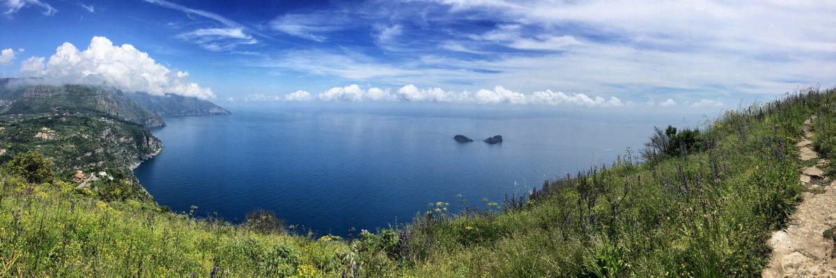
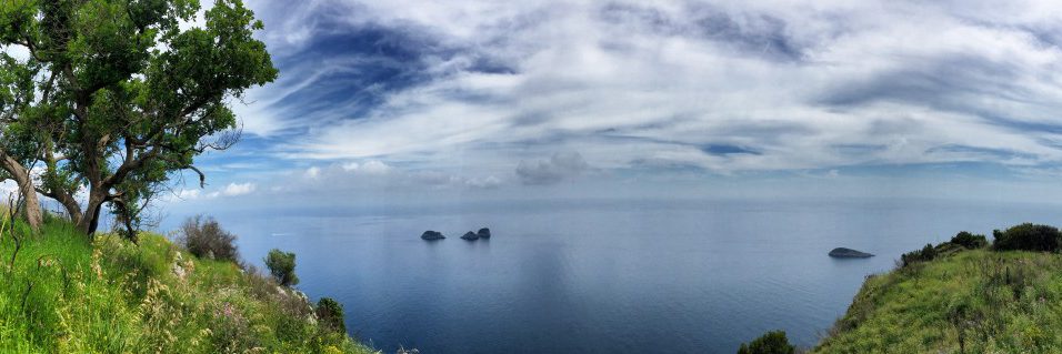
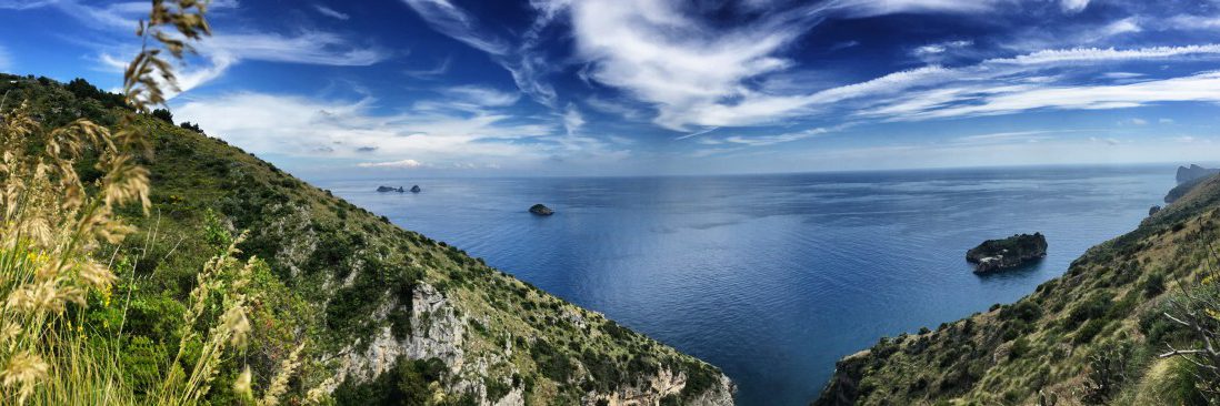
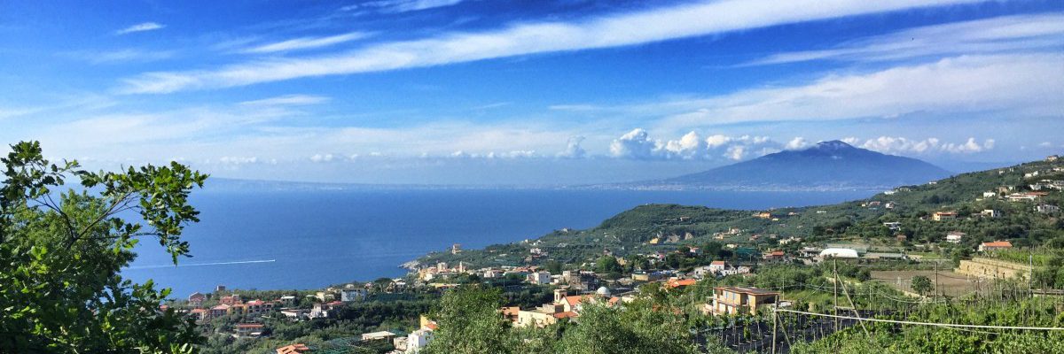
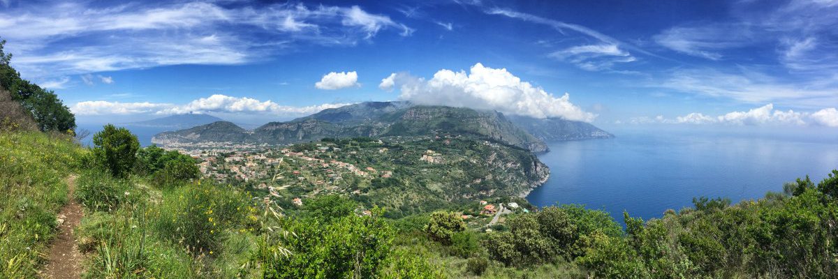
 combined view of the Amalfi Coast, Vesuvius and the Gulf of Naples
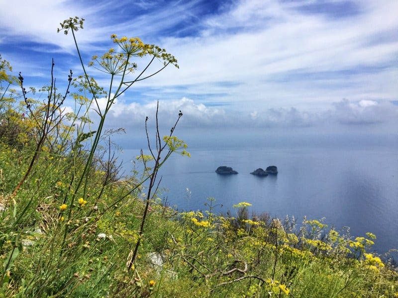
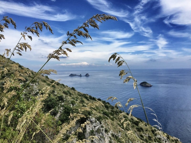
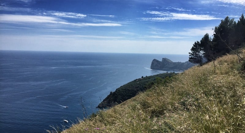
 The loneliest stretch of the Amalfi Coast: magnificent view of the "Sirenuses" archipelago
 Unspoilt coastline, nature and solitude - plus a permanent panoramic view of the "Sirenusen".
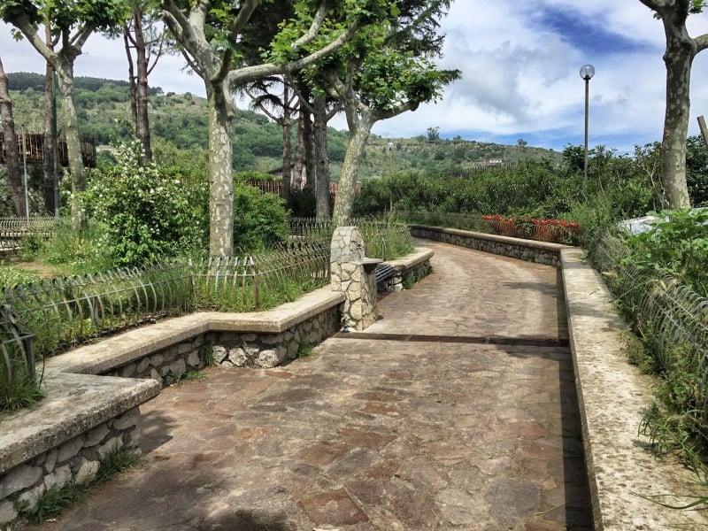
 The path behind "Torca" is even more lonely, the panorama incomparable!
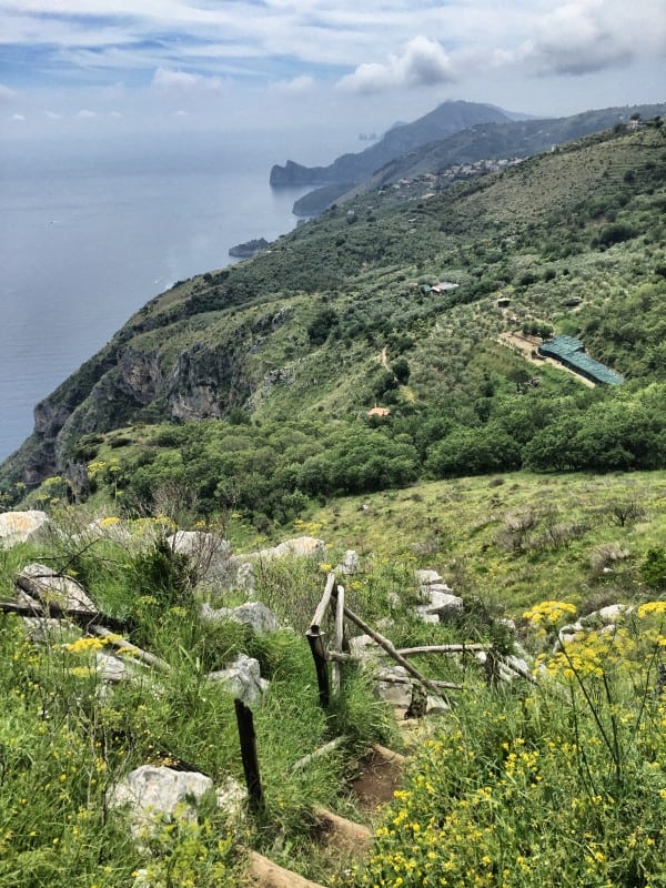
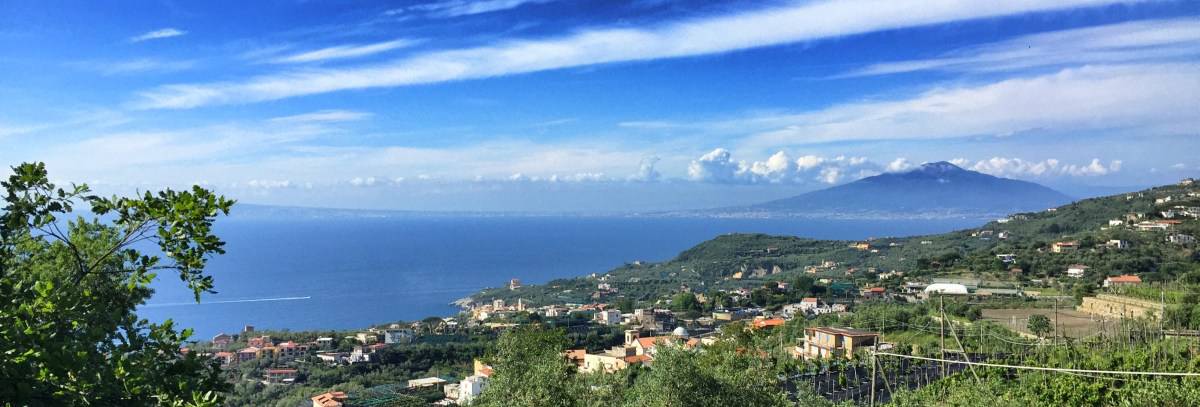
 Shortly before the finish of stage 5: Above Schiazzano, the view of the Gulf of Naples and Vesuvius is particularly impressive
The loneliest part of the Amalfi Coast
The fifth stage of our Amalfi hiking trail takes us through the loneliest section of the Amalfi Coast, giving it a very special flair. Omnipresent are the Li Galli Islands (also called "Sirenuses"), consisting of the three small, privately-owned islands of
- Gallo Lungo ("long tap")
- La Rotonda ("the round")
- and the island to the north of La Rotonda with the peculiar name "Dei Briganti a nord della Rotonda" (but sometimes also referred to as "La Castelluccia").
The islands are not only spectacular to look at, but also have an illustrious history: purchased in 1924 by the Russian choreographer and dancer Léonide Massine, a short time later a villa was built on Gallo Lungo with the collaboration of Le Corbusier with the aim of creating a creative centre for ballet, art and culture. For decades, the islands have been a magnet for artists and the rich and beautiful: Pablo Picasso was there, Igor Stravinsky, Sophia Loren and Jacqueline Kennedy Onassis as well. Despite several changes of ownership, this is still the case today: on the one hand, the group of islands can be rented for allegedly 150,000 € per week, on the other hand, artists' workshops are still held on the islands under the auspices of the "Fiorucci Art Trust".
Access: first through villages
Far from any celebrities, our hike begins quite mundanely at the bus stop at the crossroads of "Colli San Pietro". We leave this crossroads heading west on the slightly ascending road "Via Nastro Azzurro" (signpost "Sant'Agata 7 km"). We could follow this relatively busy road to the next village, but the official route of the CAI300 is nicer and quieter: it continues straight ahead in the first left-hand bend and passes a large hotel complex on the right (currently operated as "Sensimar Nastro Azzurro" by the TUI Group). Behind the hotel complex, the CAI300 runs idyllically along a stone wall and then rejoins the main road (waypoint 1, approx. 15 min after the start).
We cross the road and walk on the other side past the pretty church and after a few minutes we reach the village square of "Colli di Fontanelle", which is full of views and planted with old olive trees. From here it is a bit uphill, the road therefore runs in serpentines, which we can cleverly shorten on foot: From the village square, first take the small path between the houses, then a staircase that looks like the entrance to a pizzeria, but is a shortcut to the next bend.
After another short stretch on the road, we reach a hairpin bend at the edge of the forest outside the village - here we leave the road for good, the CAI300 leads us on a narrow path uphill into the forest (waypoint 2, approx. 45 min from start).
Lonely: On the CAI300 to Torca
Now the lonely part of the hike begins. We continue on a narrow path with a great view, always following the red and white markings. At first we are fascinated by the fact that from this point we can see Vesuvius, the Gulf of Naples and the Amalfi Coast together, then the three "Li Galli" islands cast their spell over us again and again. A short distance later, the foothills of Capri with the characteristic cone-shaped rocks "Faraglioni di Capri" appear on the horizon.
We reach the somewhat sleepy village of "Torca" about 1:30h later (church in the centre of Torca, waypoint 3). If by chance all the shops and bars in Torca are closed, you can at least fill up your water bottle here: there is a public drinking fountain in the small park next to the car park in front of the church.
Facts about stage 5
Altitude metres: 460 m ascent / 500 m descent
Duration: 5:00h (without breaks)
See also Elevation profile in detail
GPS route download for stage 5
From Torca further west
We leave the large square of Torca through "Via Nula", which branches off to the lower right as seen from the church portal. After a few metres, we turn right at the T-junction. Shortly after, the path passes very close to a tall, elongated house. Attention: here our path branches off to the left through an easily overlooked archway "right through the middle of the house" (waypoint 4). We walk downhill through a small olive grove and shortly afterwards meet the familiar tiled signposts (direction "Marina di Crapolla" and "Punta Campanella").
In a hollow we meet a small stream bed with a bridge (waypoint 5). We continue to follow the CAI300 slightly downhill in a southerly direction. Shortly afterwards, the view widens, the three "Li-Galli" islands appear again spectacularly and we can enjoy the view on a stone bench. Shortly afterwards, there is the possibility of a detour down to the sea (waypoint 6): If you have the time and inclination to climb an additional 200 metres (down and up), you can descend on CAI-344 to the beach in the "Fiordo di Crapolla"/"Marina di Crapolla". The following section of the CAI-300 is even less frequently used than the previous section. The path is marked throughout, but it seems improvised in places: handwritten signs with arrows sprayed in red help in some places.
About 1:30 h after Torca we see a small pine grove in front of us. We ignore a path still leading upwards (waypoint 7), instead we continue towards the lower part of the pine grove and reach the fork between CAI-300 and CAI-355 (waypoint 8). Theoretically, it is possible to descend to Marina del Cantone on CAI-300 from here. Attention: We do not recommend this route, the feedback from some hikers was that this section is in very bad condition (danger of slipping, overgrown, thorns). On the other hand, we recommend an overnight stay on the other side of the mountain (e.g. in Schiazzano), because there you can better enjoy the beautiful evening sun and the sunset. Therefore, in the following we describe the way to Schiazzano.
Information and feedback on the current state of the path: The section from Torca is one of the loneliest sections of the entire hike, so it can happen, especially in late spring/early summer, that the path is somewhat overgrown. We therefore continuously collect Feedback on the current state of the path and ask for the help of all hikers!
From CAI-300 to Schiazzano on the other side of the mountain
At the end of the pine grove (waypoint 8), CAI-355 branches off to the right. Don't be surprised: this path is also quite overgrown and difficult to see, but it leads upwards and to the left over a small cut in the mountain onto a road, the "Via Spina" (waypoint 9). Follow this road in a north-westerly direction until, after a few bends, you reach the through road "Via Leucosia" (Waypoint 10). Turn left here and follow the road for about 800 metres. You will pass some restaurants and shops. Outside the village, at the crossroads where Via Tuoro meets our road from the left (Waypoint 11), we turn right (Via della Tore).
We reach the turn-off to Schiazzano (waypoint 12) a little later: this is a steep spur road (dead-end sign) that leads down to the right on a concrete slope directly in front of the magnificent entrance gate of the private villa "Fondo Turiello".
If we found the path along the main road a little dull, we are now rewarded at the latest by a magnificent view of the Gulf of Naples, Vesuvius and the island of Ischia. After a few minutes, we reach the small village of "Schiazzano" with the wonderful Lubra Casa Relax (approx. 1:15h from the junction of CAI-355 at waypoint 8).
