From Schiazzano via Punta Campanella back to Schiazzano and on to Sorrento
Stage 6: Route description
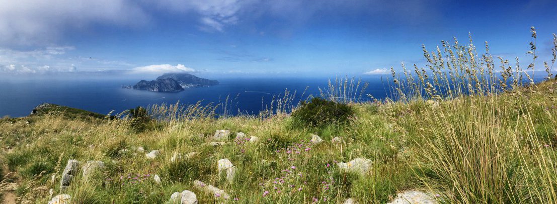 One of the highlights at the end of the hike on the CAI300 - Capri in the deep blue sea.
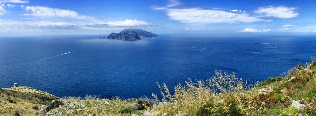
 The island of Capri from above: On the last stretch of the CAI-300, there is an almost unreal perspective of the neighbouring island.
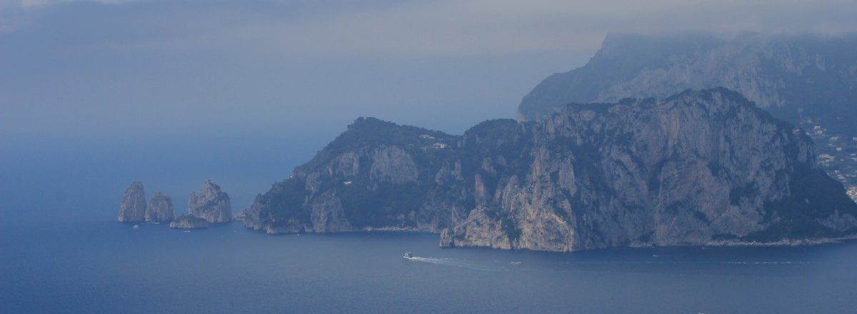 Capri from afar - the CAI 300 offers fantastic views of Capri "floating in the sea".
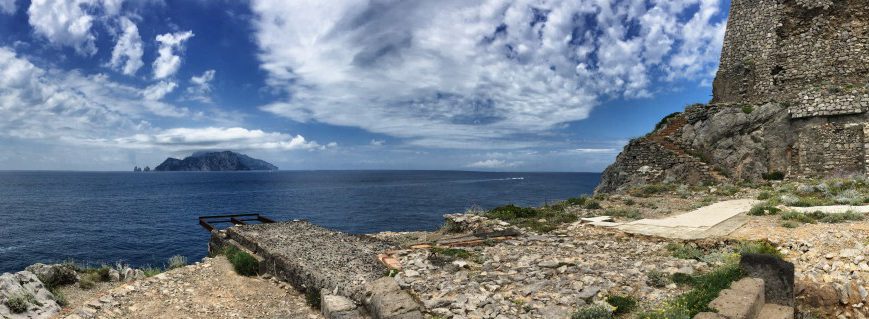 The CAI-300 ends at the lighthouse at Punta Campanella.
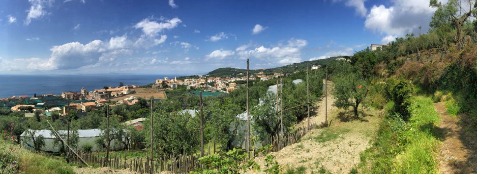 On the way to Sorrento
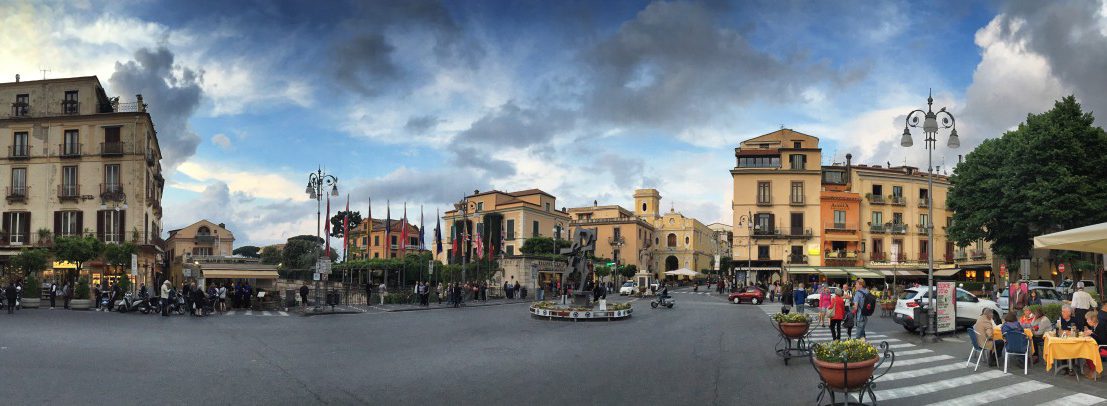 Evening atmosphere in Sorrento - on the one hand very crowded, on the other hand a bit like in a film.
From Schiazzano to Punta Campanella and back
This beautiful circular walk takes us to "Punta Campanella" - the westernmost tip of the Amalfi Coastal Walk - and offers a wonderful view of the island of Capri in fine weather!
In the following, we describe a short and a long variant - the shorter one is suitable, for example, for a final morning excursion on the day of departure followed by a bus or taxi ride to Sorrento. However, both variants can also be extended further by walking the beautiful route to Sorrento on the same day. The hiking route from Termini to Sorrento leads along many hidden paths or small trails through gardens, olive groves and citrus fields and is definitely worthwhile!
Note on maps: Strangely enough, this part of the Amalfi Coast is insufficiently mapped, at least many asphalted roads that have obviously existed for years are not marked on either Google Maps or OpenStreetMaps. However, free walking maps for the western tip of the Amalfi Coast are available in most accommodation facilities, showing these roads. Alternatively, the maps are available online: www.massalubrenseturismo.it/de/cartine/.
Entry/start point
Depending on where you stay overnight, the starting point for this stage varies, of course. In the following section, we describe the hiking route from Schiazzano because we are so enthusiastic about the hotel there. Those who stayed overnight outside of Schiazzano, however, can easily orientate themselves by the first intermediate destination: The white chapel "Chiesa San Costanzo", which is clearly visible from everywhere on the hill of the same name, Monte San Costanzo.
From Schiazzano we walk in a southerly direction, i.e. uphill past the hotel "Lubra Casa Relax" out of the town. On the back of the small hill we reach a road, which we follow briefly to the right uphill, to turn left after about 100 metres (still uphill, waypoint 1). The path offers beautiful views to the right of the Gulf of Naples and to the left of the bay of Marina del Cantone, gradually becoming smaller and finally a path at the end of which you reach Termini. Here we turn left and reach the main square with the church, SITA bus stop and bar (about 30 minutes from Schiazzano, waypoint 2).
From Termini to the White Chapel
We leave Termini square in a south-easterly direction and turn right at the T-junction (signposted "Punta Campanella"). After a slight bend to the left, we reach the next junction where we turn right along a direct route to "Punta Campanella" and straight on to the white chapel "Chiesa San Costanzo", from where we can descend to "Punta Campanella". We keep straight on here and come across a stairway path that serves as a shortcut to the serpentines of the road. The path is marked here with large white arrows on the asphalt, but we walk against the direction of the arrows. The climb from Termini to the white chapel takes about 30 minutes.
From the white chapel "Chiesa San Costanzo" to Punta Campanella
At the white chapel we turn around and descend again along the path lined with wooden crosses. Where the wooden cross path turns right (waypoint 3), however, we keep straight on and cross the pine grove parallel to the road. The path is very well marked here in red and white and with a bit of luck we can even recognise a faded marking as a CAI-300 hiking trail. At turn-offs, you should always orientate yourself by the colour marking, there are some other wrong paths that lead no further.
The red and white CAI 300 trail leads us out of the pine forest onto the ridge, which soon offers us wonderful views of Capri. As we are relatively high above the sea, the view of the neighbouring island from above is even more surreal than from the lighthouse at Punta Campanella, which is more or less at sea level. On the left, we see the headland of the "Baia Di Jeranto" nature reserve.
Branch off to the short variant
If the great view of Capri from the heights is enough for you, or if you have less time or are less fit, you should keep your eyes open on the ridge for a turn-off to the right (approx. 30 min after the white chapel). A sign embedded in the ground shows us the turn-off for the short variant (waypoint 4). With the short variant we save about 250 metres of ascent and descent and about 1.5 hours of time, without missing anything really essential of this stage. The short variant leads back to Termini in about 30 minutes.
Long variant: Descent to Punta Campanella
For the longer variant, we continue to follow the path straight ahead and always downhill. The destination "Punta Campanella" with an old tower soon appears and is reached after about 1.5 hours (calculated from the white chapel).
The way back from the "Punta Campanella" leads along a well-maintained hiking trail, which is quite popular with excursionists, back to Termini (approx. 1 hour ascent).
Back in Termini, there is the option of taking the SITA bus to Sorrento (usually at most once an hour and unfortunately less frequently around lunchtime, so it is best to check the departure times on the way there at the latest!)
Facts about stage 6
Altitude metres:
long version: 685 m ascent / 955 m descent
Short variant: 445m ascent / 720 m descent
Duration: Long version: 5:15h / short version 3:45h (each without breaks)
See also Elevation profile in detail
GPS route download for stage 6 - short variant
GPS route download for stage 6 - long variant
Refreshment stops along the way
There are numerous places to stop for refreshments (bars or restaurants) along the route, e.g. in Termini, Schiazzano, Massa Lubrense and of course at the destination in Sorrento.

The white chapel "Chiesa San Costanzo", visible from afar, is a stopover on stage 6

The "Baia Di Jeranto" nature reserve

Capri again and again - especially impressive from above!

Dead end with English signage - this is exactly where we walk along!
From Termini back to Schiazzano
We leave the main square of Termini in a westerly direction, pass the post office and follow the panoramic right-hand bend that turns into a sharp left-hand bend. Exactly in the left bend, the small "Via di Padri" branches off, unmistakable by a dead-end sign with an English subtitle (waypoint 5). We follow the concrete "Via di Padri", but shortly afterwards leave the concrete track to the right onto a path, at this point a tiled signpost to "Sorrento" is set in concrete.
A little later we meet an asphalt path again, which we follow to the right (briefly uphill), to turn left downhill shortly afterwards at an ornate iron gate (waypoint 6).
At the end of this path, which leads directly into the driveway of a private house, our hiking trail branches off sharply to the right. If you look carefully, you will find a "U-turn" sign in concrete on the wooden railing in the direction of Sorrento, which points us in the right direction (waypoint 7). Through a small depression we follow the path that leads us through vineyards and olive groves and on a concreted section closely past a long house. Via Turiello branches off at this house, but we continue straight on. The next turn-off is the "Vicolo Barbarella" (waypoint 8). The "Vicolo Barbarella" leads us back to Schiazzano in five minutes (section from Termini to Schiazzano: approx. 40 min).
From Schiazzano to Sorrento
However, if you want to continue hiking directly to Sorrento and also do not want to take a lunch break in Schiazzano, do not turn into "V. Barbarella", but continue straight ahead. The path leads us further downhill, over a small stream and then to the left again slightly uphill to S. Maria (approx. 15 minutes from Schiazzano).
In S. Maria we meet the church directly, which we walk halfway around, as our hiking trail continues diagonally opposite as a beautiful stairway (before the house with the gateway on the right, waypoint 9). However, we only stay on the stairway for a short time. Before it leads us too far downhill, we turn right onto a narrow garden path ("Via Sant'Aniello Vecchio", waypoint 10), which rewards us with beautiful views and leads us in a small curve but tending straight ahead to Massa Lubrense. The garden path leads us quite suddenly out of the greenery into a narrow alley where we turn left onto "Via Mortella" (this begins at the house with the clearly visible street sign "Via Maldacea", but we take the other street called "Via Mortella" at this house, waypoint 11).
In Massa Lubrense (approx. 30 minutes from S. Maria) we come across a triangular, leafy square, which we leave to the north at the "short", slightly higher end. After a few metres, we turn (shortly after a building of the Italian Post Office) into "Via Molini" (waypoint 12). At a wall with a turret and an image of a saint (waypoint 13), we keep to the right and from then on follow the road, which is only sporadically used by Vespas and smaller cars. The road winds through gardens and past a school and, although winding, leads us over the last hill to be crossed to Sorrento.
The next prominent landmark in this section of the trail is reached from "Massa Lubrense" after about 30 minutes: we meet a major road (waypoint 14). Our footpath continues directly opposite here, after about 5 more minutes serpentines or steps begin with a great view of Sorrento and the bay of "Marina Grande". At the end of the serpentines, our view falls on a very narrow house decorated with battlements. Behind this house, an inconspicuous staircase leads down. The only indication that this is not a private access staircase is the presence of an official road sign with the inscription "1ª Trav Capo" (Waypoint 15).
After a few steps we reach the old town of Sorrento and after many days of hiking in nature we are suddenly surrounded by international tourism again.
Tip: If you are going back to Naples by boat and therefore need to get to the harbour: The most beautiful footpath leading to the harbour starts at the promenade behind the church of San Francesco. Here there is a small path for pedestrians, integrated into the steep wall downwards, which leads along the sun decks to the harbour.

Vicolo Barbarella" street sign in Schiazzano

On the sunny side of the road - Stage 6 between Massa Lubrense and Sorrento

The promenade above the cliff in Sorrento

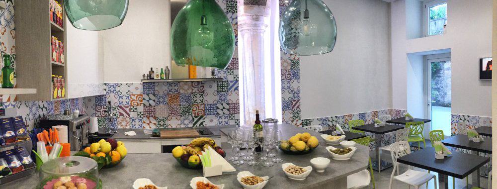
Time for "aperitivo" in Sorrento
Stage 6: Overnight stay
Staying in Sorrento - good choice at high prices
Sorrento is the "Italian dream" par excellence for many travellers due to its exceptional geographical position above steep cliffs, its pleasant climate, its unique sunsets and its proximity to Ischia and Capri, and is therefore an international tourist magnet. This is noticeable both in the variety of offers and in the price level of the accommodation on offer. Numerous 5-star hotels compete for guests as well as small guesthouses, bed-and-breakfasts and boutique accommodation without star classification. Nevertheless, almost all of them are expensive. To put it bluntly, Sorrento has the largest selection of accommodation beyond the 200-euro-per-night limit.
We were lucky and got hold of a very chic and reasonably affordable room at Sorrento Flats at short notice (Sorrento Flats). As a rule, however, you have to dig deep into your pocket in Sorrento or make concessions in terms of quality or proximity to the centre. Anyone who goes searching on booking.com, should therefore, in our experience, not be based on stars but only on the rating result (e.g. 8 and better) and the price.

Art exhibition on a roof terrace in Sorrento

Star hotels on the cliffs of Sorrento

Beach baths in front of the cliffs of Sorrento
