Stage 1: Overnight stay

Rooms with great views and colourful tiling: Hotel Torre di Milo in Maiori

Hotel recommendation in Maiori: Hotel Torre di Milo

Maiori is nowhere near as fashionable and famous as other places on the Amalfi Coast, which is why accommodation prices in Maiori are kept within reasonable limits.

We can recommend the following hotel in Maiori: Hotel Torre di Milo. At the Hotel Torre di Milo there are well-kept rooms at reasonable prices, all rooms have recently renovated bathrooms and some rooms have a balcony with a view. Breakfast is outsourced to a nearby restaurant in the pedestrian zone, which is also worth a visit in the evening: At Ristorante Pineta 1903 good cuisine is served (also vegan on request), in good weather also on the cosy terrace.

Hotel Torre di Milo in Maiori: the namesake tower is right next door

Stage 2: Map

From Maiori via Ravello and Amalfi to Pogerola

Stage 2: Route description

  • Amalfi Hiking Trail Stage 2 Between Maiori and Minori
    Amalfi Hiking Trail Stage 2 - Between Maiori and Minori

From Maiori via Ravello to Amalfi or Pogerola

The starting point of the walk is the staircase that leads up from the pedestrian zone on the right, past the church, towards the old part of Minori:

Start in Maiori: The stairway to the church

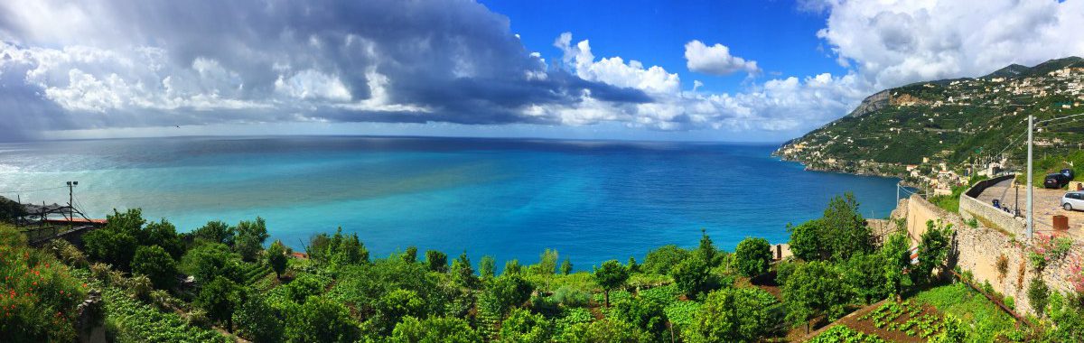
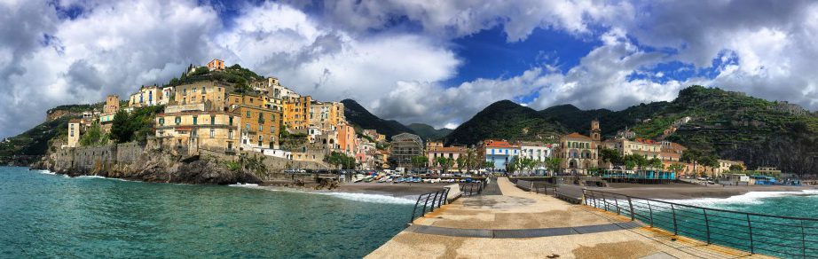
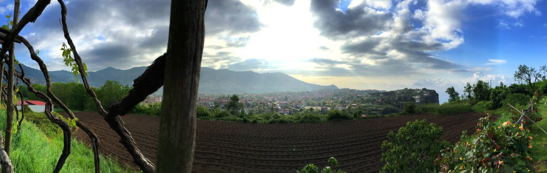
Once at the top (waypoint 1), we follow the Via Vena closely along the houses towards Minori. This section of the trail is also called "Via dei Limoni" (Way of the Lemons) The varied trail leads past many viewpoints in about an hour to the neighbouring town of Minori, which is a lot more picturesque than Maiori and is suitable for a first coffee break.

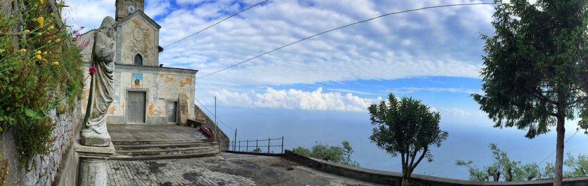
On the boardwalk after this bend, a staircase leads upwards on the left in direct extension of a zebra crossing (waypoint 2). After a few metres, we cross a road and follow the stairs on the opposite side up to the cemetery. Behind the cemetery, a longer climb with many stairs begins (waypoint 3), recognisable by the sign "Ravello". We pass the "Chiesa di S. Michele" and reach a road, where we either take the stairs straight ahead or choose the more panoramic option (waypoint 4). This leads more leisurely upwards on the left and towards the church of San Pietro alla Costa (waypoint 5). Once there, we turn sharply right again and then come back to the steeper stairway variant (waypoint 6).

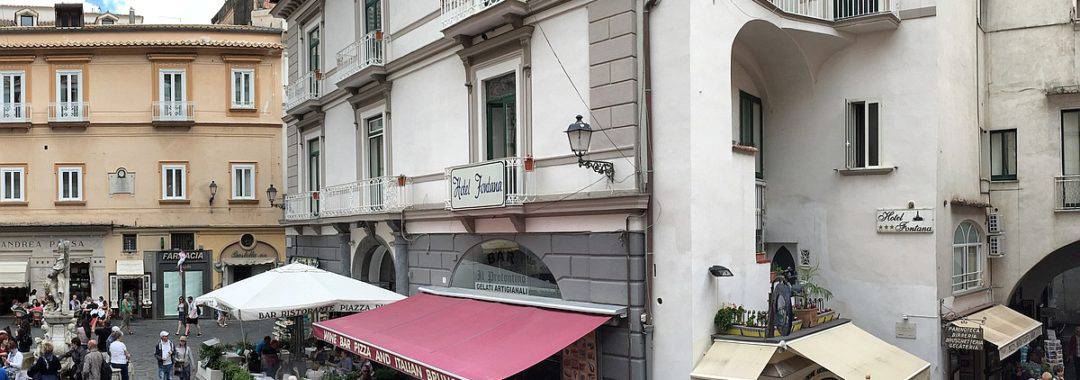
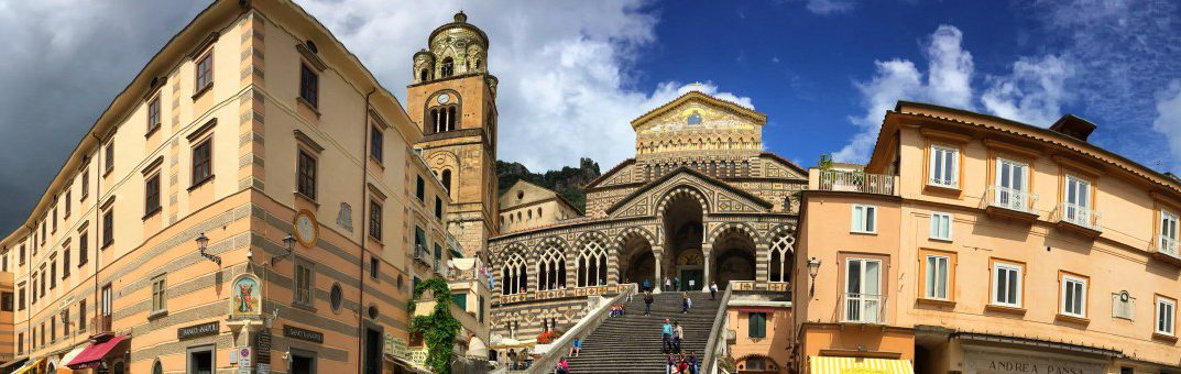
The path continues along the road above the "Auditorio Oscar Niedermeyer", visible from afar, to the viewing platform. Through a short tunnel we reach the main square of Ravello with a view of the cathedral (Waypoint 7, from Minori approx. 1:15 h walking time). The place is very picturesque and accordingly well frequented.

We leave the Piazza del Duomo to the south and follow the signs towards "Villa Cimbrone", a park on the cliff top of Ravello that can be visited for an entrance fee. However, our path turns right just before the archway labelled "Villa Cimbrone" (waypoint 8). As of May 2016, this path was officially closed (orange plastic barrier) due to construction work that began in 2014, but apart from a few steps in need of repair, it could be passed without any problems or danger. After a few minutes, we turn left onto a flat path (signpost towards Amalfi, waypoint 9) that circles the rocky peak of "Villa Cimbrone" to the south.

Facts about stage 2

Altitude metres:  

to Amalfi: 500m ascent/ 500m descent  

to Pogerola: 800m ascent/ 500m descent  

Duration: 3:30h to Amalfi / 4:30h to Pogerola (without breaks)

See also Elevation profile in detail.

GPS route download for stage 2

Refreshment stops between Maiori and Amalfi or Pogerola

There are numerous places to stop along the way: Maiori, Minori, Ravello, Atrani, Amalfi and Pogerola each have bars, grocery shops and restaurants.

Amalfi Coast Hiking Stage 2 - View of Minori and Ravello in the background

Amalfi Hiking Trail Stage 2 - View from Sentiero dei Limoni

At this archway with the inscription "Villa Cimbrone" our path turns right...

...if you continue straight ahead, you will reach the entrance area of Villa Cimbrone.

From Ravello to Amalfi

Soon a stairway leads down to the right (waypoint 10) towards Amalfi with wonderful views of the coast. We cross a road and follow the steps of "Via Castiglione", which we soon leave to the right (waypoint 11, signposted "Amalfi") to get wonderful views of the church "Chiesa di Santa Maria Maddalena".

When you reach the church (Waypoint 12), turn right and after a few steps you reach the coastal road, which you can recognise by the distinctive arches of the bridge. Here, however, we turn right before the coastal road and follow the wide steps further down, where we reach the main square of Atrani after a short passage (waypoint 13, approx. 1 hour from Ravello to Atrani). Here is the first opportunity for lunch - much quieter and more relaxed than in the neighbouring town of Amalfi.

We cross the square and leave it through the archway to the right of the red letterbox: the passage towards Amalfi is hidden here. After about 15 minutes we reach Amalfi. The main sight, which is easy to miss, is the cathedral with its unique mosaic façade.

Detour to Pogerola

A good, panoramic and quiet alternative to an overnight stay in Amalfi itself is the village of Pogerola, 300 metres above Amalfi. To get there, we follow the village road from Amalfi a few hundred metres inland until, shortly after a wide archway, the road "Via Casamare" turns left to the "Carabinieri" (waypoint 14). At the end of the dead-end street, our path leads upwards via steps and a paved hiking trail. After an hour we reach the small village of Pogerola with some restaurants, bars and worthwhile bed & breakfast accommodation.

Hiking on the Amalfi Coast - always a great view of the sea

Sometimes almost unreal: The Amalfi Coast in sunshine below Ravello

Amalfi Overnight stay in the centre

Stage 2: Overnight stay

Located an hour above Amalfi, but warm and personal: the newly opened Bed&Breakfast "L'Arabesco"

Overnight stay in Pogerola (above Amalfi)

The town of Amalfi gives its name to the entire coast and is an international tourist magnet with correspondingly high accommodation prices. For long-distance hikers in good shape, we therefore recommend an overnight stay a little above Amalfi in the small village of "Pogerola" (approx. 1 hour additional walk). There are some very nice and comparatively affordable bed & breakfast accommodations and a sufficiently large selection of pizzerias and restaurants. Highly recommended is the Bed&Breakfast L'Arabesco, newly opened in 2014, with only 3 rooms (see picture above, Bed&Breakfast L'Arabesco) and a very lovingly prepared breakfast on the sun terrace. Located directly on the small village square of Pogerola and also highly recommended is the B&B Villa Maria (B&B Villa Maria), which, however, is usually booked up very far in advance.

Stay overnight in Amalfi

However, despite the somewhat higher prices, an overnight stay directly in Amalfi does have its appeal: as soon as all the day tourists have left in the late afternoon, it is much easier to guess why Amalfi has become so famous. And anyone planning a normal hiking holiday on the Amalfi Coast instead of a long-distance hike should stay overnight in Amalfi anyway. Pogerola is not sufficiently connected to the SITA bus lines for this purpose.

The B&B Villa Maria is very popular and therefore often already fully booked

Stage 3: Map

From Pogerola via San Lazzaro to Bomerano

Stage 3: Route description

  • Amalfi Coast Hike Stage 3 View shortly after Amalfi
    View shortly after Amalfi - just above the coastal road

Entering stage 3 from Pogerola

After spending the night in Pogerola above Amalfi, we first have to return to almost sea level. From the centre of Pogerola we follow Via Castello past the church towards the sea until we see steps to the right with a sign pointing towards Amalfi. Follow these downwards into a gorge until, after about half an hour, you reach the coastal road or the hiking route directly from Amalfi (directly at the end of the tunnel, waypoint 1).

Steep stairs in the rock lead us back to the coastal road in a green gorge coming from Pogerola

Facts about stage 3

Altitude metres: 

from Amalfi: 950m ascent/ 320m descent  

from Pogerola: 950m ascent/ 620m descent  

Duration: 4:00h from Amalfi / 4:30h from Pogerola (without breaks)

See also Elevation profile in detail.

GPS route download for stage 3

Refreshment stops

small bar with snacks and pizza at the crossroads in Lone, several restaurants in San Lazzaro.

Entering stage 3 from Amalfi

If you stayed in Amalfi instead of Pogerola, leave Amalfi via the coastal road heading west slightly uphill and cross the road tunnel. Immediately after the tunnel (waypoint 1) you meet the route coming from Pogerola.

After the tunnel, the road continues

A few metres after the tunnel, we leave the coastal road and continue on the path parallel to it, initially still below residential houses, then increasingly more rural. Approx. 25 minutes after the tunnel, we unfortunately have to leave the high trail, as a track closure prevents passage further on. The corresponding stairway exit (waypoint 2) is directly after an arched lattice gate with the tiled house number 33 and looks like this:

Amalfi Coast Hike - Stage 3 - Looking back at the steep coastline

Shortly before this little tower we take the stairs down - further ahead the path is blocked!

Diversions due to track closure and ascent to San Lazzaro

The diversions leads along the coastal road past a bar/pizzeria with a view (waypoint 3), where we take the right of the two roads and follow it for two hairpin bends. At the second hairpin bend, a staircase leads us to the left (waypoint 4), we meet a flat path after a short while, which we follow to the left. At a church, we rejoin the road and our stairway continues upwards, offset a little to the left (waypoint 5).
We follow this scenic and much hiked path up the mountain to San Lazzaro (approx. 1:40 h from the bar in the hamlet of Lone). In San Lazzaro there are several opportunities for a lunch break (waypoint 6).

Attention: Shortly after waypoint 5 there is a (new) route closure - see symbol on the map! Hikers have two options here, depending on their willingness to take risks:

  1. Safe option: According to reports from hikers, a bypass is possible, for example, via the town of Tovere and from there on the CAI-361b hiking trail. However, you first have to walk through the road tunnel, then steep steps lead to “Via Grado” to Tovere and there onto the CAI-361b (see detour symbols on the map and blue route).
  2. Simple variant that hikers have reported on several times. Quote: “There are climbing aids at both ends to get over the blockages. The closed section is approx. 10 (downhill) to 20 minutes (uphill) long. The path is weathered, obviously not maintained and has large and small boulders lying in some places. The path itself has not been washed away or destroyed. The path is easy and safe to walk. You only have to worry about further rockfalls or mudslides or something similar if it has just rained heavily or a lot or if there is a storm going on. If that’s not the case – most of the time – you can pass the path without any danger.”

From San Lazzaro to Bomerano

From the end point of the stairway in San Lazzaro, our path first leads slightly uphill on the road to the small church, where we turn left (waypoint 7). Now we go downhill again a little and then turn left again into "Via Pino". The road descends in serpentines and at a bend we change to a small path (waypoint 8). This leads us below a steep rock face, popular with climbers, to a small stream.

On the opposite side of the gorge, the trail heads south and joins a small access road. Follow this until you reach the higher main road (waypoint 9). Turn left here and follow the main road downhill for 750m. Just before the first bend in the main road, turn right towards "S. Alfonso" (Waypoint 10). At the end of this road, a beautiful and well-marked hiking trail begins to Bomerano (approx. 2 hours from San Lazzaro).

Red poppies and the Amalfi Coast in the background

The route closure shortly after waypoint 5