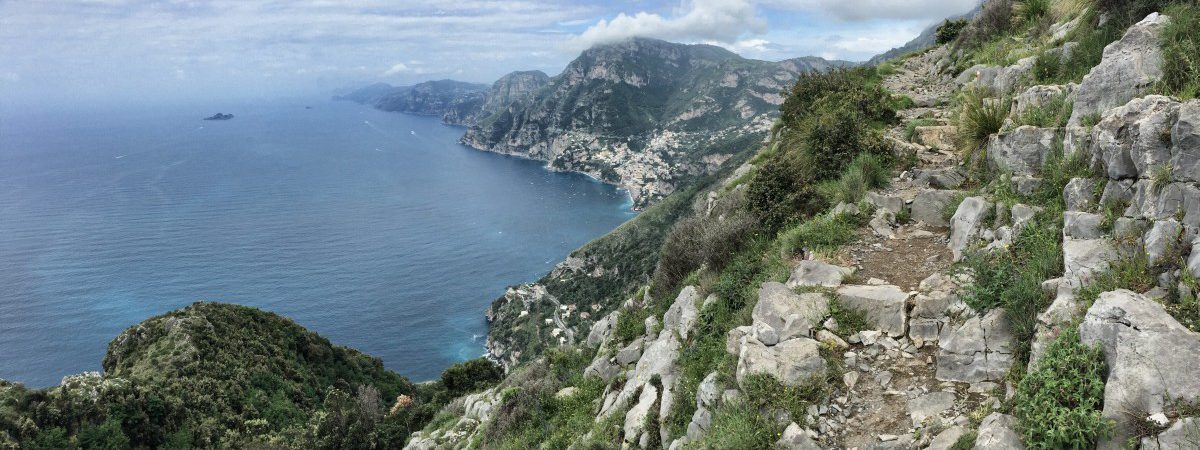
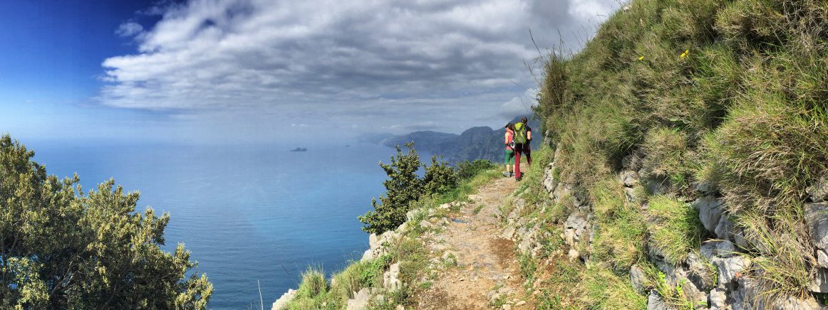
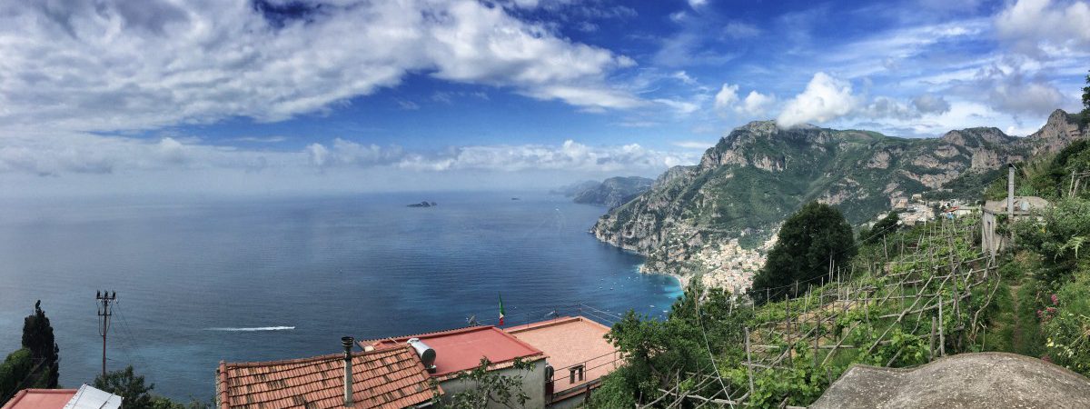
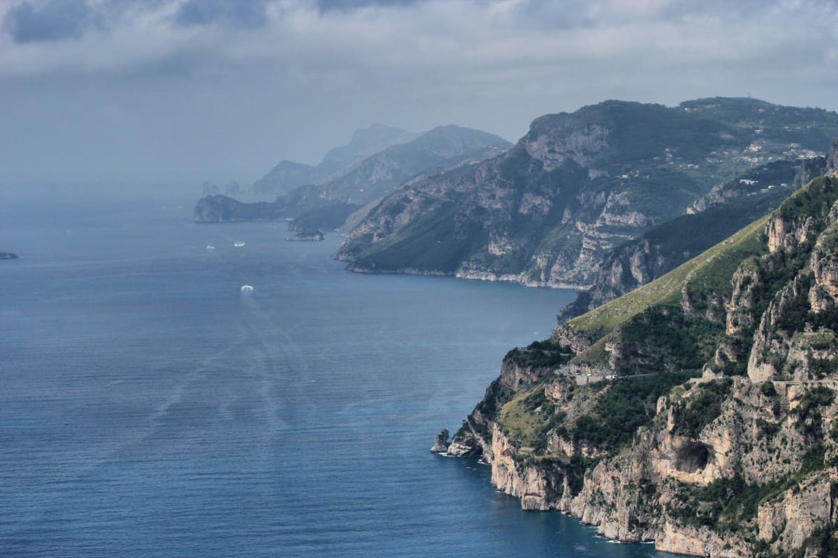
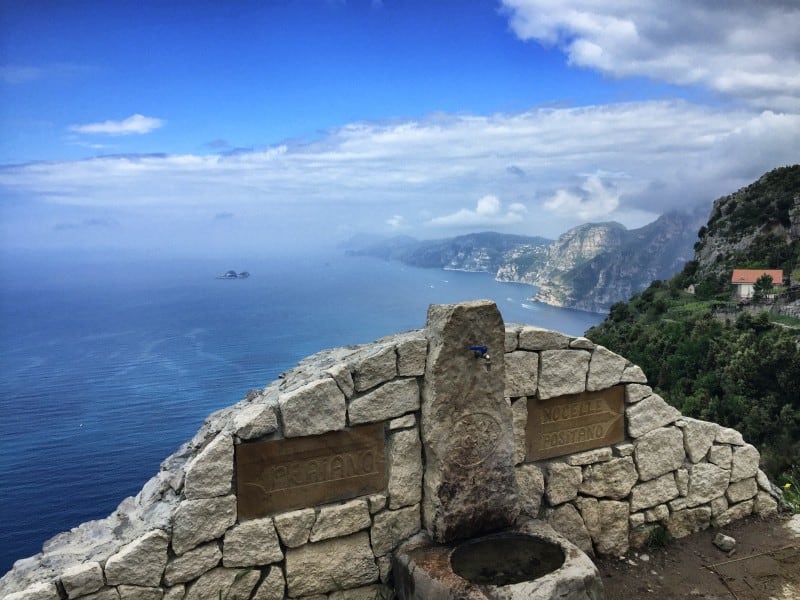
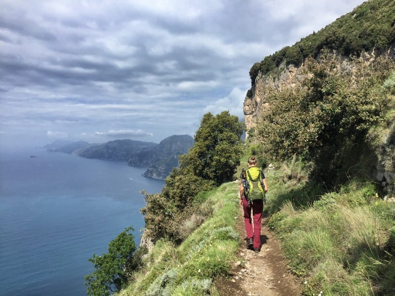
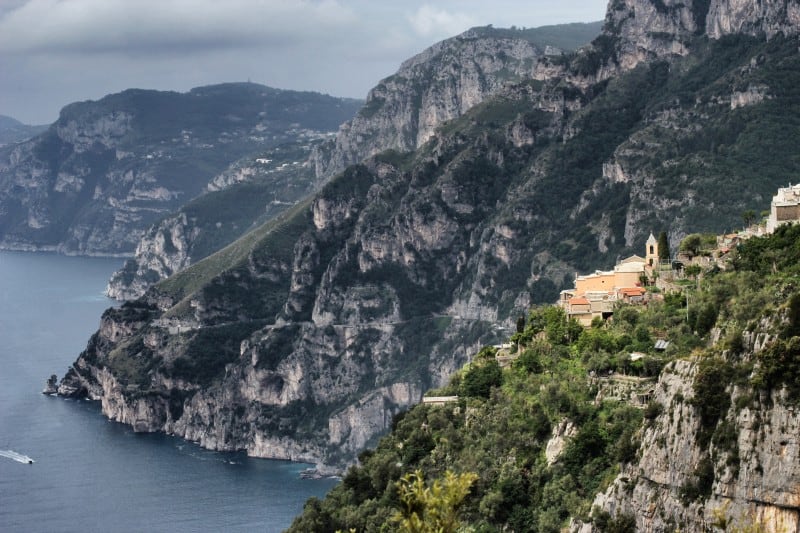
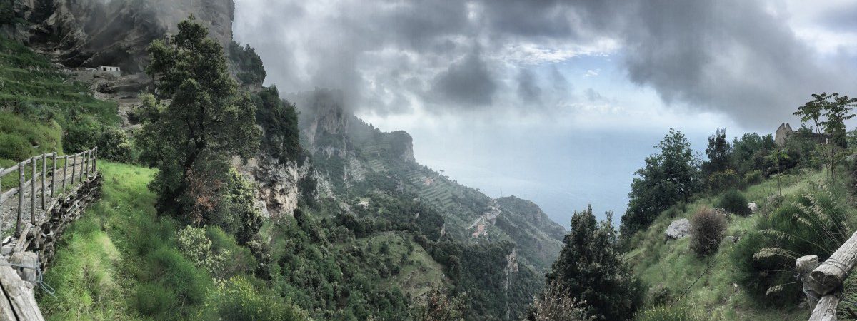
 Shortly after the start of the "Sentiero degli Dei", it was unfortunately still slightly cloudy. But the magnificent panorama can already be guessed!
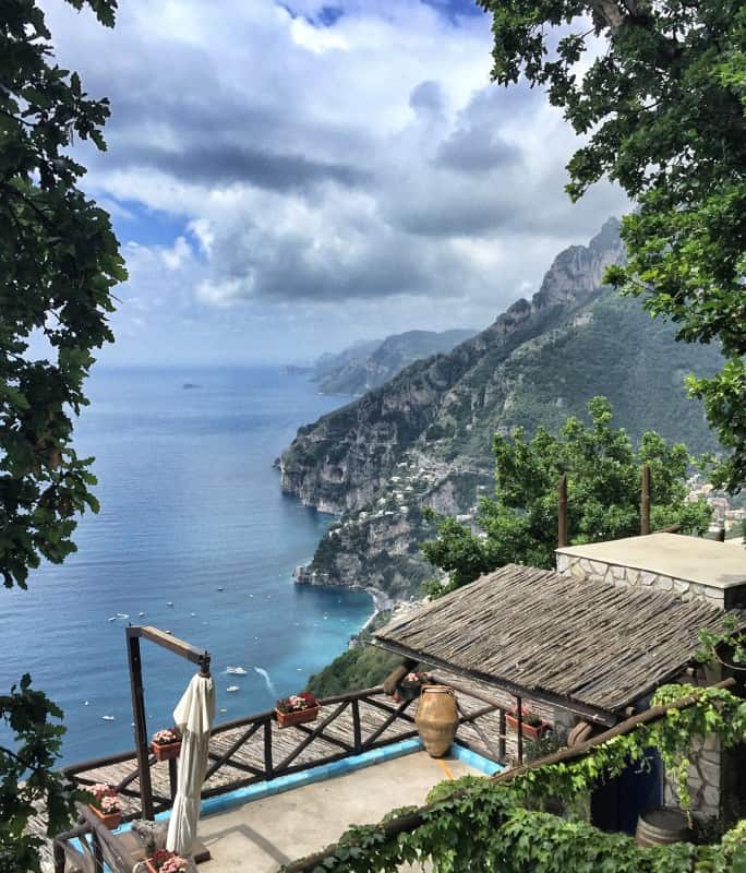
 The Sentiero Degli Dei: View of Positano and the entire Amalfi Coast as far as Capri.
 Hiking from Bomerano via Nocelle to Positano - the panorama is a constant companion along the way
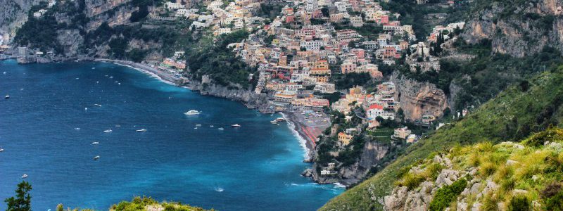
 View of Positano from the "Sentiero Degli Dei" - the path of the gods.
 The small square in front of the church of "Nocelle" is a nice place for a break and good for panoramic photos.
The "Path of the Gods" to Positano, bus ride and summit climb
Today we are going to do the most famous part of our hike, the so-called "Sentiero Degli Dei" - in German "Pfad der Götter". A tip on pronunciation: the "gl" in "Degli" is pronounced in Italian similar to the "ll" in Million and not as a German "g". So all in all it's something like this: "Sen-ti-ero De-lli De-i".
The "Sentiero Degli Dei" is very popular because of its spectacular viewpoints and probably also because of its catchy name, and is accordingly well signposted. Getting lost is as good as impossible. However, the path directly on the cliff requires a certain amount of head for heights.
The destination of stage 4 is Positano, a former fishing village that has become world-famous for its spectacular, almost vertically stacked houses. However, the number of visitors and accommodation prices are correspondingly high. For this reason, we describe here a total of three alternatives for stage 4:
normal variant with bus trip the next day: Hike to Positano, relaxed afternoon and evening in Positano, overnight in Positano. To start stage 5, a bus ride to Colli S. Pietro is necessary the next morning.
Variant with bus trip in the afternoon and additional short hike: Since the trail to Positano is more of a half-day hike, this hike can be combined very well with another short hike (Climbing the "Monte Vico Alvano). This requires a short bus ride from Positano in the early afternoon to Colli S. Pietro (the start of stage 5). Details on the bus ride can be found further down in the text. Overnight stays are therefore outside Positano, which is usually rather overpriced.
Panorama variant above Positano without bus ride: The CAI-300 hiking trail runs about 400 metres above the "Sentiero Degli Dei". Instead of descending to Positano, it is possible to return to the higher trail from Montepertuso. This was the option we originally had in mind when planning our tour, but unfortunately we didn't find the way in the rain and fog. In the meantime, however, several other hikers have confirmed to us that this path exists and is very worthwhile (many thanks to Jörg, who provided me with his GPS track for this variant). You can find more details about this variant here: Variant for stage 4.
Facts about stage 4
Altitude metres: 350 m ascent / 840 m descent
Duration: 3:45h (without breaks)
See also Elevation profile in detail
GPS route download for stage 4
A head for heights
Stage 4 may not be suitable for hikers with a fear of heights. See Comment from Flavia.
Refreshment stops
Small snacks in Nocelle, restaurant "La Tagliata" just before Montepertuso, other restaurants in Montepertuso and Positano.
"Sentiero Degli Dei": the path of the gods
The "Sentiero Degli Dei" starts at the main square of Bomerano and leads slightly downhill to "Nocelle" with wonderful viewpoints and great perspectives. The path is particularly impressive in clear weather and with good visibility, when the entire Amalfi Coast stretches out before you to the horizon.
The first part of the hike up to the small church of "Nocelle" leads mostly gently downhill and is therefore very pleasant to hike. The steep part to Positano only follows in the second part. Many hiking groups are therefore picked up again by their coach in Nocelle, but for us it's down many hundreds of steps to Positano.
From Bomerano to Nocelle
Due to the good signposting of the "Sentiero Degli Dei", we will limit ourselves at this point only to the essential turn-offs:
- 200m after leaving the village square of Bomerano, the path passes under a bridge, beyond which we have to turn right (waypoint 1).
- After about 30 minutes, directly after a two-fingered rock on the side of the path, we reach a small hilltop with a ruin and a "T-junction" (waypoint 2): Turn left here and immediately right again to a watering place with beautiful signposting in the direction of "Nocelle / Positano").
- In Nocelle (approx. 1:45 h from Bomerano), keep to the left or downhill until you reach a small church with a viewing platform and public WC (waypoint 3).
From Nocelle to Montepertuso
From Nocelle there are two different ways to get to Positano: either you take the direct way down, which simply continues down from the small square in front of the church of Nocelle, or an alternative way via the village of "Montepertuso". Both variants are beautiful, but the direct path to Positano leads along the busy coastal road SS163 for about 1 km at the end.
We describe here only the variant via Montepertuso, as this is less frequently climbed and requires more explanation than the "direct" variant.
From the church square in Nocelle, go back a little way. A few metres above, a path with signs for "Montepertuso Positano" turns off to the left (waypoint 4). Attention: both the bus and the footpath to Montepertuso are signposted. The footpath first leads along below the road with little traffic and from the next bend on the road towards Montepertuso. After a bend to the right, we come to the popular panoramic restaurant "La Tagliata" past to Monteperuso. There we pass the sports field and after a right turn we reach the triangular village square with some restaurants and a supermarket (waypoint 5, about 40 min from Nocelle to Montepertuso).
From Montepertuso down to Positano
About 350m after the village square of Montepertuso, directly in front of house no. 10 and recognisable by the crossing zebra crossing, the steep path to Positano branches off to the left (waypoint 6). A few metres after entering the stairway, an even steeper path branches off to the left. It doesn't really matter which of the two stairs we follow, as both paths meet again at waypoint 7. In our opinion, however, the left (i.e. steeper) stairway path has the more beautiful view.
At waypoint 7 we meet the SS163 - the "Strada Statale Amalfitana". Here is the first SITA bus stop from which we could go towards Sorrento or Colli San Pietro. The buses usually run every half hour, but tickets must be purchased in a tabacchi shop before starting the journey (alternatively via the "UnicoCampania" app, see note on stage 1). Attention: The buses are sometimes overcrowded, even in low season, so that you may be turned away by the bus driver and have to wait for the next bus. It is therefore advisable to plan a little more time. A current bus timetable can be downloaded here: www.sitasudtrasporti.it (As of January 2019, bus number 5070 is relevant between Positano and Sorrento).
Somewhat more convenient and interactive is the timetable prepared by a third-party provider, which can be accessed via the following link: moovitapp.com. This international public transport guide shows not only the departure times but also the route of the bus line including all intermediate stops. In Positano, all SITA stops are on the SS163. This also applies to today's destination: the SITA stop at the Bar Internazionale (Tabacchi shop diagonally opposite).
Before that, however, it's downhill again: further, partly somewhat hidden stairways lead us down to the church of Santa Maria Assunta with its striking dome and to the beach of Positano. Note: if you don't find the entrance to the stairs straight away, you should orientate yourself by the zebra crossings - these are usually placed exactly where a stairway crosses the road!
A short summit climb as an afternoon programme?
For those who come back well-fed from lunch after the strenuous descent to Positano and still feel like a short climb to the summit, we recommend the following short hike in the afternoon: Hike to Monte Vico Alvano.

